File:1850 Tallis Map of North America ( Texas at fullest ) - Geographicus - NorthAmerica-tallis-1850.jpg
Original file (3,032 × 4,290 pixels, file size: 2.05 MB, MIME type: image/jpeg)
Captions
Captions
| North America. | ||||||
|---|---|---|---|---|---|---|
| Artist | ||||||
| Title |
North America. |
|||||
| Description |
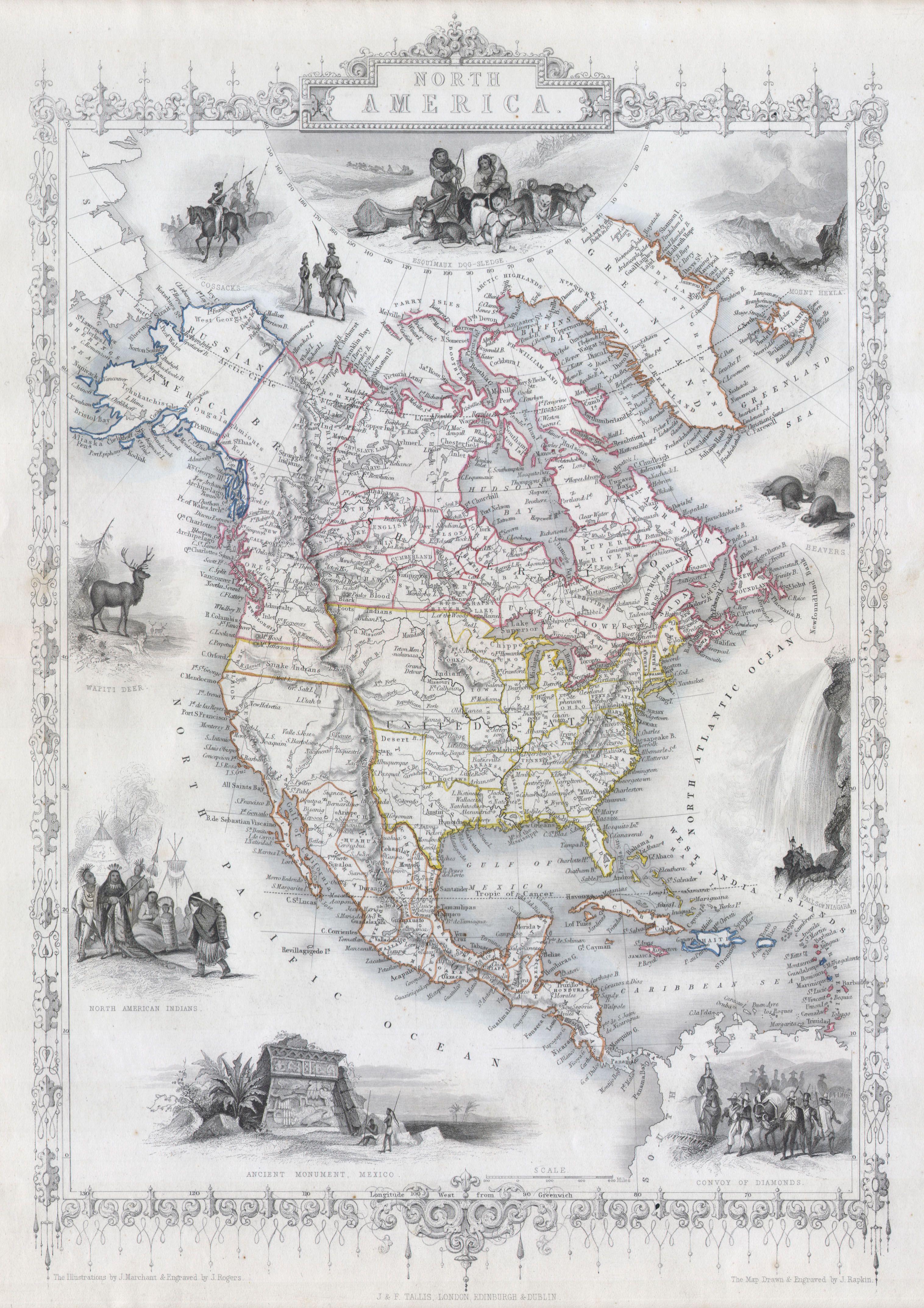
English: This is John Tallis’s highly desirable and very rare 1850 Map of the North America. Made shortly following the entry of Texas into the Union, this map depicts an important point in American history. Herein Texas is shown at near its fullest extent including Santa Fe and but excluding the Green Mountain extension in the Northwest. Upper California has yet to become a part of the United States and while Oregon is included, Washington remains a part of British America. The mythical Buenaventure River appears in northern California. Offers several beautiful vignettes depicting “North American Indians”, a “White Dear”, Beavers, the “Falls of Niagara”, a “Convoy of Diamonds”, an “Ancient Monument, Mexico”, “Cossacks”, and the Esquimaux Dog-Sledge. Highly decorative border. Undated, but the form of Texas allows us to positively date this to the early 1850 issue of Tallis’s valuable map. |
|||||
| Date | 1850 | |||||
| Dimensions | height: 9.5 in (24.1 cm); width: 14 in (35.5 cm) | |||||
| Accession number |
Geographicus link: NorthAmerica-tallis-1850 |
|||||
| Source/Photographer |
|
|||||
| Permission (Reusing this file) |
|
|||||
File history
Click on a date/time to view the file as it appeared at that time.
| Date/Time | Thumbnail | Dimensions | User | Comment | |
|---|---|---|---|---|---|
| current | 18:43, 24 March 2011 | | 3,032 × 4,290 (2.05 MB) | BotMultichillT (talk | contribs) | {{subst:User:Multichill/Geographicus |link=http://www.geographicus.com/P/AntiqueMap/NorthAmerica-tallis-1850 |product_name=1850 Tallis Map of North America ( Texas at fullest ) |map_title=North America. |description=This is John Tallis’s highly desirabl |
You cannot overwrite this file.
File usage on Commons
The following page uses this file:
_-_Geographicus_-_NorthAmerica-tallis-1850.jpg)
_-_Geographicus_-_NorthAmerica-tallis-1850.jpg&oldid=863179766)
- 1850 maps of North America
- Maps by John Tallis
- Russian Cossacks in art
- Indigenous peoples in Canada
- Dogsleds
- Dogsleds in art
- Beavers in art of Canada
- Niagara Falls in art
- Niagara Falls in the 19th century
- Convoys
- Transport in art
- Mesoamerican cultures
- Engravings of monuments
- Cervus canadensis in art
- Maps of the indigenous peoples of North America