File:1855 Colton Map of South Carolina - Geographicus - SouthCarolina-colton-1855.jpg
Jump to navigation
Jump to search

Size of this preview: 725 × 600 pixels. Other resolutions: 290 × 240 pixels | 580 × 480 pixels | 928 × 768 pixels | 1,238 × 1,024 pixels | 2,475 × 2,048 pixels | 4,000 × 3,310 pixels.
Original file (4,000 × 3,310 pixels, file size: 3.92 MB, MIME type: image/jpeg)
Captions
Captions
Add a one-line explanation of what this file represents
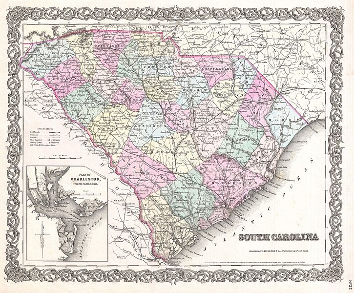
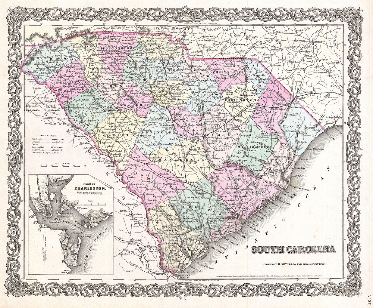
| J. H. Colton: South Carolina.
( |
|||||||||||||||||||||
|---|---|---|---|---|---|---|---|---|---|---|---|---|---|---|---|---|---|---|---|---|---|
| Artist |
|
||||||||||||||||||||
| Title |
South Carolina. |
||||||||||||||||||||
| Description |
English: A beautiful 1855 first edition example of Colton's map of South Carolina. Covers the entire state as well as adjacent parts of Georgia and North Carolina. Map is hand colored in pink, green, yellow and blue pastels to identify counties. Identifies towns, cities, railroads, roads and some topographical features. Features an inset of Charleston and Vicinity in the lower left quadrant. Names the Blue Ridge Mountains. Surrounded by Colton's typical spiral motif border. This is one of the few mid 19th century atlas maps to depict South Carolina independently. It is more commonly mapped in conjunction with North Carolina. Dated and copyrighted to J. H. Colton, 1855. Published from Colton's 172 William Street Office in New York City. Issued as page no. 27 in volume 1 of the first edition of George Washington Colton's 1855 Atlas of the World . |
||||||||||||||||||||
| Date | 1855 (dated) | ||||||||||||||||||||
| Dimensions | height: 13 in (33 cm); width: 16 in (40.6 cm) | ||||||||||||||||||||
| Accession number |
Geographicus link: SouthCarolina-colton-1855 |
||||||||||||||||||||
| Source/Photographer |
Colton, G. W., Colton's Atlas of the World Illustrating Physical and Political Geography, Vol 1, New York, 1855 (First Edition).
|
||||||||||||||||||||
| Permission (Reusing this file) |
|
||||||||||||||||||||

File history
Click on a date/time to view the file as it appeared at that time.
| Date/Time | Thumbnail | Dimensions | User | Comment | |
|---|---|---|---|---|---|
| current | 10:52, 23 March 2011 | | 4,000 × 3,310 (3.92 MB) | BotMultichillT (talk | contribs) | {{subst:User:Multichill/Geographicus |link=http://www.geographicus.com/P/AntiqueMap/SouthCarolina-colton-1855 |product_name=1855 Colton Map of South Carolina |map_title=South Carolina. |description=A beautiful 1855 first edition example of Colton's map of |
You cannot overwrite this file.
File usage on Commons
The following page uses this file: