File:1855 U.S. Coast survey Map of Florida - Geographicus - Florida-uscs-1855.jpg
Jump to navigation
Jump to search
Size of this preview: 439 × 599 pixels. Other resolutions: 176 × 240 pixels | 352 × 480 pixels | 563 × 768 pixels | 751 × 1,024 pixels | 1,502 × 2,048 pixels | 3,500 × 4,773 pixels.
Original file (3,500 × 4,773 pixels, file size: 2.74 MB, MIME type: image/jpeg)
Captions
Captions
Add a one-line explanation of what this file represents
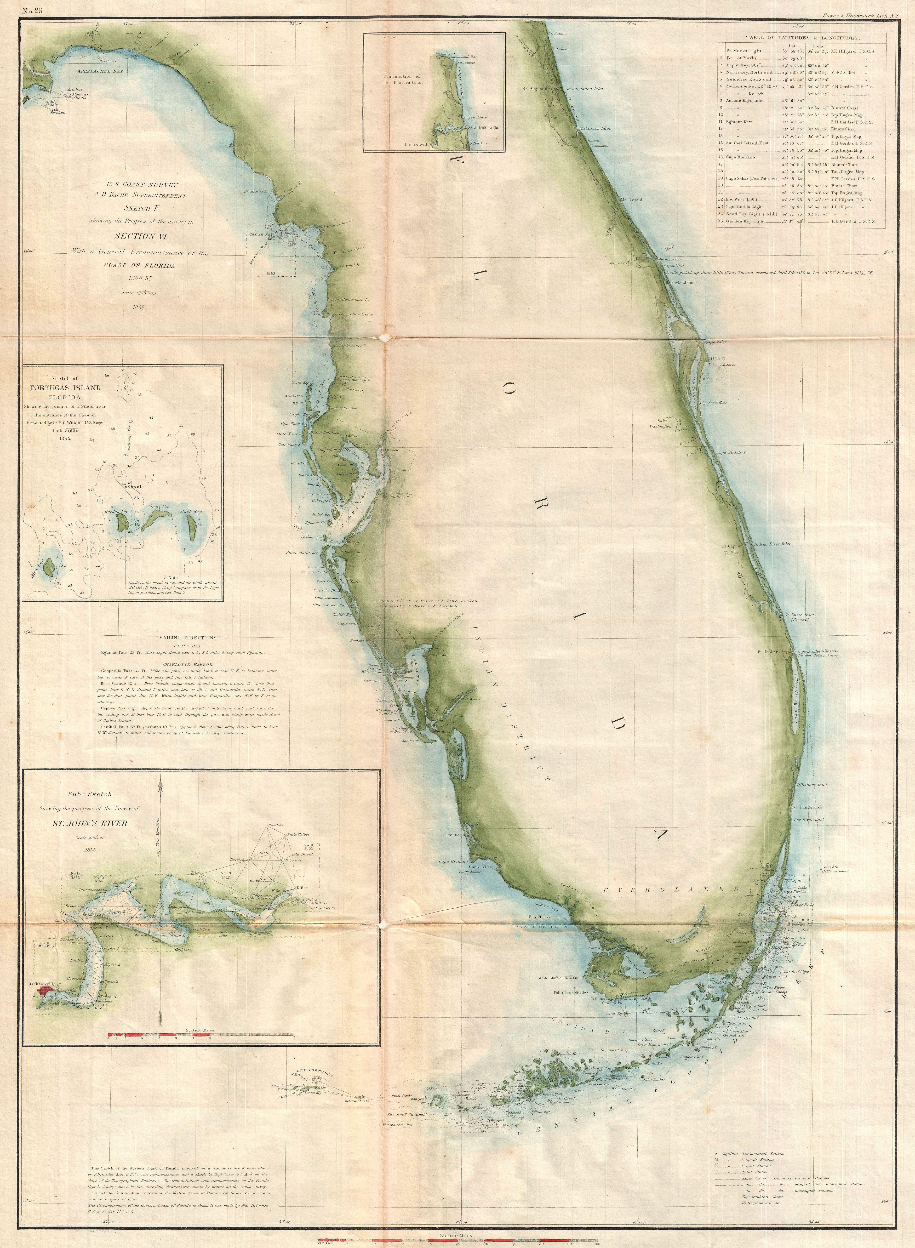
| Sketch F Showing the Progress of the Survey in Section VI. With a General Reconnaissance of the Coast of Florida 1848-55. | ||||||
|---|---|---|---|---|---|---|
| Artist | ||||||
| Title |
Sketch F Showing the Progress of the Survey in Section VI. With a General Reconnaissance of the Coast of Florida 1848-55. |
|||||
| Description |
English: A beautiful example of the U.S. Coast Survey’s 1855 triangulation chart or map of the Florida Peninsula. This map covers from St. Augustine and Apalachee Bay southwards as far as Key West and the Dry Tortugas. Triangulation charts of this type were prepared by the Coast Survey before more detailed survey work could take place. They firmly mapped the coastline noting various pointes, inlets, harbors, and Islands. Names Fort Lauderdale, St. Augustine, Key West, and Miami. This particular example features three insets focusing on St. John’s River as far as Jacksonville, the Tortugas Islands, and the Florida coastline in the vicinity of Jacksonville. Sailing directions are given to the left of Charlotte Harbor. The upper right quadrant features a table of latitudes and longitudes identifying major points, cities, and lighthouses. Published in the 1855 Superintendent's Report under the supervision of A. D. Bache, one of the most prolific and influential Superintendents of the U.S. Coast Survey. |
|||||
| Date | 1855 (dated) | |||||
| Dimensions | height: 17 in (43.1 cm); width: 23 in (58.4 cm) | |||||
| Accession number |
Geographicus link: Florida-uscs-1855 |
|||||
| Source/Photographer |
Report of the Superintendent of the United States Coast Survey, (Washington) 1855.
|
|||||
| Permission (Reusing this file) |
|
|||||
File history
Click on a date/time to view the file as it appeared at that time.
| Date/Time | Thumbnail | Dimensions | User | Comment | |
|---|---|---|---|---|---|
| current | 05:30, 25 March 2011 | | 3,500 × 4,773 (2.74 MB) | BotMultichillT (talk | contribs) | {{subst:User:Multichill/Geographicus |link=http://www.geographicus.com/P/AntiqueMap/Florida-uscs-1855 |product_name=1855 U.S. Coast survey Map of Florida |map_title=Sketch F Showing the Progress of the Survey in Section VI. With a General Reconnaissance o |
You cannot overwrite this file.
File usage on Commons
The following page uses this file: