File:1873 Colton Map of the Arctic or North Pole - Geographicus - PolarRegions-colton-1873.jpg
Jump to navigation
Jump to search

Size of this preview: 489 × 600 pixels. Other resolutions: 196 × 240 pixels | 391 × 480 pixels | 626 × 768 pixels | 835 × 1,024 pixels | 1,670 × 2,048 pixels | 3,000 × 3,679 pixels.
Original file (3,000 × 3,679 pixels, file size: 3.43 MB, MIME type: image/jpeg)
Captions
Captions
Add a one-line explanation of what this file represents
| J. H. Colton: Northern Regions.
( |
|||||||||||||||||||||
|---|---|---|---|---|---|---|---|---|---|---|---|---|---|---|---|---|---|---|---|---|---|
| Artist |
|
||||||||||||||||||||
| Title |
Northern Regions. |
||||||||||||||||||||
| Description |
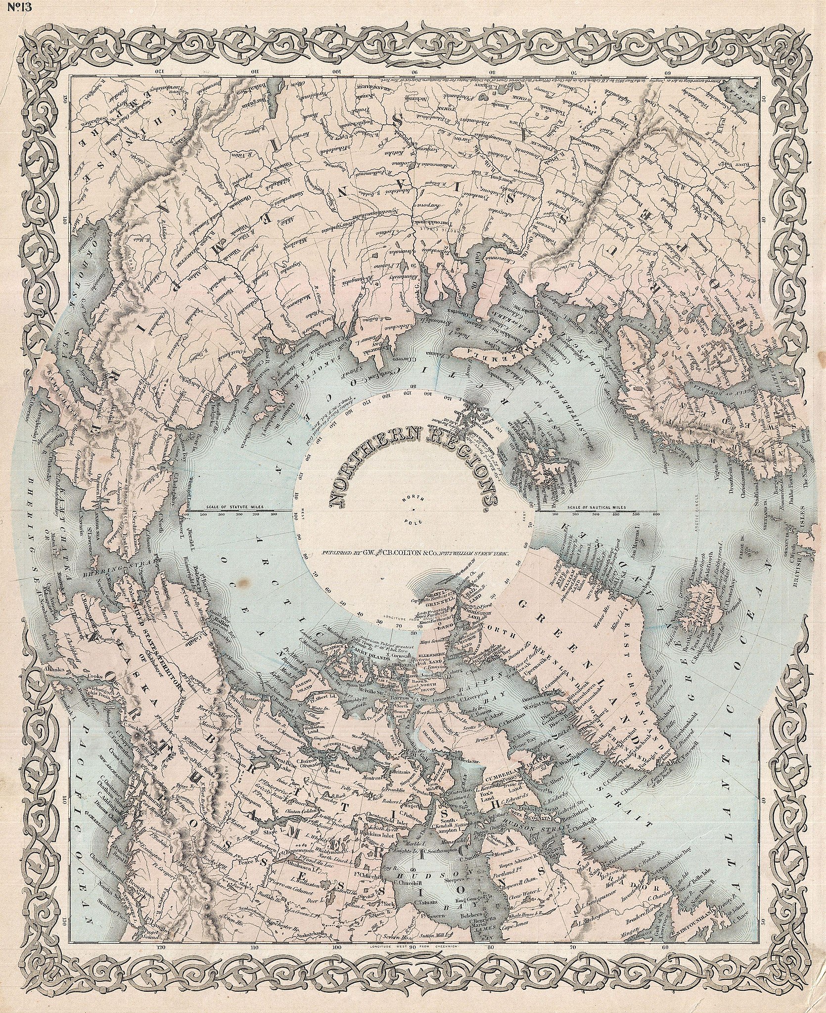
English: A rarely seen variant state of Colton’s map of the North Pole or Arctic. Covers from Lake Baikal, the Hudson Bay, the British Isles and Kamchatka north to the Pole. Generally gives an excellent overview of the state of Arctic exploration and discovery to about 1873. While Colton rarely updated his copyrights he did update his maps to reflect the most recent political changes, explorations, and discoveries. Colton's mapping of the arctic, first published in 1855 and subsequently updated though the 1870s, provides a valuable record of arctic exploration. This particular example, ostensibly very similar to the 1872 edition, features a number of notable updates around Peterman's Land, Franz Joseph Land, and northern Greenland. Identifies the United States Territory of Alaska, a curious convention common to Colton maps but rarely seen elsewhere as Alaska did not officially take on territory status until the 1880s. Lake many of the later editions of Colton's Northern Regions, this example is exceptionally rare and features a full color wash. Most previous editions of this map were in black and white. Prepared by G. W. and C. B. Colton as map no. 13 in the 1873 edition of Colton's Atlas of The World. |
||||||||||||||||||||
| Date | 1873 (undated) | ||||||||||||||||||||
| Dimensions | height: 16 in (40.6 cm); width: 13.5 in (34.2 cm) | ||||||||||||||||||||
| Accession number |
Geographicus link: PolarRegions-colton-1873 |
||||||||||||||||||||
| Source/Photographer |
Colton, G.W. & C.B., Colton's Atlas Of The World, Illustrating Physical And Political Geography., (1872 editon).
|
||||||||||||||||||||
| Permission (Reusing this file) |
|
||||||||||||||||||||

File history
Click on a date/time to view the file as it appeared at that time.
| Date/Time | Thumbnail | Dimensions | User | Comment | |
|---|---|---|---|---|---|
| current | 00:03, 24 March 2011 | | 3,000 × 3,679 (3.43 MB) | BotMultichillT (talk | contribs) | {{subst:User:Multichill/Geographicus |link=http://www.geographicus.com/P/AntiqueMap/PolarRegions-colton-1873 |product_name=1873 Colton Map of the Arctic or North Pole |map_title=Northern Regions. |description=A rarely seen variant state of Colton’s map |
You cannot overwrite this file.
File usage on Commons
The following page uses this file: