File:1882年の相模川河口(彩色).jpg

Original file (3,252 × 2,226 pixels, file size: 928 KB, MIME type: image/jpeg)
Captions
Captions
| Description |
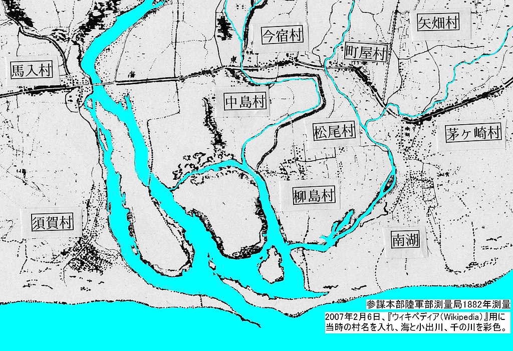
日本語: 著作権・版権の切れた古地図を加工したもの。
場所:現在の神奈川県茅ヶ崎市の南西部。相模川河口付近。 加工内容:海と川とを青く彩色し、旧村名を入れた。 目的:関東大震災前の相模川河口の状況を示す。 |
|||||
| Date | ||||||
| Source | 原図:参謀本部陸軍部測量局(1882年測量、1883年製版)。加工者:投稿者。 | |||||
| Author | 参謀本部陸軍部測量局 | |||||
| Permission (Reusing this file) |
|

File history
Click on a date/time to view the file as it appeared at that time.
| Date/Time | Thumbnail | Dimensions | User | Comment | |
|---|---|---|---|---|---|
| current | 13:37, 6 February 2007 | | 3,252 × 2,226 (928 KB) | Kafuka1964 (talk | contribs) | 著作権・版権の切れた古地図を加工したもの。 原図:参謀本部陸軍部測量局(1882年測量、1883年製版)。 場所:現在の神奈川県茅ヶ崎市の南西部。相模川河口付近。 加工内容:海と川とを� |
You cannot overwrite this file.
File usage on Commons
There are no pages that use this file.
File usage on other wikis
The following other wikis use this file:
- Usage on ja.wikipedia.org
.jpg&oldid=745940425)