File:1899 View Map of Boston Harbor from Boston to Cape Cod and Provincetown - Geographicus - Boston-unionnews-1899.jpg
Original file (3,500 × 2,758 pixels, file size: 3.36 MB, MIME type: image/jpeg)
Captions
Captions
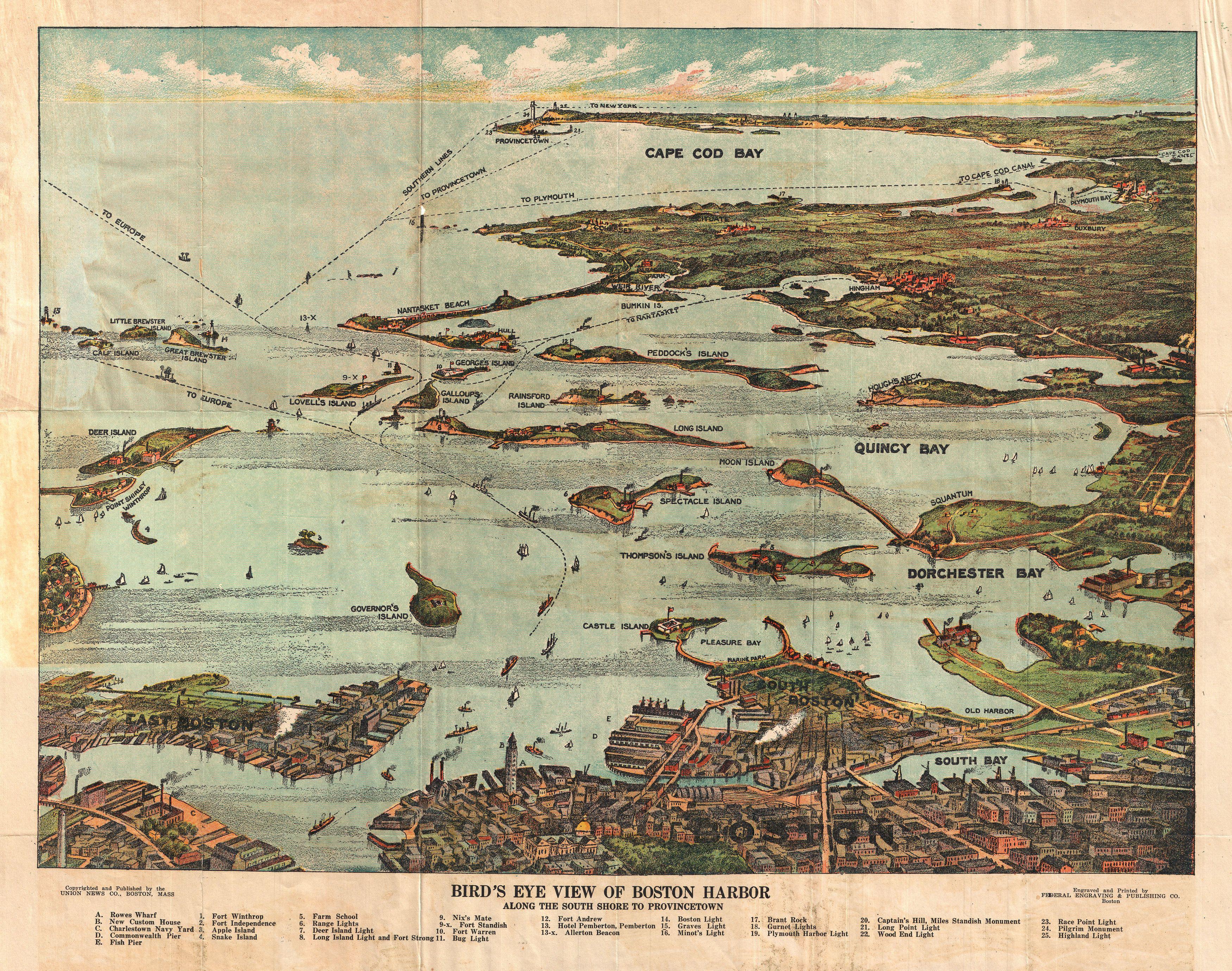
| Bird's Eye View of Boston Harbor in colors Along the South Shore to Plymouth Cape Code Canal and Provincetown Showing all Steamboat Routes. | ||||||
|---|---|---|---|---|---|---|
| Artist | ||||||
| Title |
Bird's Eye View of Boston Harbor in colors Along the South Shore to Plymouth Cape Code Canal and Provincetown Showing all Steamboat Routes. |
|||||
| Description |
English: A remarkable chromolithograph map and view of Boston Harbor from Boston to Provincetown. Includes all of Cape Cod Bay, Quincy Bay and Dorchester Bay with the communities of Boston, East Boston, South Boston, Dorchester, Quincy, Hough's Neck, Mingham, Nantasket, Duxbury, Plymouth, Cohasset, Scituate, and Provincetown noted. Also notes many of the Islands in Boston Harbor including Moon Island, Spectacle Island, Thomson's Island, Long Island, Governor's Island, and many others. Ferry and steamboat routes are noted. Though undated the style is clearly that of the 1890s. Published by the Union News Company of New York and Boston. |
|||||
| Date | circa 1899(undated) | |||||
| Dimensions | height: 16 in (40.6 cm); width: 19.5 in (49.5 cm) | |||||
| Accession number |
Geographicus link: Boston-unionnews-1899 |
|||||
| Source/Photographer |
|
|||||
| Permission (Reusing this file) |
|
|||||
File history
Click on a date/time to view the file as it appeared at that time.
| Date/Time | Thumbnail | Dimensions | User | Comment | |
|---|---|---|---|---|---|
| current | 21:05, 24 March 2011 | | 3,500 × 2,758 (3.36 MB) | BotMultichillT (talk | contribs) | {{subst:User:Multichill/Geographicus |link=http://www.geographicus.com/P/AntiqueMap/Boston-unionnews-1899 |product_name=1899 View Map of Boston Habor from Boston to Cape Cod and Provincetown |map_title=Bird's Eye View of Boston Harbor in colors Along the |
You cannot overwrite this file.
File usage on Commons
The following 2 pages use this file: