File:1918 Wisconsin State Highway Map.pdf
Jump to navigation
Jump to search
Size of this JPG preview of this PDF file: 480 × 599 pixels. Other resolutions: 192 × 240 pixels | 385 × 480 pixels | 615 × 768 pixels | 821 × 1,024 pixels | 1,641 × 2,048 pixels | 3,029 × 3,779 pixels.
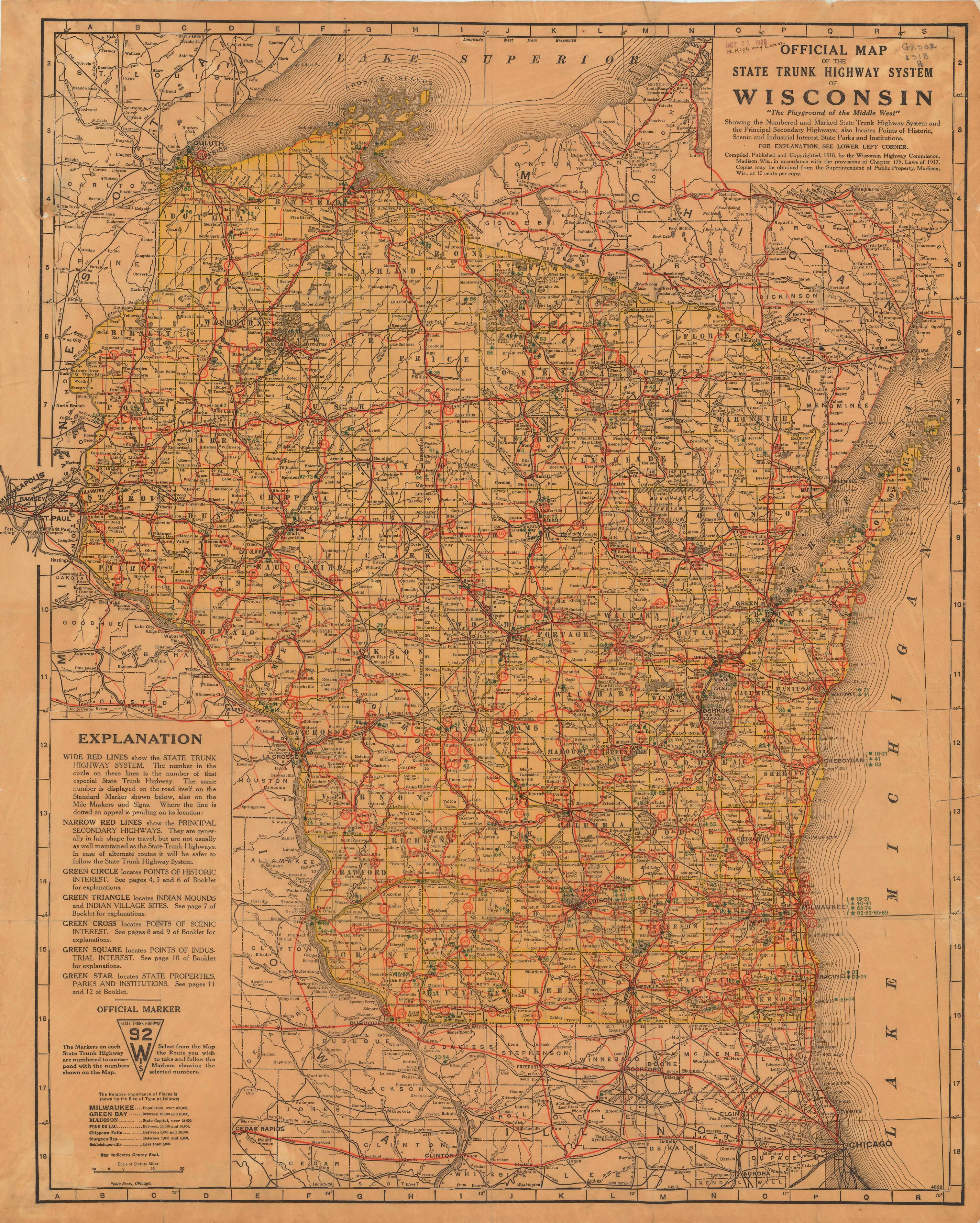
Original file (3,029 × 3,779 pixels, file size: 4.67 MB, MIME type: application/pdf)
Captions
Captions
Add a one-line explanation of what this file represents
Summary[edit]
| Description |
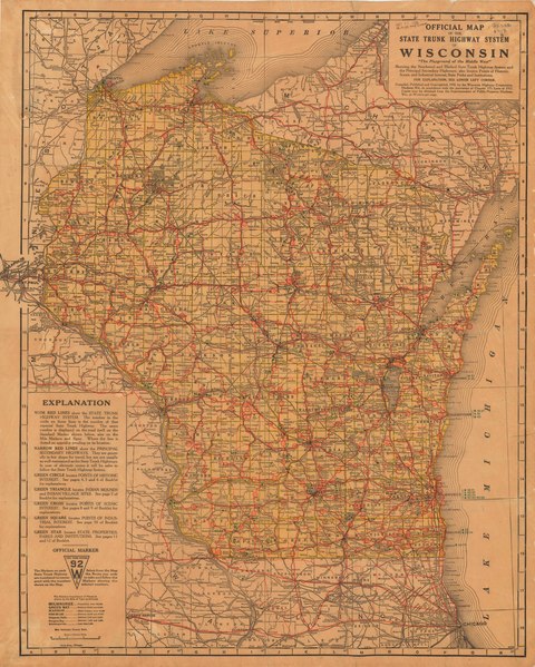
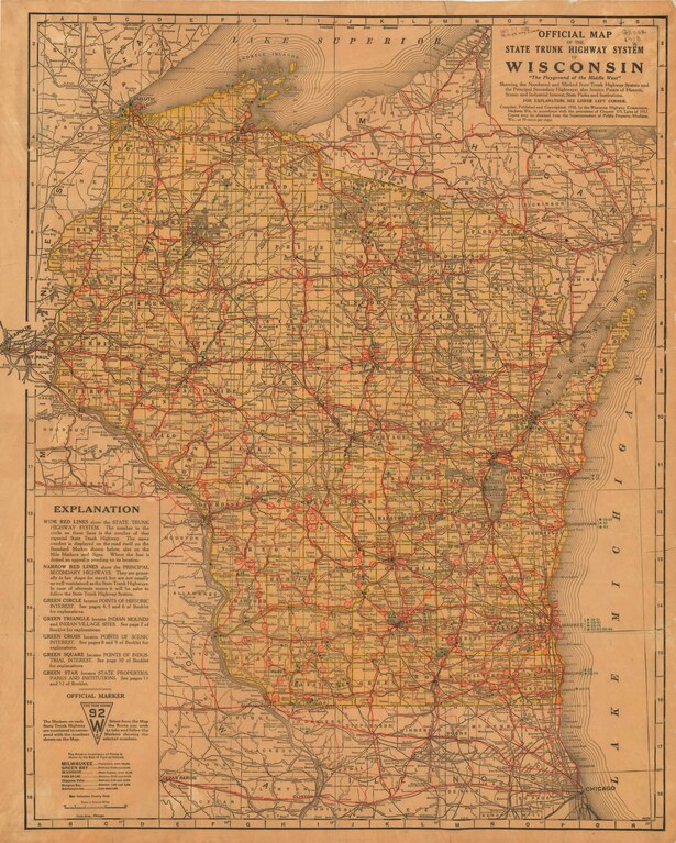
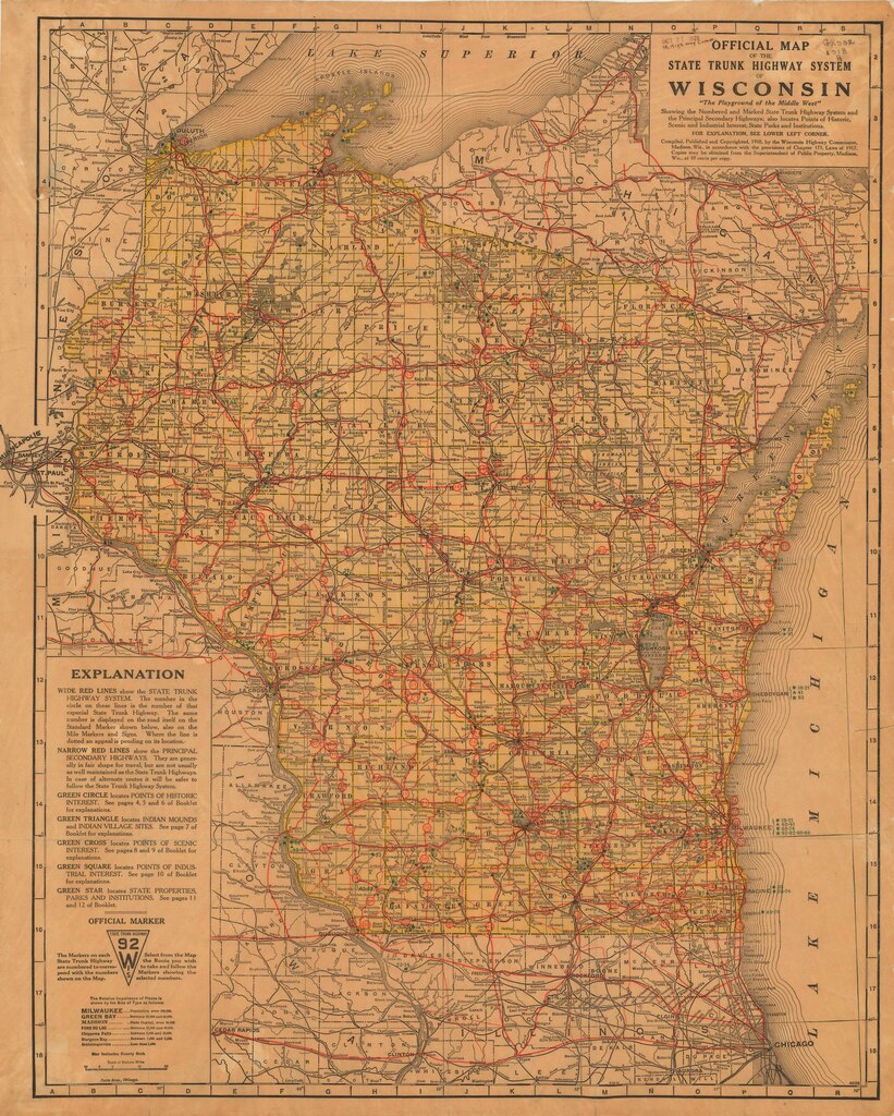
English: Official Map of the State Trunk Highway System of Wisconsin |
| Date | |
| Source | Official Wisconsin highway map: Historic maps] |
| Author | Wisconsin Highway Commission |
Licensing[edit]
This work is in the public domain in the United States because it was published (or registered with the U.S. Copyright Office) before January 1, 1929.
Public domain works must be out of copyright in both the United States and in the source country of the work in order to be hosted on the Commons. If the work is not a U.S. work, the file must have an additional copyright tag indicating the copyright status in the source country.
Note: This tag should not be used for sound recordings. |
File history
Click on a date/time to view the file as it appeared at that time.
| Date/Time | Thumbnail | Dimensions | User | Comment | |
|---|---|---|---|---|---|
| current | 00:07, 6 February 2023 |  | 3,029 × 3,779 (4.67 MB) | Imzadi1979 (talk | contribs) | Uploaded a work by Wisconsin Highway Commission from [https://wisconsindot.gov/Pages/travel/road/hwy-maps/default.aspx Official Wisconsin highway map: Historic maps]] with UploadWizard |
You cannot overwrite this file.
File usage on Commons
The following 2 pages use this file: