File:1940 German military map - Übersichtskarte Charkow-Batum.jpg
Jump to navigation
Jump to search

Size of this preview: 456 × 599 pixels. Other resolutions: 183 × 240 pixels | 365 × 480 pixels | 585 × 768 pixels | 779 × 1,024 pixels | 1,559 × 2,048 pixels | 24,662 × 32,395 pixels.
Original file (24,662 × 32,395 pixels, file size: 123.02 MB, MIME type: image/jpeg)
Captions
Captions
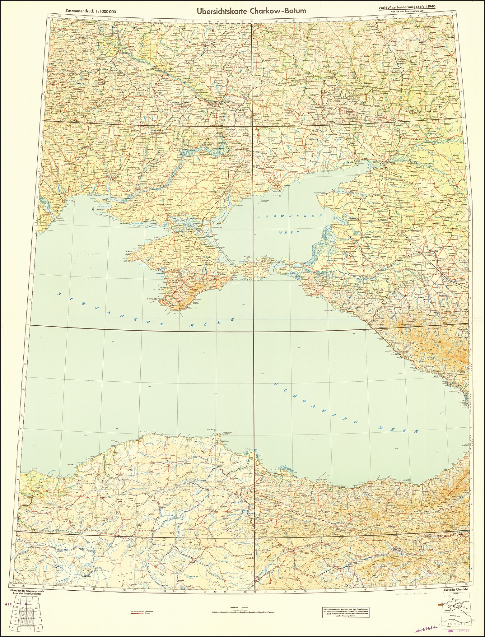
1940 German military map - Übersichtskarte Charkow-Batum
Summary
[edit]
| Warning | The original file is very high-resolution. It might not load properly or could cause your browser to freeze when opened at full size. |
|---|
| Description |
English: 1940 German military map - Übersichtskarte Charkow-Batum |
| Date | |
| Source | https://www.raremaps.com/gallery/detail/64726/second-world-war-eastern-mediterranean-and-southeastern-e-general-staff-of-the-german-army |
| Author | General Staff of the German Army |
Licensing
[edit]
This content comes from historical documents as service regulations ("Dienstvorschrift", "H.Dv.", "L.Dv", "M.Dv." etc.) or maps of the German Armed Forces (Wehrmacht) and its offices. Since these documents are considered official works, the content is in the public domain. Nevertheless, there may be restrictions on use due to other legal provisions (prohibited symbols of the Nazi era). Not all sources correctly state the rights to authorship of the Wehrmacht, sometimes it comes to the intellectual property rights fame (Copyfraud), if the authorship of the Wehrmacht and its legal successors is clearly recognizable and not indicated accordingly.
|
 |
| This work of bildende Kunst (visual art) or photography was published in Germany before the Law on Copyrights and Neighboring Rights (UrhG) came into effect on January 1, 1966. It does not indicate its author and was published by a legal entity under public law (§ 5 KUG; for details see Wikipedia:Bildrechte). Therefore according to § 134 Satz 2 UrhG, copyright expires 70 years after publishing.
|
 |
File history
Click on a date/time to view the file as it appeared at that time.
| Date/Time | Thumbnail | Dimensions | User | Comment | |
|---|---|---|---|---|---|
| current | 10:10, 3 June 2020 | | 24,662 × 32,395 (123.02 MB) | Balkanique (talk | contribs) | Uploaded a work by General Staff of the German Army from Raremaps.com with UploadWizard |
You cannot overwrite this file.
File usage on Commons
The following page uses this file: