File:1943 World War II Japanese Aeronautical Map of Australia - Geographicus - Australia15-wwii-1943.jpg
ナビゲーションに移動
検索に移動

このプレビューのサイズ: 800 × 560 ピクセル。 その他の解像度: 320 × 224 ピクセル | 640 × 448 ピクセル | 1,024 × 716 ピクセル | 1,280 × 895 ピクセル | 2,560 × 1,791 ピクセル | 5,000 × 3,498 ピクセル。
元のファイル (5,000 × 3,498 ピクセル、ファイルサイズ: 5.59メガバイト、MIME タイプ: image/jpeg)
キャプション
キャプション
このファイルの内容を1行で記述してください
| Australia. | |||||
|---|---|---|---|---|---|
| 作者 | |||||
| タイトル |
Australia. |
||||
| 解説 |
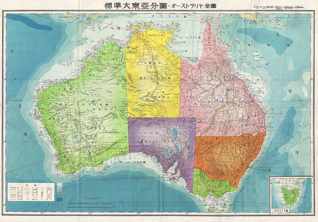
English: A stunning large format Japanese map of Australia dating to World War II. Covers the entirety of the continent with color coding according to district. Offers superb detail regarding both topographical and political elements. Notes cities, roads, trade routes on air, sea and land, and uses shading to display oceanic depths. While Allied World War II maps of this region are fairly common it is extremely rare to come across their Japanese counterparts. All text in Japanese. This map was created as map no. 15 of a 20 map series detailing of parts of Asia and the Pacific prepared by the Japanese during World War II. |
||||
| 日付 | 1943年 (undated) | ||||
| 寸法 | 高さ: 20 in (50.8 cm);幅: 29 in (73.6 cm) | ||||
| 台帳番号 |
Geographicus link: Australia15-wwii-1943 |
||||
| 情報源/撮影者 |
|
||||
| 許可 (ファイルの再利用) |
|
||||

ファイルの履歴
過去の版のファイルを表示するには、その版の日時をクリックしてください。
| 日付と時刻 | サムネイル | 寸法 | 利用者 | コメント | |
|---|---|---|---|---|---|
| 現在の版 | 2011年3月22日 (火) 16:38 | | 5,000 × 3,498 (5.59メガバイト) | BotMultichillT (トーク | 投稿記録) | {{subst:User:Multichill/Geographicus |link=http://www.geographicus.com/P/AntiqueMap/Australia15-wwii-1943 |product_name=1943 World War II Japanese Aeronautical Map of Australia |map_title=Australia. |description=A stunning large format Japanese map of Aus |
このファイルは上書きできません。
ファイルの使用状況
以下のページがこのファイルを使用しています:
グローバルなファイル使用状況
以下に挙げる他のウィキがこの画像を使っています:
- ja.wikipedia.org での使用状況