File:19970926 094026 umbria-marche shakemap.jpg
Jump to navigation
Jump to search
Size of this preview: 602 × 599 pixels. Other resolutions: 241 × 240 pixels | 482 × 480 pixels | 772 × 768 pixels | 1,029 × 1,024 pixels | 2,058 × 2,048 pixels.
Original file (2,058 × 2,048 pixels, file size: 888 KB, MIME type: image/jpeg)
Captions
Captions
Add a one-line explanation of what this file represents
Summary
[edit]
| Description |
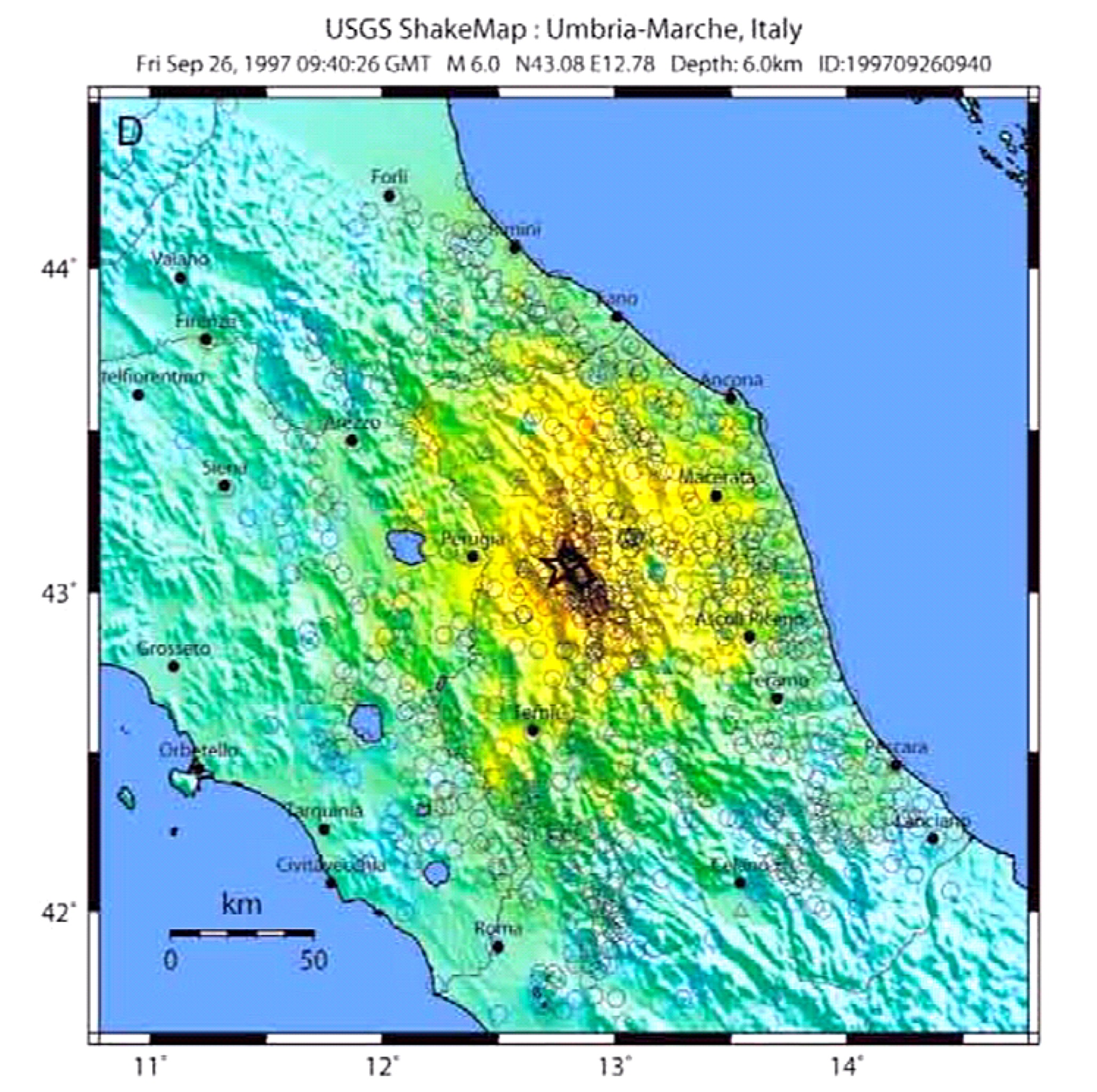
English: Map of the intensity of the Umbria and Marche earthquake of September 26, 1997
Italiano: Mappa dell'intensità del terremoto di Umbria e Marche del 26 settembre 1997 |
| Date | |
| Source | https://pubs.usgs.gov/of/2008/1236/downloads/OF08-1236_508.pdf |
| Author | USGS |
Licensing
[edit]
This image is in the public domain in the United States because it only contains materials that originally came from the United States Geological Survey, an agency of the United States Department of the Interior. For more information, see the official USGS copyright policy.
|
File history
Click on a date/time to view the file as it appeared at that time.
| Date/Time | Thumbnail | Dimensions | User | Comment | |
|---|---|---|---|---|---|
| current | 11:12, 18 April 2019 | | 2,058 × 2,048 (888 KB) | Lrt000 (talk | contribs) | {{Information |description ={{en|1=Map of the intensity of the Umbria and Marche earthquake of September 26, 1997}} {{it|1=Mappa dell'intensità del terremoto di Umbria e Marche del 26 settembre 1997}} |date =2019-04-18 |source =https://pubs.usgs.gov/of/2008/1236/downloads/OF08-1236_508.pdf |author =USGS }} |
You cannot overwrite this file.
File usage on Commons
There are no pages that use this file.
File usage on other wikis
The following other wikis use this file:
- Usage on en.wikipedia.org
- Usage on fr.wikipedia.org
- Usage on it.wikipedia.org