File:20100505 Helperlinie Groningen NL.jpg
Jump to navigation
Jump to search
Size of this preview: 600 × 600 pixels. Other resolutions: 240 × 240 pixels | 480 × 480 pixels | 768 × 768 pixels | 1,024 × 1,024 pixels | 2,158 × 2,158 pixels.
Original file (2,158 × 2,158 pixels, file size: 3.84 MB, MIME type: image/jpeg)
Captions
Captions
Add a one-line explanation of what this file represents
| Description |
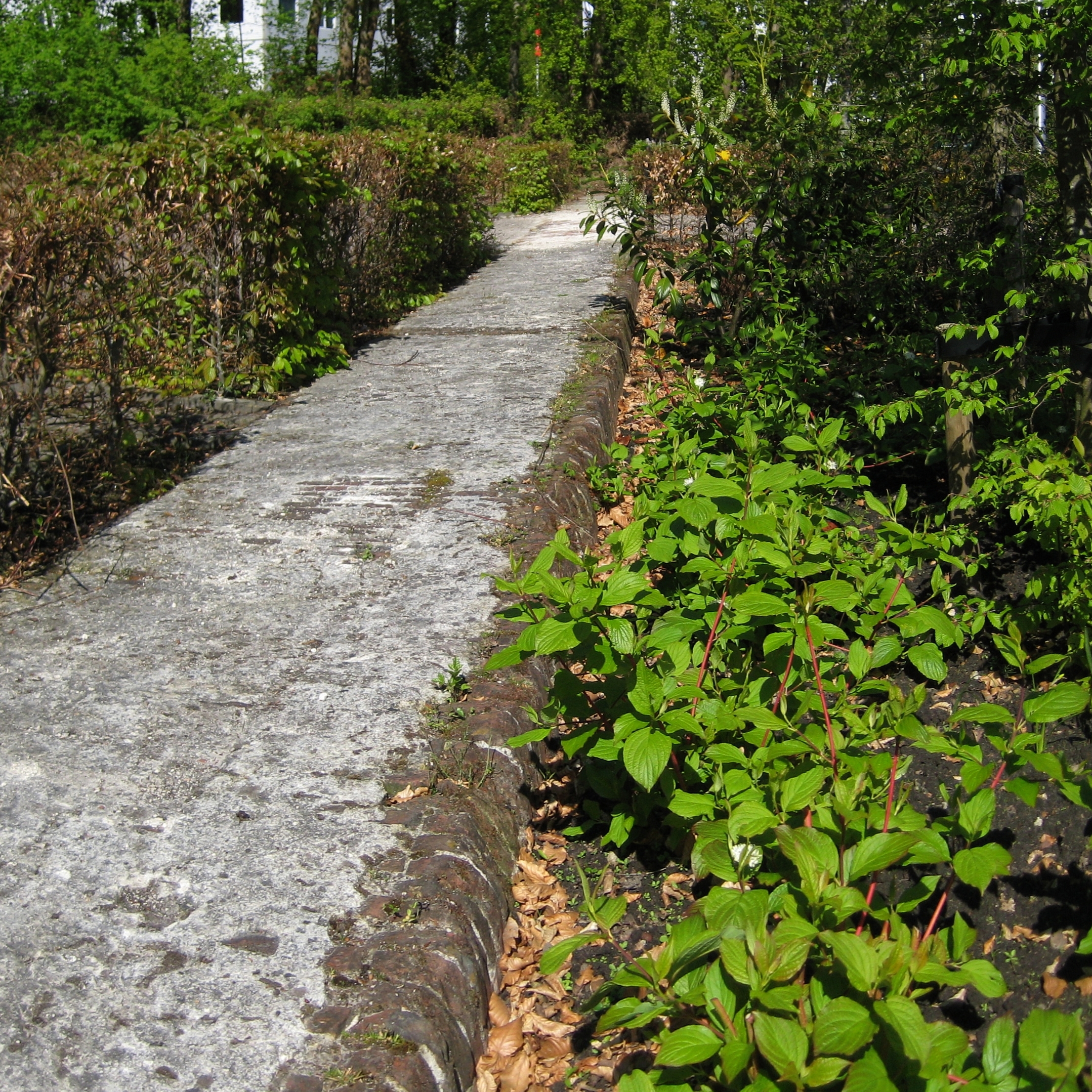
Frysk: Resten fan de festingmuorre fan de Helperlinie, de eardere súdlike ferdigeningswurken fan Grins, dy't yn 1698 ûntwurpen waarden troch Menno fan Coehoorn (1641-1704). In part fan wat der fan oer is westlik fan de Herewei is oanwiisd as argeologysk gemeentlik monumint (obj.nr. 106422). It mitselwurk op dizze foto, dat part is fan it parkearterrein fan in skoalle oan de Herewei, datearret út sa. 1855, doe't de festing ferbettere waard. Nederlands: Resten van de vestingmuur van de Helperlinie, de voormalige vestingwerken ten zuiden van de stad Groningen (1698, Menno van Coehoorn). Een deel van de overblijfselen ten westen van de Hereweg is aangewezen als archeologisch gemeentelijk monument (obj.nr. 106422). Het metselwerk op deze foto dateert uit ca. 1855, toen de vesting werd verbeterd.
|
||
| Date | |||
| Source | Own work | ||
| Author | Wutsje | ||
| Permission (Reusing this file) |
This file is licensed under the Creative Commons Attribution-Share Alike 3.0 Unported license.
|
||
| Other versions |
 .jpg) .jpg) |
||
| Attribution (required by the license) | Wutsje / Wikimedia Commons / | ||
| Camera location | | View this and other nearby images on: OpenStreetMap |
|---|
File history
Click on a date/time to view the file as it appeared at that time.
| Date/Time | Thumbnail | Dimensions | User | Comment | |
|---|---|---|---|---|---|
| current | 02:01, 6 May 2010 | | 2,158 × 2,158 (3.84 MB) | Wutsje (talk | contribs) | {{Information |Description={{en|1=Remains of the ''Helperlinie'', a former outwork in the Dutch city of Groningen.}} {{fy|1=Resten fan de festingmuorre fan de ''Helperlinie'', de eardere súdlike ferdigeningswurken fan Grins, dy't |
You cannot overwrite this file.
File usage on Commons
The following 6 pages use this file:
File usage on other wikis
The following other wikis use this file:
- Usage on nl.wikipedia.org
- Usage on www.wikidata.org