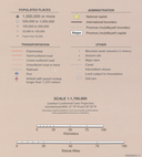
File:2011 CIA Syria country profile map.png

Πρωτότυπο αρχείο (5.984 × 6.020 εικονοστοιχεία, μέγεθος αρχείου: 67 MB, τύπος MIME: image/png)
Λεζάντες
Λεζάντες
Σύνοψη
[επεξεργασία]| Περιγραφή2011 CIA Syria country profile map.png |
English:  |
||||||
| Ημερομηνία | |||||||
| Πηγή |
United States Library of Congress https://lccn.loc.gov/2012594227 http://hdl.loc.gov/loc.gmd/g7460.ct003606 https://www.loc.gov/item/2012594227/ |
||||||
| Δημιουργός | United States Central Intelligence Agency | ||||||
| άλλες εκδόσεις |
|
Αδειοδότηση
[επεξεργασία]| Public domainPublic domainfalsefalse |
| This image is a work of a Central Intelligence Agency employee, taken or made as part of that person's official duties. As a Work of the United States Government, this image or media is in the public domain in the United States.
čeština ∙ Deutsch ∙ eesti ∙ English ∙ español ∙ français ∙ italiano ∙ português ∙ polski ∙ sicilianu ∙ slovenščina ∙ suomi ∙ Tiếng Việt ∙ български ∙ македонски ∙ русский ∙ українська ∙ বাংলা ∙ മലയാളം ∙ 한국어 ∙ 日本語 ∙ 中文 ∙ 中文(简体) ∙ 中文(繁體) ∙ العربية ∙ پښتو ∙ +/− |

|
Ιστορικό αρχείου
Πατήστε σε μια ημερομηνία/ώρα για να δείτε το αρχείο όπως εμφανιζόταν εκείνη την χρονική στιγμή.
| Ημερομηνία/Ώρα | Μικρογραφία | Διαστάσεις | Χρήστης | Σχόλιο | |
|---|---|---|---|---|---|
| τρέχον | 19:43, 9 Αυγούστου 2021 |  | 5.984 × 6.020 (67 MB) | GPinkerton (συζήτηση | Συνεισφορά) | File:2011 CIA Syria country profile.png cropped 49 % horizontally, 23 % vertically using CropTool with lossless mode. |
Δεν μπορείτε να αντικαταστήσετε αυτό το αρχείο.
Χρήση αρχείου
Οι ακόλουθες 3 σελίδες χρησιμοποιούν προς αυτό το αρχείο:
Μεταδεδομένα
Αυτό το αρχείο περιέχει πρόσθετες πληροφορίες, που πιθανόν προστέθηκαν από την ψηφιακή φωτογραφική μηχανή ή τον σαρωτή που χρησιμοποιήθηκε για την δημιουργία ή την ψηφιοποίησή του. Αν το αρχείο έχει τροποποιηθεί από την αρχική του κατάσταση, ορισμένες λεπτομέρειες πιθανόν να μην αντιστοιχούν πλήρως στο τροποποιημένο αρχείο.
| Οριζόντια ανάλυση | 118,11 dpc |
|---|---|
| Κατακόρυφη ανάλυση | 118,11 dpc |
| Ημερομηνία και ώρα τελευταίας επεξεργασίας αρχείου | 19:39, 9 Αυγούστου 2021 |

