File:20130904 Hunze (Drentsche Diep) Gn NL.jpg
Jump to navigation
Jump to search

Size of this preview: 800 × 267 pixels. Other resolutions: 320 × 107 pixels | 640 × 213 pixels | 1,024 × 341 pixels | 1,280 × 427 pixels | 2,560 × 853 pixels | 7,500 × 2,500 pixels.
Original file (7,500 × 2,500 pixels, file size: 4.98 MB, MIME type: image/jpeg)
Captions
Captions
Add a one-line explanation of what this file represents
| Description |
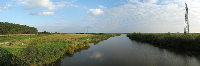
Frysk: De Hunze (hjir it Drentsche Diep neamd), sjoen nei it súdeasten ta fan de fytsbrêge wei yn it Polderpad, it fytspaad dat tusken Waterhuizen en Meerwijck troch de Westerbroekstermadepolder en de Kropswolderbuitenpolder rint. Links it spoar fan Grins nei Wynskoat en de Westerbroekstermadepolder, rjochts de Onnerpolder. Nederlands: De Hunze (hier het Drentsche Diep genoemd), gezien vanaf de fietsbrug in het Polderpad, het fietspad dat tussen Waterhuizen en Meerwijck door de Westerbroekstermadepolder en de Kropswolderbuitenpolder loopt. Links de spoorlijn Groningen-Winschoten en de Westerbroekstermadpolder, rechts de Onnerpolder. |
| Date | |
| Source | Own work |
| Author | |
| Attribution (required by the license) | Wutsje / Wikimedia Commons / |
| Permission (Reusing this file) |
This file is licensed under the Creative Commons Attribution-Share Alike 3.0 Unported license.
|
| Camera location | | View this and other nearby images on: OpenStreetMap |
|---|
_Gn_NL.jpg¶ms=053.180339_N_0006.657622_E_globe:Earth_type:camera_scale:5000_region:NL_heading:155.00&language=en)
File history
Click on a date/time to view the file as it appeared at that time.
| Date/Time | Thumbnail | Dimensions | User | Comment | |
|---|---|---|---|---|---|
| current | 17:21, 5 October 2013 | 7,500 × 2,500 (4.98 MB) | Wutsje (talk | contribs) | {{Information |Description = {{Multilingual description |en=The ''Hunze'', a river in the Dutch provinces of Groningen and Drenthe. |fy=De ''Hunze'' (hjir it ''Drentsche Diep'' neamd), sjoen n... |
You cannot overwrite this file.
File usage on Commons
The following 2 pages use this file:
- File:130904 Hunze (Drentsche Diep) Gn NL.jpg (file redirect)
- Category:Hunze (river)
_Gn_NL.jpg&redirect=no)
File usage on other wikis
The following other wikis use this file:
- Usage on ca.wikipedia.org
- Usage on eo.wikipedia.org
- Usage on www.wikidata.org
_Gn_NL.jpg&oldid=775099603)