File:20150407-RD-LSC-1006 (17028411407).jpg
Jump to navigation
Jump to search

Size of this preview: 800 × 534 pixels. Other resolutions: 320 × 214 pixels | 640 × 427 pixels | 1,024 × 683 pixels | 1,280 × 854 pixels | 2,560 × 1,709 pixels | 7,360 × 4,912 pixels.
Original file (7,360 × 4,912 pixels, file size: 7.06 MB, MIME type: image/jpeg)
Captions
Captions
Add a one-line explanation of what this file represents
Summary
[edit].jpg&action=edit§ion=1)
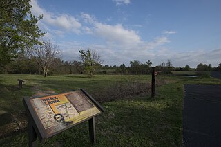
| Description | Honey Springs Visitors’ Center, a multi-purpose community/visitor center and library, in Rentiesville, OK, on Wednesday, Apr. 6, 2015. In January the U.S. Department of Agriculture (USDA) opened bids for building a multi-purpose community/visitor center and library in Rentiesville, OK. Rentiesfille, OK is the historic site of Oklahoma’s largest military engagement, The Battle of Honey Springs and the nation’s largest Civil War battle in which African American, American Indian, Hispanic and Anglo American soldiers engaged. The heroics of the Civil War’s first African American regiment, the First Kansas Colored, were largely responsible for the Union’s victory there. The center is a multi-million dollar partnership between four federal agencies, a state agency, McIntosh County, several local businesses, and a non-profit organization. The federal involvement includes the National Park Service, as well as all three agencies of the U.S. Department of Agriculture’s (USDA) Rural Development (RD) Rural Business Service (RBS), Rural Utilities Service (RUS), and Rural Housing Service (RHS). USDA photo by Lance Cheung. |
| Date | |
| Source | 20150407-RD-LSC-1006 |
| Author | Lance Cheung/photojournalist/USDA photo by Lance Cheung |
| Permission (Reusing this file) |
Flinfo has extracted the license below from the metadata of the image (tag "IFD0:Copyright" contained "Public Domain"). The license visible at Flickr was "Public Domain Mark". |
| Camera location | | View this and other nearby images on: OpenStreetMap |
|---|
.jpg¶ms=035.564797_N_-095.472906_E_globe:Earth_type:camera_source:Flickr_&language=en)
Licensing
[edit].jpg&action=edit§ion=2)
This image or file is a work of a United States Department of Agriculture employee, taken or made as part of that person's official duties. As a work of the U.S. federal government, the image is in the public domain.
|
 |
| This image was originally posted to Flickr by USDAgov at https://flickr.com/photos/41284017@N08/17028411407 (archive). It was reviewed on 22 December 2017 by FlickreviewR 2 and was confirmed to be licensed under the terms of the Public Domain Mark. |
File history
Click on a date/time to view the file as it appeared at that time.
| Date/Time | Thumbnail | Dimensions | User | Comment | |
|---|---|---|---|---|---|
| current | 13:20, 22 December 2017 | | 7,360 × 4,912 (7.06 MB) | Artix Kreiger 2 (talk | contribs) | Transferred from Flickr via Flickr2Commons |
You cannot overwrite this file.
File usage on Commons
There are no pages that use this file.
.jpg&oldid=798886116)