File:20180504535DR Hermsdorf (Ottendorf-Okrilla) Hermsdorfer Schloßpark.jpg
Jump to navigation
Jump to search

Size of this preview: 800 × 600 pixels. Other resolutions: 320 × 240 pixels | 640 × 480 pixels | 1,024 × 768 pixels | 1,280 × 960 pixels | 2,560 × 1,920 pixels | 3,648 × 2,736 pixels.
Original file (3,648 × 2,736 pixels, file size: 8.01 MB, MIME type: image/jpeg)
Captions
Captions
Add a one-line explanation of what this file represents
Summary
[edit]| Description |
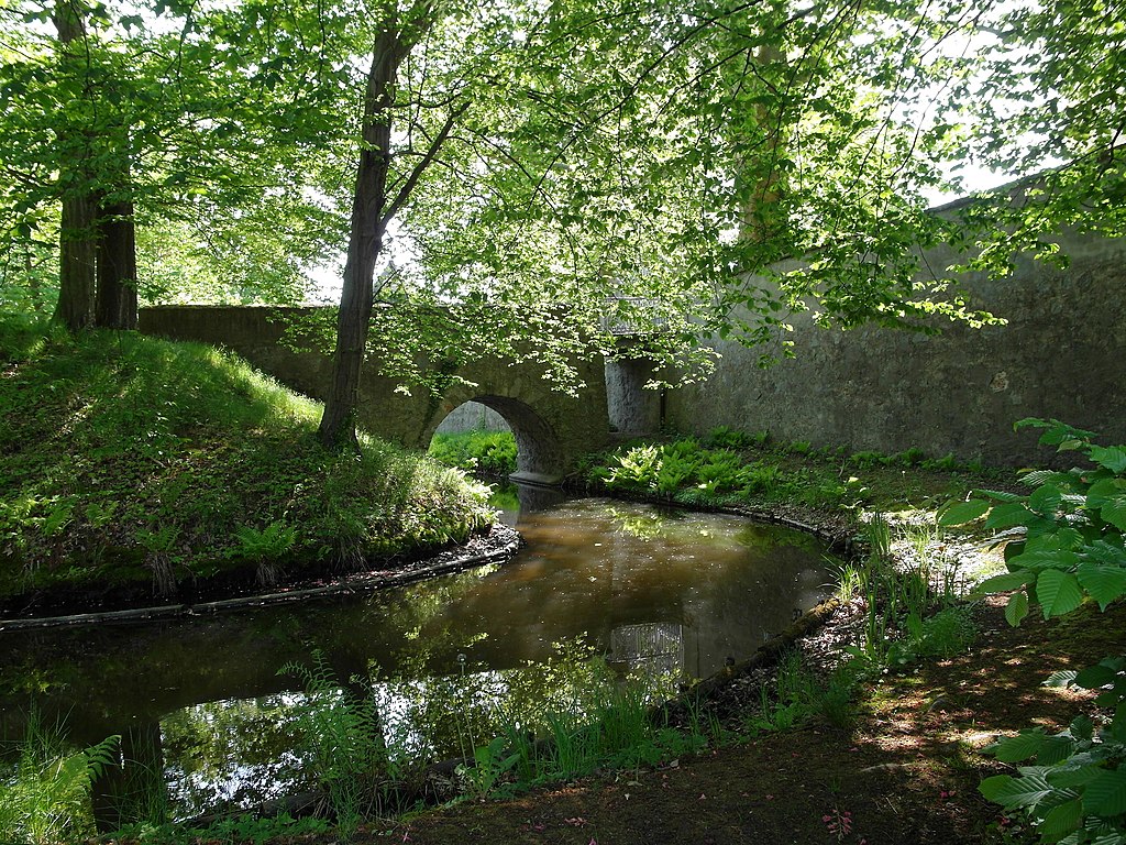
Deutsch: 04.05.2018 01458 Hermsdorf (Ottendorf-Okrilla), Schloßstraße: Wasserschloß Hermsdorf (GMP: 51.164413,13.819631). Vor seiner Ostseite ließ Adam Friedrich Graf von Flemming ab 1730 einen Barockgarten mit einer baumbumstandenen Wasserachse, dem Schloßgraben (GMP: 51.163124,13.823377), anlegen, der von der Großen Röder gespeist wird. Die barocken Gartenquartiere zu beiden Seiten der Wasserachse wurden in der zweiten Hälfte des 18. Jahrhunderts in einen englischen Landschaftspark umgewandelt. Hier die steinerne Schloßgrabenbrücke (GMP: 51.164189,13.828315) zum Park. [SAM5889.JPG]20180504535DR.JPG(c)Blobelt |
||||||||||||||
| Date | |||||||||||||||
| Source | Own work | ||||||||||||||
| Author |
|
||||||||||||||

_Hermsdorfer_Schlo%C3%9Fpark.jpg&action=edit§ion=1)
| Object location | | View this and other nearby images on: OpenStreetMap |
|---|
_Hermsdorfer_Schlo%C3%9Fpark.jpg¶ms=051.164413_N_0013.819631_E_globe:Earth_class:object_type:object__&language=en)
Licensing
[edit]_Hermsdorfer_Schlo%C3%9Fpark.jpg&action=edit§ion=2)
I, the copyright holder of this work, hereby publish it under the following license:
This file is licensed under the Creative Commons Attribution-Share Alike 4.0 International license.
- You are free:
- to share – to copy, distribute and transmit the work
- to remix – to adapt the work
- Under the following conditions:
- attribution – You must give appropriate credit, provide a link to the license, and indicate if changes were made. You may do so in any reasonable manner, but not in any way that suggests the licensor endorses you or your use.
- share alike – If you remix, transform, or build upon the material, you must distribute your contributions under the same or compatible license as the original.
This image was uploaded as part of Wiki Loves Earth 2018.
|
 |
File history
Click on a date/time to view the file as it appeared at that time.
| Date/Time | Thumbnail | Dimensions | User | Comment | |
|---|---|---|---|---|---|
| current | 21:26, 9 May 2018 | | 3,648 × 2,736 (8.01 MB) | Jörg Blobelt (talk | contribs) | User created page with UploadWizard |
You cannot overwrite this file.
File usage on Commons
The following page uses this file:
_Hermsdorfer_Schloßpark.jpg&oldid=847105410)