File:2019 PEI Polls Map.svg
Jump to navigation
Jump to search

Size of this PNG preview of this SVG file: 800 × 536 pixels. Other resolutions: 320 × 214 pixels | 640 × 429 pixels | 1,024 × 686 pixels | 1,280 × 858 pixels | 2,560 × 1,715 pixels | 818 × 548 pixels.
Original file (SVG file, nominally 818 × 548 pixels, file size: 9.17 MB)
Captions
Captions
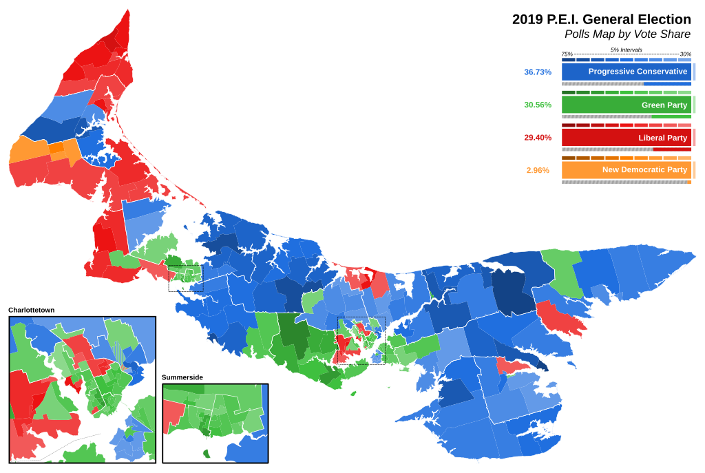
Map of the 2019 P.E.I. General Election by Electoral Polls
Summary
[edit]
| Description |
English: Map of the 2019 P.E.I. General Election by Electoral Polls with Riding Boundaries overlaid |
| Date | |
| Source | Own work |
| Author | Talleyrand6 |
Licensing
[edit]
I, the copyright holder of this work, hereby publish it under the following license:
This file is licensed under the Creative Commons Attribution-Share Alike 4.0 International license.
- You are free:
- to share – to copy, distribute and transmit the work
- to remix – to adapt the work
- Under the following conditions:
- attribution – You must give appropriate credit, provide a link to the license, and indicate if changes were made. You may do so in any reasonable manner, but not in any way that suggests the licensor endorses you or your use.
- share alike – If you remix, transform, or build upon the material, you must distribute your contributions under the same or compatible license as the original.
File history
Click on a date/time to view the file as it appeared at that time.
| Date/Time | Thumbnail | Dimensions | User | Comment | |
|---|---|---|---|---|---|
| current | 22:20, 13 March 2023 | | 818 × 548 (9.17 MB) | Talleyrand6 (talk | contribs) | let me change my own damn map how I please |
| 22:04, 13 March 2023 |  | 818 × 548 (9.17 MB) | Talleyrand6 (talk | contribs) | Uploaded own work with UploadWizard |
You cannot overwrite this file.
File usage on Commons
The following 2 pages use this file:
File usage on other wikis
The following other wikis use this file:
- Usage on en.wikipedia.org