File:20210603100DR Tharandt Burgruine und Bergkirche.jpg
Jump to navigation
Jump to search

Size of this preview: 800 × 568 pixels. Other resolutions: 320 × 227 pixels | 640 × 455 pixels | 1,024 × 727 pixels | 1,280 × 909 pixels | 2,560 × 1,818 pixels | 3,648 × 2,591 pixels.
Original file (3,648 × 2,591 pixels, file size: 7.35 MB, MIME type: image/jpeg)
Captions
Captions
Add a one-line explanation of what this file represents
Summary[edit]
| Description |
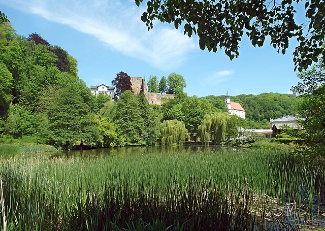
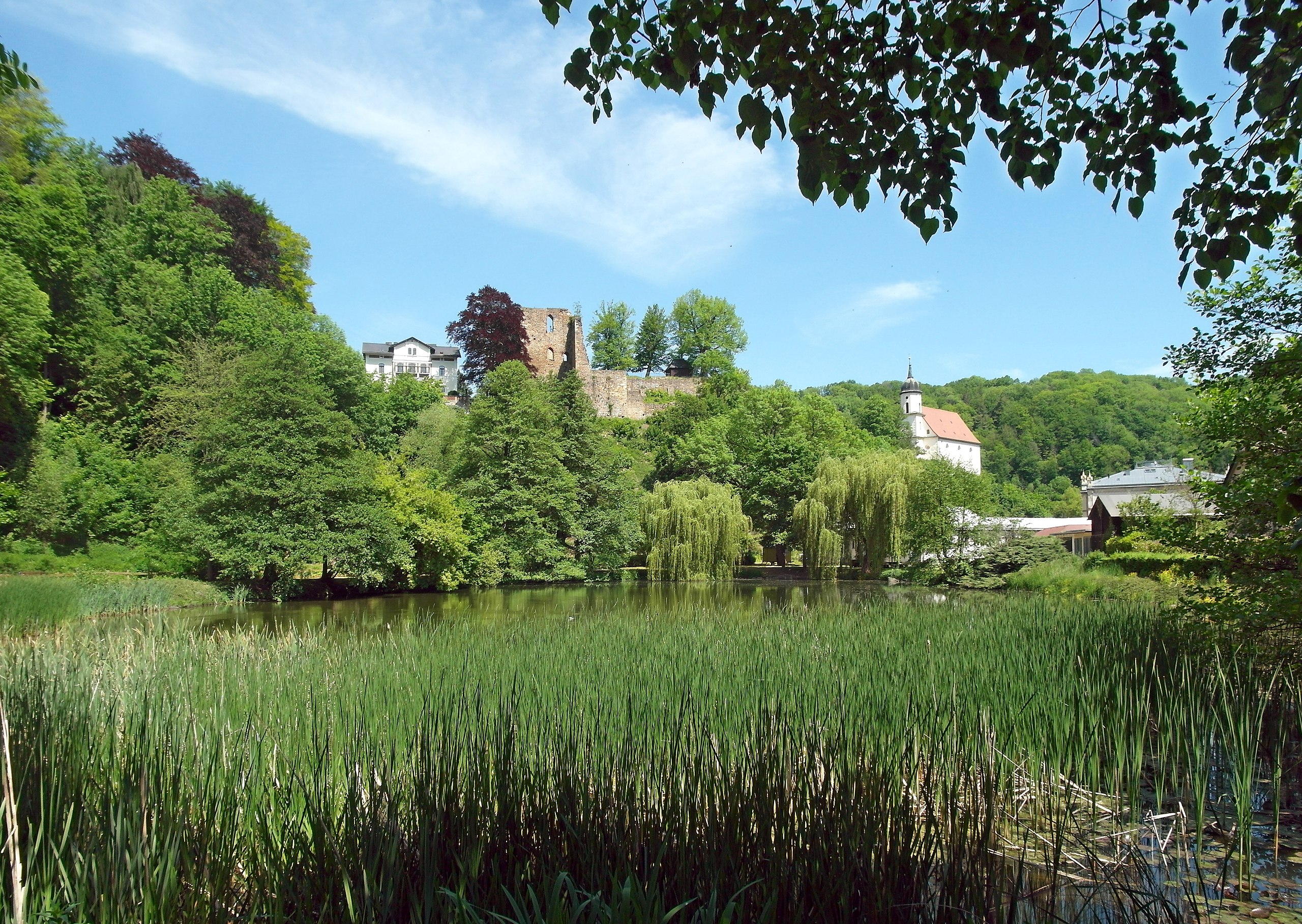
Deutsch: 03.06.2021 01737 Tharandt, Heinrich-Cotta -Straße: Burgruine aus dem 13. Jahrhundert (GMP: 50.982664,13.581209). Gegründet wurde die Burg Granaten (später in Tharandt umbenannt) im frühen 13. Jahrhundert von Dietrich dem Bedrängten, Markgraf von Meißen. Von hier aus begann die Erschließung des Tharandter Waldes. Heinrich der Erlauchte (1218-1288) hielt sich oft in der Burg auf, die er als Jagdsitz nutzte. 1476 führte Arnold von Westfalen, der Baumeister der Meißner Albrechtsburg, für Herzog Albrecht (1443-1500) und seine Gemahlin Zdena (Sidonie) Umbauten durch. Als 1568 die Burganlage durch Blitzschlag zerstört wurde, gab Kurfürst August von Sachsen (1526-1586) den alten Herrensitz auf. Links der Burg die 1851 für Julius Adolph Stöckhardt gebaute klassizistische Villa, Heinrich-Cotta-Straße 19. Rechts die Bergkirche Zum Heiligen Kreuz, 1626-1629 auf den Mauern der Unterburg erbaut und 1631 geweiht. Sicht von Südosten. [SAM4863.]20210603100DR.JPG(c)Blobelt |
||||||||||||||
| Date | |||||||||||||||
| Source | Own work | ||||||||||||||
| Author |
|
||||||||||||||

| Object location | | View this and other nearby images on: OpenStreetMap |
|---|
Licensing[edit]
This file is licensed under the Creative Commons Attribution-Share Alike 4.0 International license.
- You are free:
- to share – to copy, distribute and transmit the work
- to remix – to adapt the work
- Under the following conditions:
- attribution – You must give appropriate credit, provide a link to the license, and indicate if changes were made. You may do so in any reasonable manner, but not in any way that suggests the licensor endorses you or your use.
- share alike – If you remix, transform, or build upon the material, you must distribute your contributions under the same or compatible license as the original.
File history
Click on a date/time to view the file as it appeared at that time.
| Date/Time | Thumbnail | Dimensions | User | Comment | |
|---|---|---|---|---|---|
| current | 18:05, 3 June 2021 | | 3,648 × 2,591 (7.35 MB) | Jörg Blobelt (talk | contribs) | Uploaded a work by {{Creator:Jörg Blobelt}} from {{own}} with UploadWizard |
You cannot overwrite this file.
File usage on Commons
The following page uses this file: