File:24039-Besse-Sage.png
Jump to navigation
Jump to search
Size of this preview: 800 × 566 pixels. Other resolutions: 320 × 226 pixels | 640 × 453 pixels | 1,024 × 724 pixels | 1,280 × 905 pixels | 2,560 × 1,810 pixels | 7,015 × 4,960 pixels.
Original file (7,015 × 4,960 pixels, file size: 2.97 MB, MIME type: image/png)
Captions
Captions
Add a one-line explanation of what this file represents
Summary
[edit]
| Description |
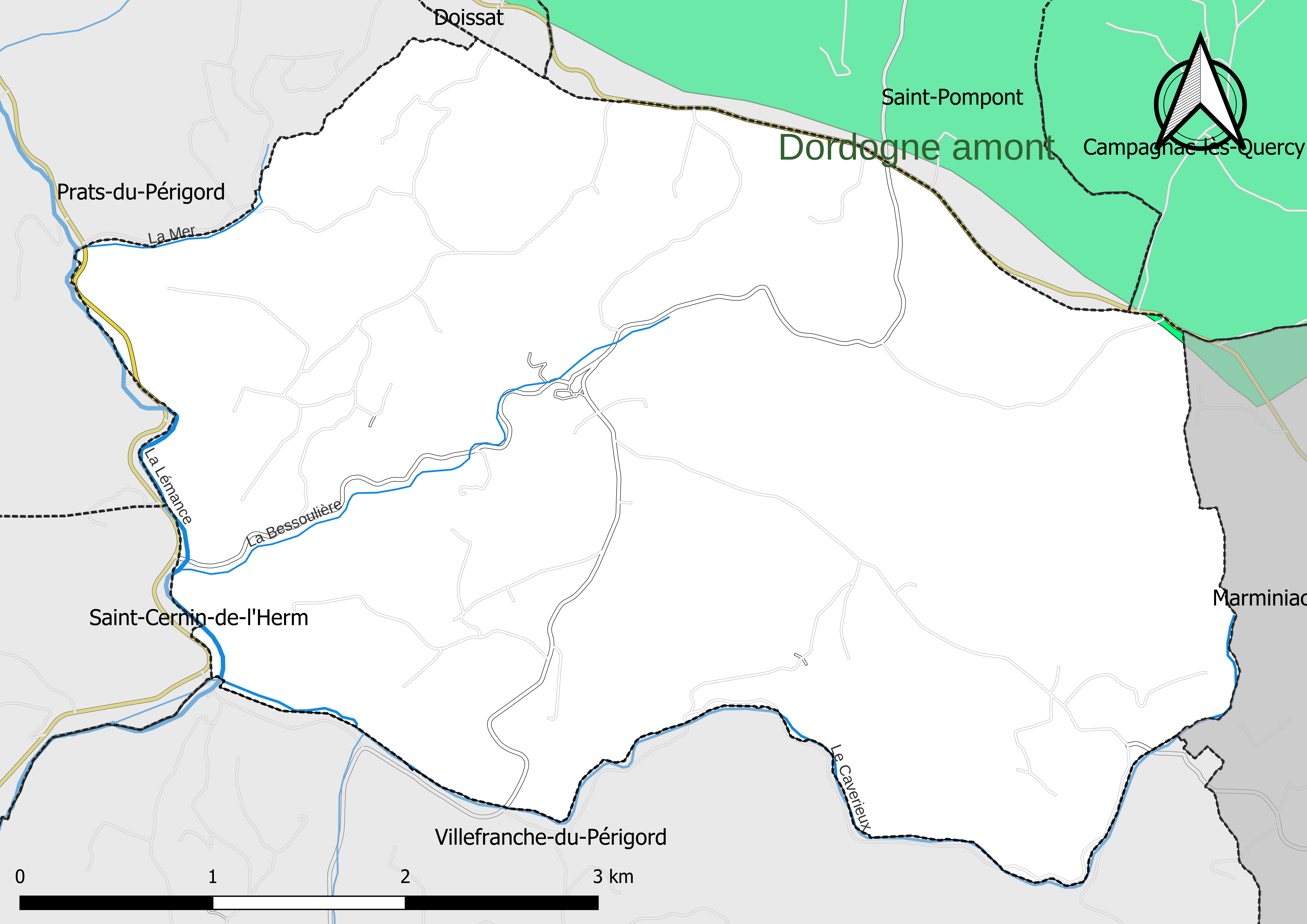
Français : Carte du ou des schémas d'aménagement et de gestion des eaux (SAGE) couvrant le territoire communal de Besse (Dorgogne, France). |
| Date | |
| Source |
Own work avec les données : * Découpage administratif communal et départemental : Export simple de janvier 2022 - vérifié et simplifié à 5 m sur le site du portail de données libres du gouvernement français, élaboré avec le concours des contributeurs à OpenStreetMap * Réseaux routier et ferré : : Export openstreetmap de Geofabrik- version de juin 2021 * Cours d'eau : Cours d'eau - Métropole - BD Carthage 2017 Périmètre des SAGE : Données de gesteau.fr Assemblé et enrichi dans fr:QGis. |
| Author | Poudou99 |
Licensing
[edit]
I, the copyright holder of this work, hereby publish it under the following license:
This file is licensed under the Creative Commons Attribution 4.0 International license.
- You are free:
- to share – to copy, distribute and transmit the work
- to remix – to adapt the work
- Under the following conditions:
- attribution – You must give appropriate credit, provide a link to the license, and indicate if changes were made. You may do so in any reasonable manner, but not in any way that suggests the licensor endorses you or your use.
File history
Click on a date/time to view the file as it appeared at that time.
| Date/Time | Thumbnail | Dimensions | User | Comment | |
|---|---|---|---|---|---|
| current | 23:46, 19 November 2022 | | 7,015 × 4,960 (2.97 MB) | Poudou99 (talk | contribs) | Uploaded own work with UploadWizard |
You cannot overwrite this file.
File usage on Commons
The following page uses this file:
File usage on other wikis
The following other wikis use this file:
- Usage on fr.wikipedia.org