File:27537-Meißen-1939-Bohnitzsch-Brück & Sohn Kunstverlag-det.jpg
Jump to navigation
Jump to search
Size of this preview: 800 × 397 pixels. Other resolutions: 320 × 159 pixels | 640 × 318 pixels | 1,031 × 512 pixels.
Original file (1,031 × 512 pixels, file size: 363 KB, MIME type: image/jpeg)
Captions
Captions
Add a one-line explanation of what this file represents
Summary
[edit]
| Description |
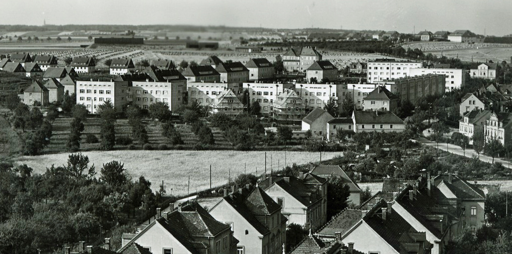
Deutsch: Die sogenannte Jahrtausendsiedlung in Meißen-Bohnitzsch, Großenhainer Str. / Tzschuckestr. (errichtet 1929–1932, unter Denkmalschutz), Architekt: Hans Waloschek |
| Date | |
| Source | File:27537-Meißen-1939-Bohnitzsch-Brück & Sohn Kunstverlag.jpg |
| Author | Brück & Sohn Kunstverlag Meißen |
| Camera location | | View this and other nearby images on: OpenStreetMap |
|---|
Licensing
[edit]
This file is licensed under the Creative Commons Attribution-Share Alike 3.0 Unported license.
- You are free:
- to share – to copy, distribute and transmit the work
- to remix – to adapt the work
- Under the following conditions:
- attribution – You must give appropriate credit, provide a link to the license, and indicate if changes were made. You may do so in any reasonable manner, but not in any way that suggests the licensor endorses you or your use.
- share alike – If you remix, transform, or build upon the material, you must distribute your contributions under the same or compatible license as the original.
File history
Click on a date/time to view the file as it appeared at that time.
| Date/Time | Thumbnail | Dimensions | User | Comment | |
|---|---|---|---|---|---|
| current | 09:55, 7 February 2019 | | 1,031 × 512 (363 KB) | SchiDD (talk | contribs) | User created page with UploadWizard |
You cannot overwrite this file.
File usage on Commons
There are no pages that use this file.
File usage on other wikis
The following other wikis use this file:
- Usage on de.wikipedia.org