File:46100 Overzicht locatie De Hoet.JPG
Jump to navigation
Jump to search
Size of this preview: 800 × 600 pixels. Other resolutions: 320 × 240 pixels | 640 × 480 pixels | 1,024 × 768 pixels | 1,280 × 960 pixels | 2,272 × 1,704 pixels.
Original file (2,272 × 1,704 pixels, file size: 2.93 MB, MIME type: image/jpeg)
Captions
Captions
Add a one-line explanation of what this file represents
Summary
[edit]
| Description |
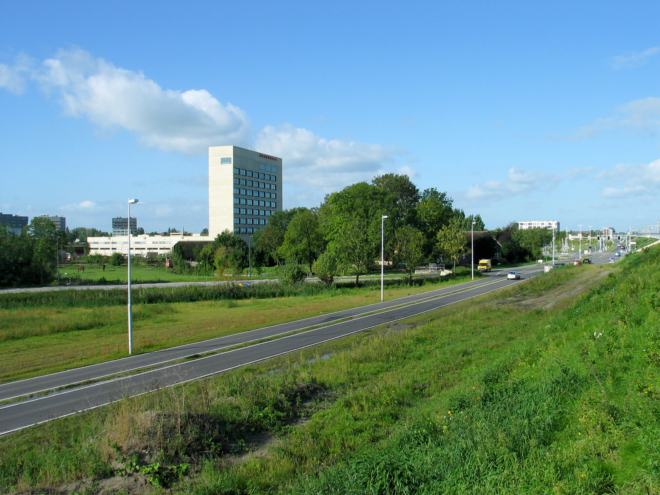
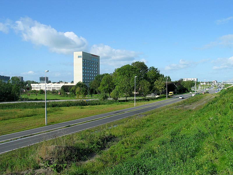
Nederlands: Overzicht van de locatie waar in de Middeleeuwen het versterkte huis De Hoet stond, aan de westelijke rand van Utrecht. Het grote gebouw is van de brandweer. onder de bomen, bij het gele bestelbusje, staat nog een smeedijzeren hek uit de 16e eeuw.
|
||
| Date | 15 September 2010 (according to Exif data) | ||
| Source | Own work | ||
| Author | Cornutus |
| Object location | | View this and other nearby images on: OpenStreetMap |
|---|
Licensing
[edit]
This image was uploaded as part of Wiki Loves Monuments 2010.
|
I, the copyright holder of this work, hereby publish it under the following license:
This file is licensed under the Creative Commons Attribution-Share Alike 3.0 Netherlands license.
- You are free:
- to share – to copy, distribute and transmit the work
- to remix – to adapt the work
- Under the following conditions:
- attribution – You must give appropriate credit, provide a link to the license, and indicate if changes were made. You may do so in any reasonable manner, but not in any way that suggests the licensor endorses you or your use.
- share alike – If you remix, transform, or build upon the material, you must distribute your contributions under the same or compatible license as the original.

File history
Click on a date/time to view the file as it appeared at that time.
| Date/Time | Thumbnail | Dimensions | User | Comment | |
|---|---|---|---|---|---|
| current | 12:34, 15 September 2010 | | 2,272 × 1,704 (2.93 MB) | Cornutus (talk | contribs) | {{Information |Description = {{nl|1=Overzicht van de locatie waar in de Middeleeuwen het versterkte huis De Hoet stond, aan de westelijke rand van Utrecht. Het grote gebouw is van de brandweer. onder de bomen, bij het gele bestelbusje, staat nog een smeed |
You cannot overwrite this file.
File usage on Commons
There are no pages that use this file.
File usage on other wikis
The following other wikis use this file:
- Usage on nl.wikipedia.org