File:8e Arrondissement, Paris, France - Open Street Map.png
Jump to navigation
Jump to search
Size of this preview: 621 × 600 pixels. Other resolutions: 249 × 240 pixels | 497 × 480 pixels | 795 × 768 pixels | 1,060 × 1,024 pixels | 1,347 × 1,301 pixels.
Original file (1,347 × 1,301 pixels, file size: 2.08 MB, MIME type: image/png)
Captions
Captions
Add a one-line explanation of what this file represents
Summary[edit]
| Description |
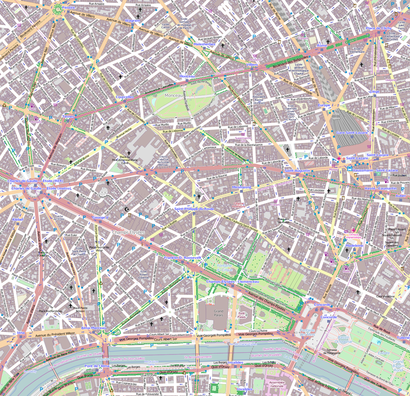
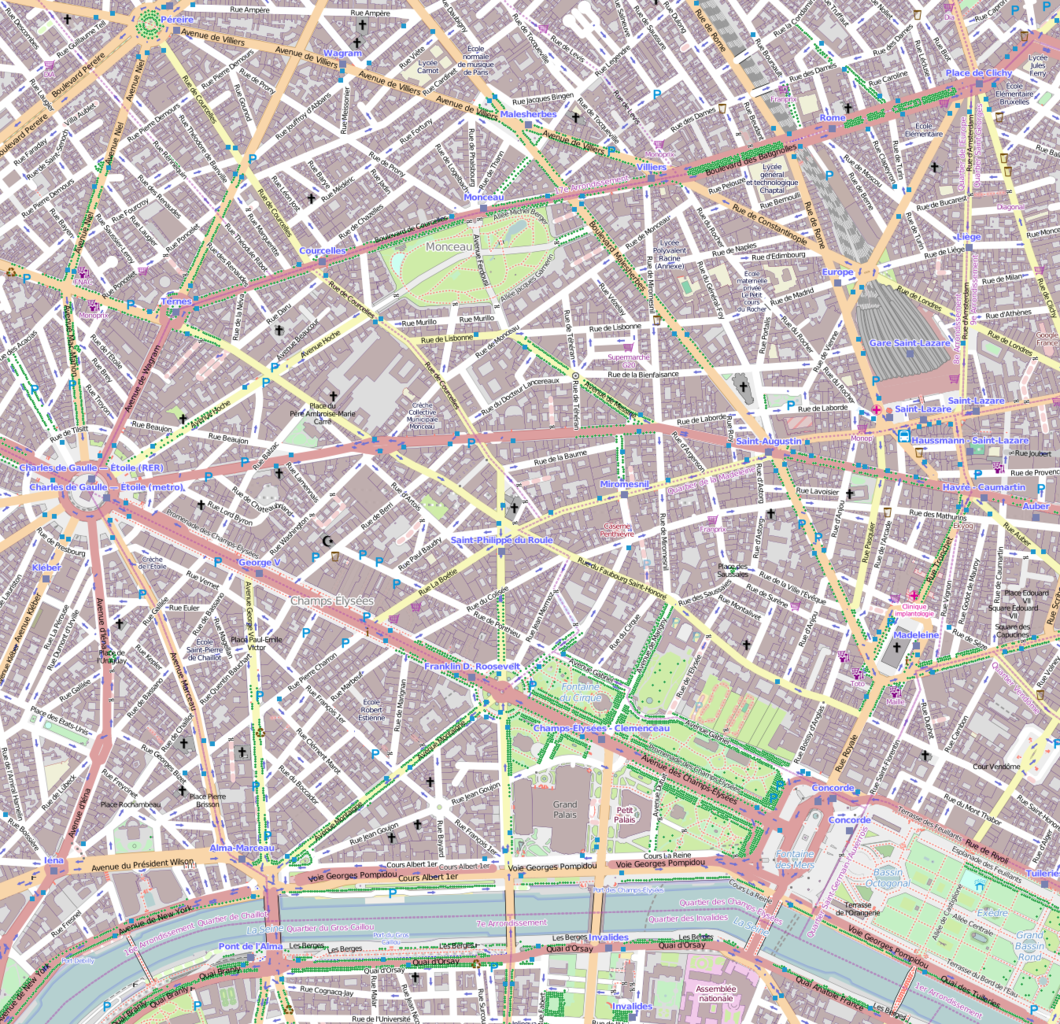
English: Map Paris 8th arrondissement. |
| Date | |
| Source | OpenStreetMap |
| Author | OpenStreetMap contributors |
Licensing[edit]
This file is licensed under the Creative Commons Attribution-Share Alike 2.5 Generic license.
- You are free:
- to share – to copy, distribute and transmit the work
- to remix – to adapt the work
- Under the following conditions:
- attribution – You must give appropriate credit, provide a link to the license, and indicate if changes were made. You may do so in any reasonable manner, but not in any way that suggests the licensor endorses you or your use.
- share alike – If you remix, transform, or build upon the material, you must distribute your contributions under the same or compatible license as the original.
File history
Click on a date/time to view the file as it appeared at that time.
| Date/Time | Thumbnail | Dimensions | User | Comment | |
|---|---|---|---|---|---|
| current | 15:40, 30 March 2014 | | 1,347 × 1,301 (2.08 MB) | Poulpy (talk | contribs) | User created page with UploadWizard |
You cannot overwrite this file.
File usage on Commons
There are no pages that use this file.
File usage on other wikis
The following other wikis use this file:
- Usage on fr.wikipedia.org
- Avenue des Champs-Élysées
- Place de la Concorde
- Place de l'Europe - Simone Veil (Paris)
- Musée Nissim-de-Camondo
- Musée Jacquemart-André
- Palais de la découverte
- Rue Montalivet
- Rue de Saint-Pétersbourg
- Musée Cernuschi
- Lycée Chaptal
- Avenue Vélasquez
- Rue Euler
- Rue de la Ville-l'Évêque
- Rue du Faubourg-Saint-Honoré
- Hôtel Grimod de La Reynière
- Rue Boissy-d'Anglas
- Place Beauvau
- Avenue Montaigne
- Modèle:Infobox Voie de Paris
- Avenue de Selves
- Rue Royale (Paris)
- Avenue de Friedland
- Église écossaise de Paris
- Ambassade des États-Unis en France
- Place de la Madeleine
- Rue d'Aguesseau (Paris)
- Rue de Monceau
- Rue de Constantinople
- Rue La Boétie
- Rue Washington
- Rue Balzac
- Passage Puteaux
- Rue des Saussaies
- Avenue George-V
- Rond-point des Champs-Élysées-Marcel-Dassault
- Rue Lavoisier
- Cours Albert-Ier
- Cours la Reine
- One-Two-Two
- Square Marcel-Pagnol
- Jardin de l'Hôtel-Salomon-de-Rothschild
- Église Saint-André-de-l'Europe
- Avenue Hoche
- Avenue Franklin-D.-Roosevelt
- Rue Beaujon
- Place du Canada (Paris)
- Avenue Gabriel
- Avenue de Marigny
- Rue Jean-Goujon
- Rue de l'Arcade (Paris)
View more global usage of this file.