File:A.L.G. Bosboom - Toussaint, schrijfster.jpg
Original file (1,560 × 1,594 pixels, file size: 1.22 MB, MIME type: image/jpeg)
Captions
Summary[edit]
DescriptionA.L.G. Bosboom - Toussaint, schrijfster.jpg |
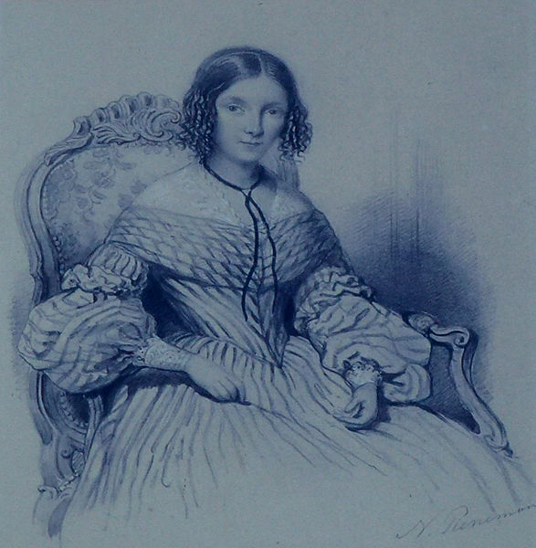
Nederlands: Anna Louisa Geertruida Bosboom-Toussaint, schrijfster van o.a. majoor Frans |
Date |
between 1820 and 1849 date QS:P,+1850-00-00T00:00:00Z/7,P1319,+1820-00-00T00:00:00Z/9,P1326,+1849-00-00T00:00:00Z/9 |
Source | Tekening van Nicolaas Pieneman, Rijksmuseum |
Author | Johannes Philippus Lange naar Nicolaas Pieneman |
Other versions |
Camera location | 52° 00′ 56.78″ N, 4° 41′ 55.01″ E | View this and other nearby images on: OpenStreetMap | 52.015772; 4.698614 |
---|
Licensing[edit]
Public domainPublic domainfalsefalse |
This work is in the public domain in its country of origin and other countries and areas where the copyright term is the author's life plus 100 years or fewer. You must also include a United States public domain tag to indicate why this work is in the public domain in the United States. | |
This file has been identified as being free of known restrictions under copyright law, including all related and neighboring rights. |
https://creativecommons.org/publicdomain/mark/1.0/PDMCreative Commons Public Domain Mark 1.0falsefalse
File history
Click on a date/time to view the file as it appeared at that time.
Date/Time | Thumbnail | Dimensions | User | Comment | |
---|---|---|---|---|---|
current | 21:51, 30 May 2015 | 1,560 × 1,594 (1.22 MB) | Agaath (talk | contribs) | User created page with UploadWizard |
You cannot overwrite this file.
File usage on Commons
The following page uses this file:
Metadata
This file contains additional information such as Exif metadata which may have been added by the digital camera, scanner, or software program used to create or digitize it. If the file has been modified from its original state, some details such as the timestamp may not fully reflect those of the original file. The timestamp is only as accurate as the clock in the camera, and it may be completely wrong.
Camera manufacturer | Panasonic |
---|---|
Camera model | DMC-TZ20 |
Exposure time | 1/160 sec (0.00625) |
F-number | f/5.3 |
ISO speed rating | 100 |
Date and time of data generation | 14:02, 24 May 2015 |
Lens focal length | 25.5 mm |
Latitude | 52° 0′ 56.78″ N |
Longitude | 4° 41′ 55.01″ E |
Width | 4,320 px |
Height | 3,240 px |
Bits per component |
|
Pixel composition | RGB |
Orientation | Normal |
Number of components | 3 |
Horizontal resolution | 180 dpi |
Vertical resolution | 180 dpi |
Software used | Adobe Photoshop Elements 12.0 Windows |
File change date and time | 14:02, 24 May 2015 |
Y and C positioning | Co-sited |
Exposure Program | Landscape mode (for landscape photos with the background in focus) |
Exif version | 2.3 |
Date and time of digitizing | 14:02, 24 May 2015 |
Meaning of each component |
|
Image compression mode | 4 |
APEX shutter speed | 7.321928 |
APEX aperture | 4.811985 |
APEX exposure bias | 0 |
Maximum land aperture | 4.8125 APEX (f/5.3) |
Metering mode | Pattern |
Light source | Unknown |
Flash | Flash did not fire, compulsory flash suppression |
Supported Flashpix version | 1 |
Color space | sRGB |
Sensing method | One-chip color area sensor |
File source | Digital still camera |
Scene type | A directly photographed image |
Custom image processing | Normal process |
Exposure mode | Auto exposure |
White balance | Auto white balance |
Digital zoom ratio | 0 |
Focal length in 35 mm film | 156 mm |
Scene capture type | Standard |
Scene control | None |
Contrast | Normal |
Saturation | Normal |
Sharpness | Normal |
GPS time (atomic clock) | 13:00 |
Satellites used for measurement | 5 |
Receiver status | Measurement in progress |
Measurement mode | 2-dimensional measurement |
Measurement precision | Moderate (1) |
Geodetic survey data used | WGS-84 |
GPS date | 24 May 2015 |
GPS tag version | 0.0.2.2 |
Date metadata was last modified | 19:11, 25 May 2015 |
Unique ID of original document | 4D274787B4EF44FB00D620549EC1F5E9 |