File:A map of the Thracian Bosphorus or canal of Constantinople - T. Jefferys delin. et sculp. - btv1b59641991.jpg
Jump to navigation
Jump to search

Size of this preview: 377 × 599 pixels. Other resolutions: 151 × 240 pixels | 302 × 480 pixels | 483 × 768 pixels | 645 × 1,024 pixels | 1,289 × 2,048 pixels | 3,128 × 4,968 pixels.
Original file (3,128 × 4,968 pixels, file size: 2.79 MB, MIME type: image/jpeg)
Captions
Captions
Add a one-line explanation of what this file represents
Summary
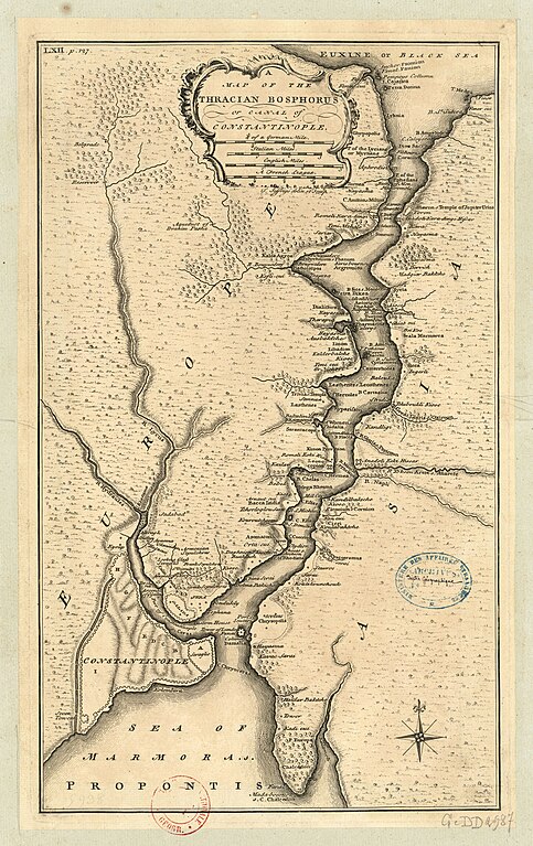
[edit]| A map of the Thracian Bosphorus or canal of Constantinople / T. Jefferys delin. et sculp.
( |
|||||||||||||||||||||||||||
|---|---|---|---|---|---|---|---|---|---|---|---|---|---|---|---|---|---|---|---|---|---|---|---|---|---|---|---|
| Author |
Jefferys, Thomas (1719?-1771). Cartographe. Graveur |
||||||||||||||||||||||||||
| Title |
A map of the Thracian Bosphorus or canal of Constantinople / T. Jefferys delin. et sculp. |
||||||||||||||||||||||||||
| Description |
Français : Sujet : Bosphore, Détroit du
Appartient à l’ensemble documentaire : AnvilMF Appartient à l’ensemble documentaire : MAEDI008 Appartient à l’ensemble documentaire : MAEDIGen0 Couverture : Europe (parties) Turquie Langue : anglais Éditeur : [s.n.] |
||||||||||||||||||||||||||
| Date | between 1700 and 1799 | ||||||||||||||||||||||||||
| Dimensions | height: 25 cm (9.8 in); width: 40 cm (15.7 in) | ||||||||||||||||||||||||||
| Collection |
|
||||||||||||||||||||||||||
| References |
Français : Notice de recueil : http://catalogue.bnf.fr/ark:/12148/cb40577015h
Appartient à : Collection d'Anville ; 05938 Notice du catalogue : http://catalogue.bnf.fr/ark:/12148/cb40671557j |
||||||||||||||||||||||||||
| Source/Photographer |
Français : Bibliothèque nationale de France, département Cartes et plans, CPL GE DD-2987 (5938)
Bibliothèque nationale de France |
||||||||||||||||||||||||||
| Permission (Reusing this file) |
|
||||||||||||||||||||||||||

File history
Click on a date/time to view the file as it appeared at that time.
| Date/Time | Thumbnail | Dimensions | User | Comment | |
|---|---|---|---|---|---|
| current | 08:44, 13 July 2022 | | 3,128 × 4,968 (2.79 MB) | Gzen92Bot (talk | contribs) | Gallica btv1b59641991 |
You cannot overwrite this file.
File usage on Commons
The following page uses this file: