File:A map of the course of the Maragnon, or Great River of Amazons, as far as it is navigable - from Jaen de Bracamoros to its mouth... drawn in 1743 and 1744, by Monsr. de la Condamine... Whereto is added the course... - btv1b8441127g.jpg
Jump to navigation
Jump to search

Size of this preview: 800 × 409 pixels. Other resolutions: 320 × 164 pixels | 640 × 327 pixels | 1,024 × 524 pixels | 1,280 × 655 pixels | 2,560 × 1,309 pixels | 7,462 × 3,816 pixels.
Original file (7,462 × 3,816 pixels, file size: 3.81 MB, MIME type: image/jpeg)
Captions
Captions
Add a one-line explanation of what this file represents
Summary
[edit]| Title |
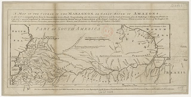
A map of the course of the Maragnon, or Great River of Amazons, as far as it is navigable / from Jaen de Bracamoros to its mouth... drawn in 1743 and 1744, by Monsr. de la Condamine, ... Whereto is added the course of Rio Negro... extracted ; from divers memoirs... of modern travellers. 100 Sea leagues of 20 to a degree |
||||||||||||||||||||||||||
| Description |
Français : Sujet : Cours d'eau
Amazone (cours d'eau) -- Jaen - embouchure Échelle(s) : [=0, 058 ; 1:9 500 000 environ] Couverture : Monde Langue : anglais Éditeur : [s.n.] |
||||||||||||||||||||||||||
| Date | 1750 | ||||||||||||||||||||||||||
| Collection |
|
||||||||||||||||||||||||||
| References |
Français : Notice du catalogue : http://catalogue.bnf.fr/ark:/12148/cb40595409m |
||||||||||||||||||||||||||
| Source/Photographer |
Français : Bibliothèque nationale de France, GED-2262
Bibliothèque nationale de France |
||||||||||||||||||||||||||
| Permission (Reusing this file) |
|
||||||||||||||||||||||||||

File history
Click on a date/time to view the file as it appeared at that time.
| Date/Time | Thumbnail | Dimensions | User | Comment | |
|---|---|---|---|---|---|
| current | 21:02, 13 August 2022 | | 7,462 × 3,816 (3.81 MB) | Gzen92Bot (talk | contribs) | Gallica btv1b8441127g |
You cannot overwrite this file.
File usage on Commons
The following page uses this file: