File:A survey of Lake Champlain including Crown Point and St. Iohn's on which is fixed the line of forty five degrees north lattit. terminating the boundarys betwe(e)n the provinces of Quebec and New York LOC 73691803.jpg
Jump to navigation
Jump to search

Size of this preview: 227 × 598 pixels. Other resolutions: 91 × 240 pixels | 182 × 480 pixels | 291 × 768 pixels | 389 × 1,024 pixels | 778 × 2,048 pixels | 5,780 × 15,214 pixels.
Original file (5,780 × 15,214 pixels, file size: 11.5 MB, MIME type: image/jpeg)
Captions
Captions
Add a one-line explanation of what this file represents
Summary
[edit]| Warning | The original file is very high-resolution. It might not load properly or could cause your browser to freeze when opened at full size. |
|---|
| Description |
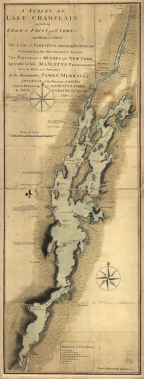
English: Scale ca. 1:127,000. Manuscript, pen-and-ink and watercolor. Relief shown pictorially and by shading. Sectioned and mounted on cloth backing. In pencil, lower left margin: No. 10. Includes descriptive notes and "References to Crown Point." LC Maps of North America, 1750-1789, 1074 Available also through the Library of Congress Web site as a raster image. Vault AACR2 |
||
| Title | A survey of Lake Champlain including Crown Point and St. Iohn's on which is fixed the line of forty five degrees north lattit. terminating the boundarys betwe[e]n the provinces of Quebec and New York agre[e]able to his Majesty's proclamation done by order and instruction of the Honourable James Murray, esqr., Governor of the Province of Quebec and the Honourable His Majestys Council | ||
| Shelf ID | G3802.C45 1765 .C6 | ||
| Date | |||
| Source | https://www.loc.gov/item/73691803/ | ||
| Author | Collins, John; Murray, James; Blaskowitz, Charles | ||
| Permission (Reusing this file) |
|
||
| Other versions |
|
||
| Location | Canada · Champlain · Vermont · Champlain, Lake · Crown Point · Lake · United States · Québec · New York · New York (State) · Québec (Province) | ||
| Part of | Military Battles And Campaigns · American Memory · Catalog · Geography And Map Division · American Revolution And Its Era: Maps And Charts Of North America And The West Indies, 1750-1789 | ||
| Subject | Canada · Maps, Manuscript · Vermont · Champlain, Lake · Crown Point · Crown Point (N.Y.) · Fortification · Boundaries · Maps · Early Works To 1800 · Buildings, Structures, Etc · New York (State) · Québec (Province) · United States |

n_the_provinces_of_Quebec_and_New_York_LOC_73691803.jpg&action=edit§ion=1)
n_the_provinces_of_Quebec_and_New_York_LOC_73691803.jpg&flash=no)
Licensing
[edit]n_the_provinces_of_Quebec_and_New_York_LOC_73691803.jpg&action=edit§ion=2)
|
This is a faithful photographic reproduction of a two-dimensional, public domain work of art. The work of art itself is in the public domain for the following reason:
The official position taken by the Wikimedia Foundation is that "faithful reproductions of two-dimensional public domain works of art are public domain".
This photographic reproduction is therefore also considered to be in the public domain in the United States. In other jurisdictions, re-use of this content may be restricted; see Reuse of PD-Art photographs for details. | ||||
File history
Click on a date/time to view the file as it appeared at that time.
| Date/Time | Thumbnail | Dimensions | User | Comment | |
|---|---|---|---|---|---|
| current | 03:42, 10 May 2018 | 5,780 × 15,214 (11.5 MB) | Fæ (talk | contribs) | LOC Maps https://www.loc.gov/item/73691803/ #5186 |
You cannot overwrite this file.
File usage on Commons
The following page uses this file:
n_the_provinces_of_Quebec_and_New_York_LOC_73691803.jpg&oldid=778941851)