File:Administrative map of Italy showing regions, provinces and communes.png
跳转到导航
跳转到搜索

本预览的尺寸:463 × 599像素。 其他分辨率:185 × 240像素 | 371 × 480像素 | 593 × 768像素 | 791 × 1,024像素 | 1,632 × 2,112像素。
原始文件 (1,632 × 2,112像素,文件大小:198 KB,MIME类型:image/png)
说明
说明
添加一行文字以描述该文件所表现的内容
摘要[编辑]
| 描述 |
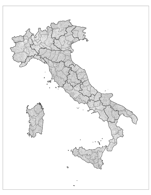
English: Administrative map of Italy showing the regions (black borders), the provinces (grey borders), and the communes (white borders). |
||
| 日期 | |||
| 来源 | 个人作品,使用: MapInfo Professional v8.5 (and various mapping resources) | ||
| 作者 | Rarelibra | ||
| 授权 (二次使用本文件) |
|
||
| 其他版本 |
此文件衍生的作品: |

|
File:Regions, provinces and municipalities in Italy.svg是此文件的矢量版本。 如果此文件质量不低于原点阵图,就应该将这个PNG格式文件替换为此文件。
File:Administrative map of Italy showing regions, provinces and communes.png → File:Regions, provinces and municipalities in Italy.svg
更多信息请参阅Help:SVG/zh。 |
 |
文件历史
点击某个日期/时间查看对应时刻的文件。
| 日期/时间 | 缩略图 | 大小 | 用户 | 备注 | |
|---|---|---|---|---|---|
| 当前 | 2007年11月29日 (四) 14:25 | | 1,632 × 2,112(198 KB) | Rarelibra(留言 | 贡献) | updated map - better borders, total conflation, and new color schema |
| 2007年1月5日 (五) 22:27 |  | 816 × 1,056(57 KB) | Rarelibra(留言 | 贡献) | Map of the municipalities of Italy. Created by ~~~~ for public domain use, using MapInfo Professional v8.5 and various mapping resources. |
您不可以覆盖此文件。
文件用途
以下3个页面使用本文件:
全域文件用途
以下其他wiki使用此文件:
- ar.wikipedia.org上的用途
- arz.wikipedia.org上的用途
- be.wikipedia.org上的用途
- cy.wikipedia.org上的用途
- fa.wikipedia.org上的用途
- fi.wikipedia.org上的用途
- fr.wikipedia.org上的用途
- hi.wikipedia.org上的用途
- hy.wikipedia.org上的用途
- ia.wikipedia.org上的用途
- kk.wikipedia.org上的用途
- ko.wikipedia.org上的用途
- mk.wikipedia.org上的用途
- nl.wikinews.org上的用途
- ro.wikipedia.org上的用途
- ru.wikipedia.org上的用途
- sv.wikipedia.org上的用途
- tg.wikipedia.org上的用途
- uz.wikipedia.org上的用途
- www.wikidata.org上的用途
- zh-min-nan.wikipedia.org上的用途
- zh.wikipedia.org上的用途