File:Admiralty Chart No 1363 Sherboro Island to Cape Mesurada, Published 1841.jpg
Jump to navigation
Jump to search

Size of this preview: 800 × 595 pixels. Other resolutions: 320 × 238 pixels | 640 × 476 pixels | 1,024 × 762 pixels | 1,280 × 953 pixels | 2,560 × 1,905 pixels | 8,127 × 6,048 pixels.
Original file (8,127 × 6,048 pixels, file size: 8.27 MB, MIME type: image/jpeg)
Captions
Captions
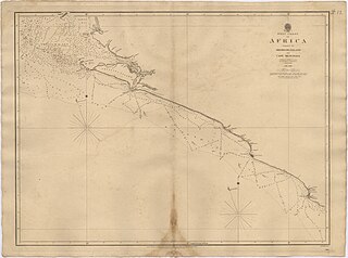
Nautical chart of Sherboro Island to Cape Mesurada
Summary[edit]
| Description |
English: Nautical chart of the west Coast of Africa : Sheet IX : Sherboro Island to Cape Mesurada. Surveyed by Captain A.T.E. Vidal and Lieutenant G.A. Bedford, HMS Aetna, 1836-1838. Not current - not to be used for navigation! |
||||||||||
| Date | |||||||||||
| Source | https://am.uc.pt/item/44593 | ||||||||||
| Author |
|
||||||||||
Licensing[edit]
This work created by the United Kingdom Government is in the public domain.
This is because it is one of the following:
HMSO has declared that the expiry of Crown Copyrights applies worldwide (ref: HMSO Email Reply)
|
 |
File history
Click on a date/time to view the file as it appeared at that time.
| Date/Time | Thumbnail | Dimensions | User | Comment | |
|---|---|---|---|---|---|
| current | 23:11, 15 February 2023 | | 8,127 × 6,048 (8.27 MB) | Kognos (talk | contribs) | Uploaded a work by {{Creator:United Kingdom Hydrographic Office}} from https://am.uc.pt/item/44593 with UploadWizard |
You cannot overwrite this file.
File usage on Commons
There are no pages that use this file.
Metadata
Categories:
- Admiralty Charts 1201-1400
- Admiralty Charts Region G: Africa south and west Coasts Azores Canaries Cape Verde Islands
- Cape Mesurado
- 19th-century maps of Liberia
- 19th-century maps of West Africa
- Sherbro Island
- 19th-century maps of Sierra Leone
- University of Coimbra
- Alexander Thomas Emeric Vidal
- 1841 maps of Africa