File:Admiralty Chart No 2324 Cape San Lucas to San Diego Bay with the Gulf of California Chiefly from the Surveys of Commander G. Dewey & Officers of the United States Ship Narrangansett 1873-5, Published 1879, Corrections to 1925.jpg
Jump to navigation
Jump to search

Size of this preview: 403 × 600 pixels. Other resolutions: 161 × 240 pixels | 322 × 480 pixels | 516 × 768 pixels | 688 × 1,024 pixels | 1,375 × 2,048 pixels | 16,185 × 24,096 pixels.
Original file (16,185 × 24,096 pixels, file size: 63.5 MB, MIME type: image/jpeg)
Captions
Captions
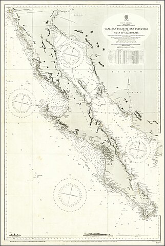
Cape San Lucas to San Diego Bay with the Gulf of California Chiefly from the Surveys of Commander G. Dewey & Officers of the United States Ship Narrangansett 1873-5 with corrections to 1895
Summary
[edit]
| Warning | The original file is very high-resolution. It might not load properly or could cause your browser to freeze when opened at full size. |
|---|
| Description |
English: Cape San Lucas to San Diego Bay with the Gulf of California Chiefly from the Surveys of Commander G. Dewey & Officers of the United States Ship Narrangansett 1873-5 with corrections to 1895 |
||||||||||
| Date | |||||||||||
| Source | https://www.raremaps.com/gallery/detail/67211/cape-san-lucas-to-san-diego-bay-with-the-gulf-of-california-british-admiralty | ||||||||||
| Author |
|
||||||||||
Licensing
[edit]
This work created by the United Kingdom Government is in the public domain.
This is because it is one of the following:
HMSO has declared that the expiry of Crown Copyrights applies worldwide (ref: HMSO Email Reply)
|
 |
File history
Click on a date/time to view the file as it appeared at that time.
| Date/Time | Thumbnail | Dimensions | User | Comment | |
|---|---|---|---|---|---|
| current | 10:22, 14 June 2020 | | 16,185 × 24,096 (63.5 MB) | Balkanique (talk | contribs) | Uploaded a work by British Admiralty from Raremaps.com with UploadWizard |
You cannot overwrite this file.
File usage on Commons
The following page uses this file: