File:Alagalla mountain range 08.jpg
Jump to navigation
Jump to search

Size of this preview: 800 × 593 pixels. Other resolutions: 320 × 237 pixels | 640 × 475 pixels | 1,024 × 759 pixels | 1,280 × 949 pixels | 2,560 × 1,898 pixels | 4,032 × 2,990 pixels.
Original file (4,032 × 2,990 pixels, file size: 10.8 MB, MIME type: image/jpeg)
Captions
Captions
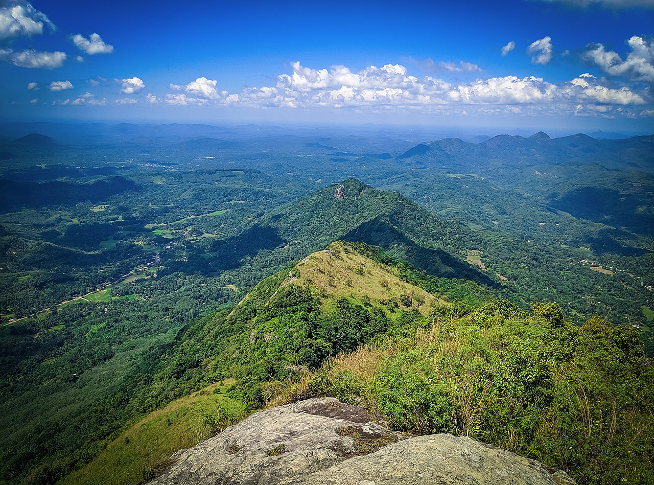
alagalla mountain range top of the hill at poojagala
Summary
[edit]
| Description |
English: Alagalla Mountain Range or “Potato Mountain Range” bordering the Central and Sabaragamuwa Province of Sri Lanka acted as a natural barrier to protect the Central part of Sri Lanka from invasions of Western powerful nations such as Portuguese, Dutch and English for approximately five centuries (1505 - 1948).
The peak of the mountain is about 1100 meters above sea level and the total climb from Ihala Kotte is about 800m. When travelling to Kandy, this mountain can be easily recognized with his height compared to other mountain ranges around him, giving the travellers an astonishing view of Mother Nature. Heading up the mountain, the hikers will have to encounter with Leeches. The wet climate of the mountain, makes a perfect living home for leeches to grow. The peak can be reached by mysterious climb through the Savannah-like-grass and the beauty of the nature. When the hikers hit the top of this mountain they’ll witness the breathtaking surrounding sceneries of other mountain ranges, traditional paddy farming, plantations, historical places, religious places and the city of Kandy. |
| Date | |
| Source | Own work |
| Author | Nisal Senanayaka |
| Camera location | | View this and other nearby images on: OpenStreetMap |
|---|
Licensing
[edit]
I, the copyright holder of this work, hereby publish it under the following license:
This file is licensed under the Creative Commons Attribution-Share Alike 4.0 International license.
- You are free:
- to share – to copy, distribute and transmit the work
- to remix – to adapt the work
- Under the following conditions:
- attribution – You must give appropriate credit, provide a link to the license, and indicate if changes were made. You may do so in any reasonable manner, but not in any way that suggests the licensor endorses you or your use.
- share alike – If you remix, transform, or build upon the material, you must distribute your contributions under the same or compatible license as the original.
This image was uploaded as part of Wiki Loves Earth 2020.
|
 |
File history
Click on a date/time to view the file as it appeared at that time.
| Date/Time | Thumbnail | Dimensions | User | Comment | |
|---|---|---|---|---|---|
| current | 11:29, 18 May 2020 | | 4,032 × 2,990 (10.8 MB) | Nisal Senanayaka (talk | contribs) | Uploaded own work with UploadWizard |
You cannot overwrite this file.
File usage on Commons
There are no pages that use this file.