File:AlapahaRiver2002.jpg
跳去導覽
跳去搵嘢

預覽大細:800 × 600 像素。 第啲解像度:320 × 240 像素 | 640 × 480 像素 | 1,024 × 768 像素 | 1,280 × 960 像素 | 2,010 × 1,507 像素。
原本檔案 (2,010 × 1,507 像素,檔案大細:641 KB ,MIME類型:image/jpeg)
Captions
Captions
Add a one-line explanation of what this file represents
摘要[編輯]
| 描述 |
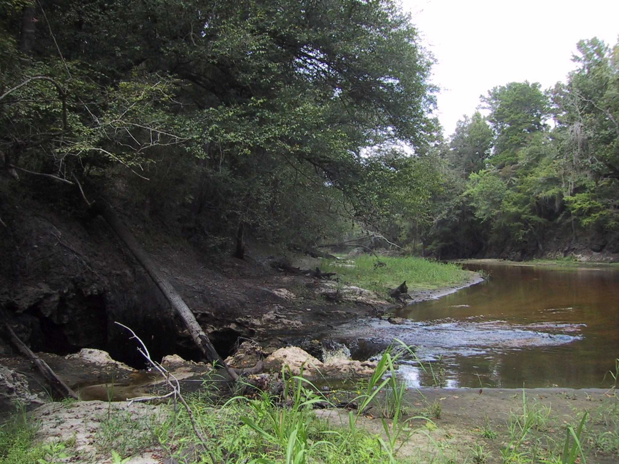
English: Surface water-Groundwater (SW-GW) interaction , August 2002. Entire flow of Alapaha River near Jennings going into sinkhole to Floridan Aquifer. Sinkholes are one of a variety of properties of Karst topographies and carstic underground water systems that develope world wide in water soluble (chemically soluble) rocks (in Florida: carbonate rocks). |
| 日期 | |
| 來源 | USGS Surface Water Photo Gallery[1], item 14 01. |
| 作者 | Stewart Tomlinson, Florida |
協議[編輯]
This image is in the public domain in the United States because it only contains materials that originally came from the United States Geological Survey, an agency of the United States Department of the Interior. For more information, see the official USGS copyright policy.
|
Original upload log[編輯]
The original description page was here. All following user names refer to en.wikipedia.
- 2008-09-01 03:17 Suntag 2010×1507× (656603 bytes)
檔案歷史
撳個日期/時間去睇響嗰個時間出現過嘅檔案。
| 日期/時間 | 縮圖 | 尺寸 | 用戶 | 註解 | |
|---|---|---|---|---|---|
| 現時 | 2012年5月19號 (六) 20:52 | | 2,010 × 1,507(641 KB) | MathewTownsend(傾偈 | 貢獻) | {{Information |Description={{en|en:Surface water-en:Groundwater (SW-GW) interaction , August 2002. Entire flow of en:Alapaha River near en:Jennings, Florida going into en:sinkhole to en:Floridan Aquifer.<br> Sinkhole... |
你無得衾咗個檔案。
檔案用途
無頁面用到呢個檔案。
全域檔案使用情況
下面嘅維基都用緊呢個檔案:
- ar.wikipedia.org嘅使用情況
- az.wikipedia.org嘅使用情況
- ckb.wikipedia.org嘅使用情況
- en.wikipedia.org嘅使用情況
- fa.wikipedia.org嘅使用情況
- hi.wikipedia.org嘅使用情況
- id.wikipedia.org嘅使用情況
- ig.wikipedia.org嘅使用情況
- ko.wikipedia.org嘅使用情況
- ml.wikipedia.org嘅使用情況
- mr.wikipedia.org嘅使用情況
- pa.wikipedia.org嘅使用情況
- simple.wikipedia.org嘅使用情況
- su.wikipedia.org嘅使用情況
- ta.wikipedia.org嘅使用情況
- tr.wikipedia.org嘅使用情況
- vi.wikipedia.org嘅使用情況
- zh-yue.wikipedia.org嘅使用情況