File:Albania location map.svg
跳至導覽
跳至搜尋

此 SVG 檔案的 PNG 預覽的大小:411 × 599 像素。 其他解析度:165 × 240 像素 | 329 × 480 像素 | 527 × 768 像素 | 703 × 1,024 像素 | 1,406 × 2,048 像素 | 688 × 1,002 像素。
原始檔案 (SVG 檔案,表面大小:688 × 1,002 像素,檔案大小:168 KB)
說明
說明
添加單行說明來描述出檔案所代表的內容
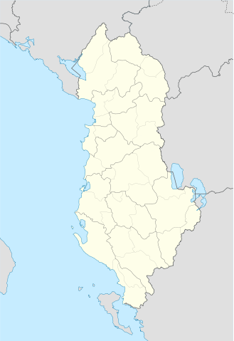
Map of Albania
摘要
[編輯]| 描述 |
Deutsch: Positionskarte von Albanien
Quadratische Plattkarte, N-S-Streckung 130 %. Geographische Begrenzung der Karte:
English: Location map of Albania
Equirectangular projection, N/S stretching 130 %. Geographic limits of the map:
|
| 日期 | |
| 來源 | 個人作品,使用: United States National Imagery and Mapping Agency data |
| 作者 | Lencer |
| SVG開發 |

授權條款
[編輯]
我,本作品的著作權持有者,決定用以下授權條款發佈本作品:

|
已授權您依據自由軟體基金會發行的無固定段落、封面文字和封底文字GNU自由文件授權條款1.2版或任意後續版本,對本檔進行複製、傳播和/或修改。該協議的副本列在GNU自由文件授權條款中。 |
此檔案採用共享創意 姓名標示-相同方式分享 3.0 未在地化版本授權條款。
- 您可以自由:
- 分享 – 複製、發佈和傳播本作品
- 重新修改 – 創作演繹作品
- 惟需遵照下列條件:
- 姓名標示 – 您必須指名出正確的製作者,和提供授權條款的連結,以及表示是否有對內容上做出變更。您可以用任何合理的方式來行動,但不得以任何方式表明授權條款是對您許可或是由您所使用。
- 相同方式分享 – 如果您利用本素材進行再混合、轉換或創作,您必須基於如同原先的相同或兼容的條款,來分布您的貢獻成品。
您可以選擇您需要的授權條款。
檔案歷史
點選日期/時間以檢視該時間的檔案版本。
| 日期/時間 | 縮圖 | 尺寸 | 用戶 | 備註 | |
|---|---|---|---|---|---|
| 目前 | 2011年6月20日 (一) 19:16 | | 688 × 1,002(168 KB) | Vinie007(對話 | 貢獻) | fix districts |
| 2010年3月22日 (一) 20:56 |  | 685 × 1,002(152 KB) | NordNordWest(對話 | 貢獻) | counties | |
| 2010年3月22日 (一) 20:06 |  | 685 × 1,002(162 KB) | NordNordWest(對話 | 貢獻) | update | |
| 2008年9月11日 (四) 16:27 |  | 685 × 1,002(278 KB) | Lencer(對話 | 貢獻) | {{Information |Description= |Source= |Date= |Author= |Permission= |other_versions= }} | |
| 2008年9月9日 (二) 18:36 |  | 685 × 1,002(278 KB) | Lencer(對話 | 貢獻) | {{Information |Description= |Source= |Date= |Author= |Permission= |other_versions= }} | |
| 2008年8月16日 (六) 12:14 |  | 685 × 1,002(279 KB) | Lencer(對話 | 貢獻) | {{Information |Description= |Source= |Date= |Author= |Permission= |other_versions= }} | |
| 2008年7月21日 (一) 17:00 |  | 258 × 377(254 KB) | Lencer(對話 | 貢獻) | {{Information |Description= |Source= |Date= |Author= |Permission= |other_versions= }} | |
| 2008年7月21日 (一) 16:42 |  | 258 × 377(254 KB) | Lencer(對話 | 貢獻) | {{Information |Description= {{de|Positionskarte von Albanien}} Quadratische Plattkarte, N-S-Streckung 130 %. Geographische Begrenzung der Karte: * N: 42.9° N * S: 39.3° N * W: 18.3° O * O: 21.5° O {{en|Location map of [[:en:Al |
無法覆蓋此檔案。
檔案用途
下列58個頁面有用到此檔案:
- User talk:NordNordWest/Archive12
- File:Administratura Apostolike e Shqiperisë së Jugut.svg
- File:Berat County in Albania.svg
- File:Berat in Albania.svg
- File:Bulqize in Albania.svg
- File:Delvine in Albania.svg
- File:Devoll in Albania.svg
- File:Diber County in Albania.svg
- File:Diber in Albania.svg
- File:Dioqeza e Lezhës.svg
- File:Dioqeza e Rrëshenit.svg
- File:Dioqeza e Sapës.svg
- File:Durres County in Albania.svg
- File:Durres in Albania.svg
- File:Elbasan County in Albania.svg
- File:Elbasan in Albania.svg
- File:Fier County in Albania.svg
- File:Fier in Albania.svg
- File:Gjirokaster County in Albania.svg
- File:Gjirokaster in Albania.svg
- File:Gramsh in Albania.svg
- File:Has in Albania.svg
- File:Kavaje in Albania.svg
- File:Kolonje in Albania.svg
- File:Korce County in Albania.svg
- File:Korce in Albania.svg
- File:Kruje in Albania.svg
- File:Kryedioqeza e Shkodrës–Pult.svg
- File:Kryedioqeza e Tiranë-Durrës.svg
- File:Kucove in Albania.svg
- File:Kukes County in Albania.svg
- File:Kukes in Albania.svg
- File:Kurbin in Albania.svg
- File:Lezhe County in Albania.svg
- File:Lezhe in Albania.svg
- File:Librazhd in Albania.svg
- File:LocationmapAlbania.png
- File:Lushnje in Albania.svg
- File:Malesi e Madhe in Albania.svg
- File:Mallakaster in Albania.svg
- File:Map of the Catholic dioceses in Albania.svg
- File:Map of the Catholic dioceses in Albania (sq).svg
- File:Mat in Albania.svg
- File:Mirdite in Albania.svg
- File:Pemet in Albania.svg
- File:Peqin in Albania.svg
- File:Pogradec in Albania.svg
- File:Puke in Albania.svg
- File:Sarande in Albania.svg
- File:Shkoder County in Albania.svg
- File:Shkoder in Albania.svg
- File:Skrapar in Albania.svg
- File:Tepelene in Albania.svg
- File:Tirana County in Albania.svg
- File:Tirana in Albania.svg
- File:Tropoje in Albania.svg
- File:Vlore County in Albania.svg
- File:Vlore in Albania.svg
.svg)
全域檔案使用狀況
以下其他 wiki 使用了這個檔案:
- ar.wikipedia.org 的使用狀況
- bn.wikipedia.org 的使用狀況
- bs.wikipedia.org 的使用狀況
- ca.wikipedia.org 的使用狀況
- ceb.wikipedia.org 的使用狀況
- Albanya
- Plantilya:Location map Albania
- Puka
- Krabi
- Komsi
- Kalja
- Kala
- Golo
- Kusha
- Tok
- Raba
- Paula
- Kota
- Korab
- Orle
- Bistrica
- Tumba
- Mali i Zi
- Guri i Zi
- Veternik
- Selce
- Propas
- Petran
- Dibra
- Osoj
- Ostrovica
- Miras
- Mali Grad
- Mala Reka
- Lofka
- Lisec
- Lipec
- Leska
- Lomnica
- Kraste
- Krasta
- Kovacica
- Gorica
- Maja e Kodres
- Klisura
- Belica
檢視此檔案的更多全域使用狀況。