File:Alexanderstein-3.jpg
Jump to navigation
Jump to search

Size of this preview: 450 × 600 pixels. Other resolutions: 180 × 240 pixels | 360 × 480 pixels | 576 × 768 pixels | 768 × 1,024 pixels | 1,536 × 2,048 pixels | 3,024 × 4,032 pixels.
Original file (3,024 × 4,032 pixels, file size: 7.88 MB, MIME type: image/jpeg)
Captions
Captions
Add a one-line explanation of what this file represents
Summary[edit]
| Description |
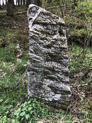
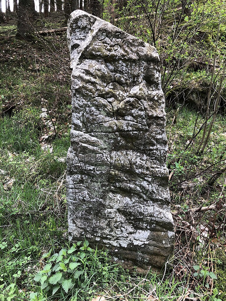
Русский: Один из нескольких десятков пограничных камней (номер 39, верхняя цифра на камне) установленных в 1837 году (нижняя цифра на камне) при принце Александре цу Сайн-Виттгенштайн-Хоэнштайне (имя Alexander читается посреди камня). Принц Александр стал управлять своей землёй Сайн-Виттгенштайн-Хоэнштайн в 1837 году и с помощью таких камней установил границы своих владения с центром в Ласфе (ныне Бад-Ласфе/ Bad Laasphe). Камень не охраняется законом, но является историческим свидетельством. Находится немного севернее хуторского поселения Брахт в пределах города Бад-Ласфе, на автодороге земельного значения L 717 при стыковке с автодорогой районного значения К 53. Историко-географическая территория Виттгенштайнер Ланд ныне в земле Северный Рейн-Вестфалия, Германия). Географические координаты точки фотографирования смотрите на этой странице ниже.
Deutsch: Einer von mehreren Dutzend Grenzsteinen (Nummer 39, obere Nummer auf dem Stein), die 1837 (untere Nummer auf dem Stein) unter Fürst Alexander zu Sayn-Wittgenstein-Hohenstein errichtet wurden (in der Mitte des Steins ist der Name Alexander zu lesen). Fürst Alexander übernahm 1837 sein Land Sayn-Wittgenstein-Hohenstein und legte mit Hilfe solcher Steine die Grenzen seines Herrschaftsbereichs mit dem Mittelpunkt in Laasphe (heute Bad Laasphe) fest. Der Stein ist nicht gesetzlich geschützt, sondern ein historischer Beweis. Es liegt etwas nördlich der Hofsiedlung Bracht innerhalb der Stadt Bad Laasphe, an der Landesstraße L 717 an der Kreuzung mit der Kreissstraße K 53. Das historische und geografische Gebiet des Wittgensteiner Landes liegt heute in Nordrhein-Westfalen. Deuschland). Die geografischen Koordinaten des Fotopunkts finden Sie auf dieser Seite unten. |
| Date | |
| Source | Own work |
| Author | Velopilger |
| Camera location | | View this and other nearby images on: OpenStreetMap |
|---|
Licensing[edit]
I, the copyright holder of this work, hereby publish it under the following license:
| This file is made available under the Creative Commons CC0 1.0 Universal Public Domain Dedication. | |
| The person who associated a work with this deed has dedicated the work to the public domain by waiving all of their rights to the work worldwide under copyright law, including all related and neighboring rights, to the extent allowed by law. You can copy, modify, distribute and perform the work, even for commercial purposes, all without asking permission.
|
File history
Click on a date/time to view the file as it appeared at that time.
| Date/Time | Thumbnail | Dimensions | User | Comment | |
|---|---|---|---|---|---|
| current | 19:54, 10 April 2024 | | 3,024 × 4,032 (7.88 MB) | Velopilger (talk | contribs) | Uploaded own work with UploadWizard |
You cannot overwrite this file.
File usage on Commons
There are no pages that use this file.