File:Alluvial zone Lac de Monsalvens 01.jpg
Jump to navigation
Jump to search

Size of this preview: 800 × 316 pixels. Other resolutions: 320 × 126 pixels | 640 × 253 pixels | 1,024 × 405 pixels | 1,280 × 506 pixels | 2,560 × 1,011 pixels | 7,422 × 2,932 pixels.
Original file (7,422 × 2,932 pixels, file size: 5.98 MB, MIME type: image/jpeg)
Captions
Captions
Add a one-line explanation of what this file represents
Summary[edit]
| Description |
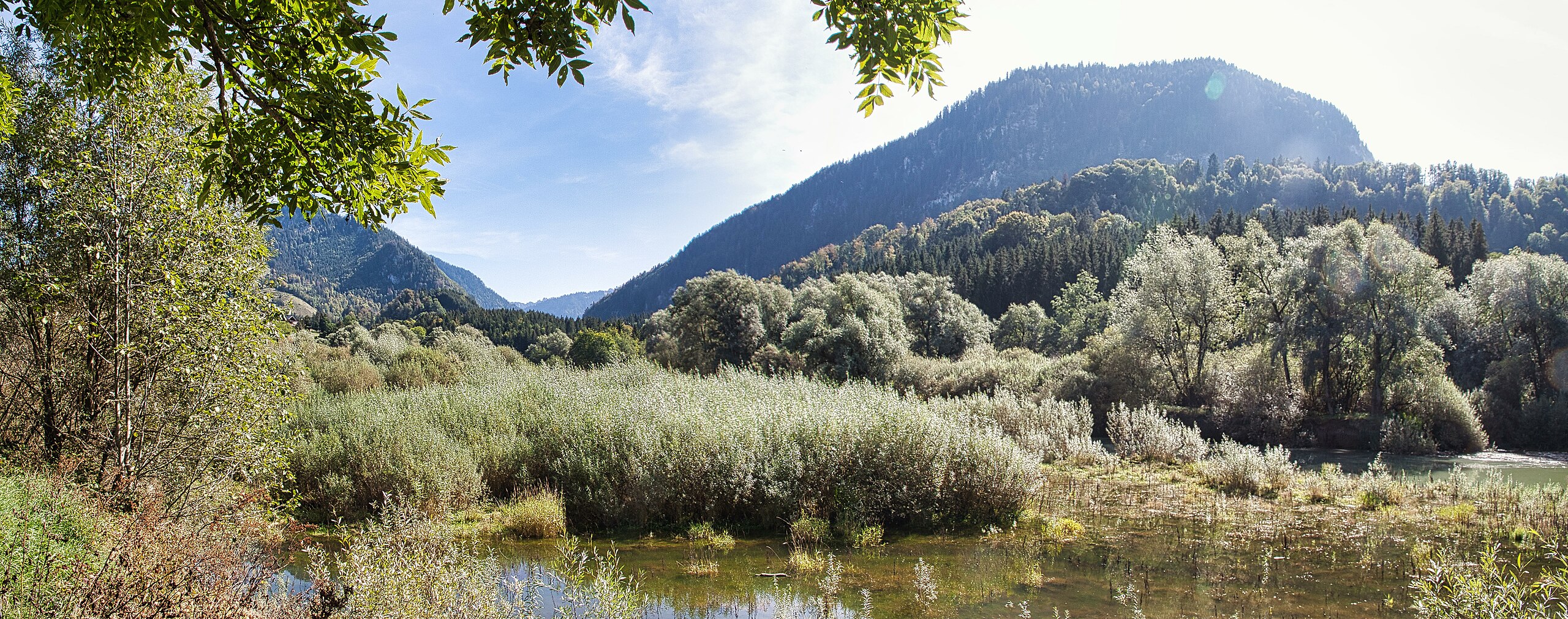
Deutsch: Blick in das national bedeutende Auengebiet Lac de Monsalvens mit stehenden und fliessenden Wassern, Gebüschen und Bäumen. Hier mündet der Jaunbach in den Stausee. |
||
| Protected |
|
||
| Date | |||
| Source | Own work | ||
| Author | Martin Thurnherr | ||
| Permission (Reusing this file) |
|
||
| Panorama |
|


| Object location | | View this and other nearby images on: OpenStreetMap |
|---|
Licensing[edit]
I, the copyright holder of this work, hereby publish it under the following license:
This file is licensed under the Creative Commons Attribution-Share Alike 4.0 International license.
Attribution: Martin Thurnherr
- You are free:
- to share – to copy, distribute and transmit the work
- to remix – to adapt the work
- Under the following conditions:
- attribution – You must give appropriate credit, provide a link to the license, and indicate if changes were made. You may do so in any reasonable manner, but not in any way that suggests the licensor endorses you or your use.
- share alike – If you remix, transform, or build upon the material, you must distribute your contributions under the same or compatible license as the original.
File history
Click on a date/time to view the file as it appeared at that time.
| Date/Time | Thumbnail | Dimensions | User | Comment | |
|---|---|---|---|---|---|
| current | 08:39, 28 September 2023 | 7,422 × 2,932 (5.98 MB) | Matutinho (talk | contribs) | {{Information |Description={{de|1=Blick in das national bedeutende Auengebiet ''Lac de Monsalvens'' mit stehenden und fliessenden Wassern, Gebüschen und Bäumen. Hier mündet der Jaunbach in den Stausee.}} |Source={{own}} |Date=2023-09-27 |Author= Martin Thurnherr |Permission={{User:Matutinho/Template:Credits}} |other_versions= }} |other_fields 1= {{Information field |name=Protected|value= 16px {{LangSwitch |de=Auengebiet von nationaler Bedeutu... |
You cannot overwrite this file.
File usage on Commons
The following page uses this file:
File usage on other wikis
The following other wikis use this file:
- Usage on de.wikipedia.org
- Usage on www.wikidata.org