File:An accurate map of the United States of America, with part of the surrounding provinces agreeable to the Treaty of Peace of 1783, LOC gm71005488.jpg
Jump to navigation
Jump to search

Size of this preview: 682 × 600 pixels. Other resolutions: 273 × 240 pixels | 546 × 480 pixels | 873 × 768 pixels | 1,165 × 1,024 pixels | 2,329 × 2,048 pixels | 8,545 × 7,514 pixels.
Original file (8,545 × 7,514 pixels, file size: 11.94 MB, MIME type: image/jpeg)
Captions
Captions
Add a one-line explanation of what this file represents
Summary
[edit]| Description |
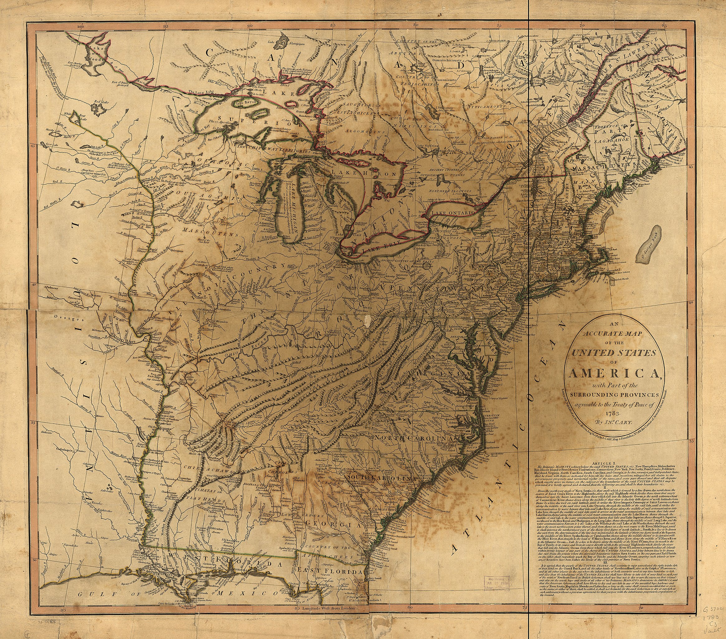
English: Scale ca. 1:4,100,000. Hand colored. Relief shown pictorially. Prime meridian: London. Shows national boundaries, towns and cities, frontier forts, trading posts, Indian villages and tribal territory, rivers and lakes, swamps, portages, and relief. Includes articles I-III of the Treaty. LC Maps of North America, 1750-1789, 747 Available also through the Library of Congress Web site as a raster image. Vault AACR2: 100; 651 |
||
| Title | An accurate map of the United States of America, with part of the surrounding provinces agreeable to the Treaty of Peace of 1783, | ||
| Shelf ID | G3700 1783 .C3 | ||
| Date | |||
| Source | https://www.loc.gov/item/gm71005488/ | ||
| Author | Cary, John | ||
| Permission (Reusing this file) |
|
||
| Location | United States | ||
| Part of | Military Battles And Campaigns · American Memory · Catalog · Geography And Map Division · American Revolution And Its Era: Maps And Charts Of North America And The West Indies, 1750-1789 | ||
| Subject | United States · Maps · Early Works To 1800 · Paris, Treaty Of |

Licensing
[edit]
|
This is a faithful photographic reproduction of a two-dimensional, public domain work of art. The work of art itself is in the public domain for the following reason:
The official position taken by the Wikimedia Foundation is that "faithful reproductions of two-dimensional public domain works of art are public domain".
This photographic reproduction is therefore also considered to be in the public domain in the United States. In other jurisdictions, re-use of this content may be restricted; see Reuse of PD-Art photographs for details. | ||||
File history
Click on a date/time to view the file as it appeared at that time.
| Date/Time | Thumbnail | Dimensions | User | Comment | |
|---|---|---|---|---|---|
| current | 10:54, 11 June 2018 | | 8,545 × 7,514 (11.94 MB) | Fæ (talk | contribs) | LOC Maps https://www.loc.gov/item/gm71005488/ #11753 |
You cannot overwrite this file.
File usage on Commons
There are no pages that use this file.