File:Anhalt1897.jpg
Jump to navigation
Jump to search
Size of this preview: 800 × 400 pixels. Other resolutions: 320 × 160 pixels | 640 × 320 pixels | 1,024 × 512 pixels | 1,280 × 640 pixels | 2,505 × 1,253 pixels.
Original file (2,505 × 1,253 pixels, file size: 709 KB, MIME type: image/jpeg)
Captions
Captions
Add a one-line explanation of what this file represents
Summary
[edit]
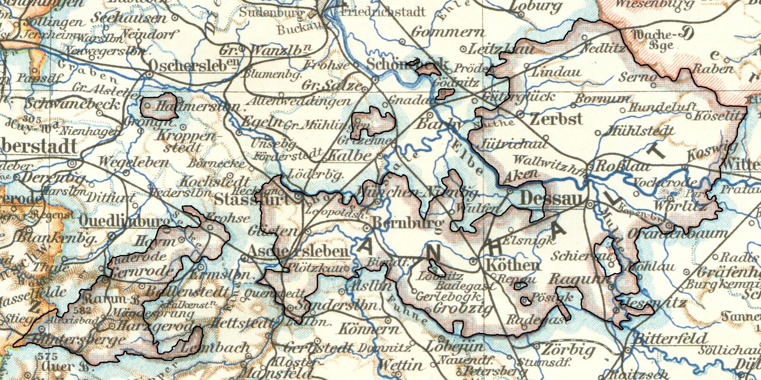
Karte von Anhalt aus dem Jahr 1897. Alle zu Anhalt gehörigen Gebiete sind schwarz umrandet. Quelle: Meyers Konversations-Lexikon, fünfte Auflage, Fünfzehnter Band, Leipzig 1897 (Ausschnitt aus der Karte „Provinz Sachsen und Anhalt“; S. 70)
Licensing
[edit]
|
This work is in the public domain in its country of origin and other countries and areas where the copyright term is the author's life plus 70 years or fewer. | |
| This file has been identified as being free of known restrictions under copyright law, including all related and neighboring rights. | |
File history
Click on a date/time to view the file as it appeared at that time.
| Date/Time | Thumbnail | Dimensions | User | Comment | |
|---|---|---|---|---|---|
| current | 16:12, 18 May 2006 | | 2,505 × 1,253 (709 KB) | Michael Sander (talk | contribs) | Karte von Anhalt aus dem Jahr 1897. Alle zu Anhalt gehörigen Gebiete sind schwarz umrandet. Quelle: ''Meyers Konversations-Lexikon, fünfte Auflage, Fünfzehnter Band, Leipzig 1897'' (Ausschnitt aus der Karte „Provinz Sachsen und Anhalt“ |
You cannot overwrite this file.
File usage on Commons
The following page uses this file:
File usage on other wikis
The following other wikis use this file:
- Usage on cs.wikipedia.org
- Usage on de.wikipedia.org
- Usage on pt.wikipedia.org