File:Arcos da Lapa1.jpg

Original file (3,264 × 2,448 pixels, file size: 4.23 MB, MIME type: image/jpeg)
Captions
Captions
Summary
[edit]
| Description |
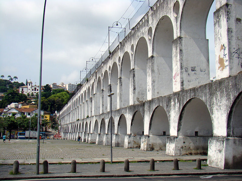
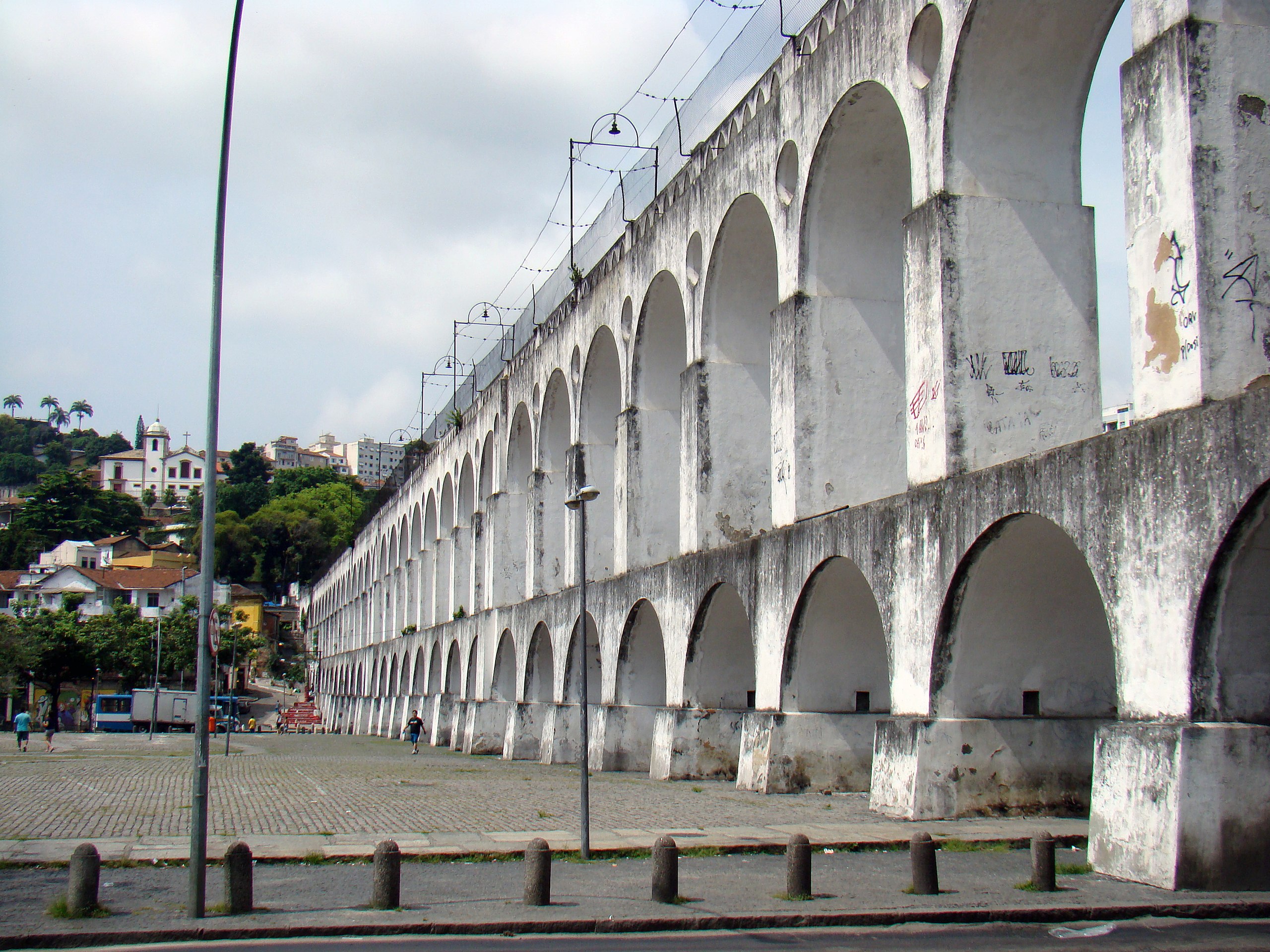
O Aqueduto da Carioca, popularmente conhecido como os Arcos da Lapa, localiza-se no bairro da Lapa, na cidade do Rio de Janeiro, no Brasil. Considerada como a obra arquitetônica de maior porte empreendida no Brasil durante o período colonial, é hoje um dos cartões postais da cidade, símbolo mais representativo do Rio Antigo preservado no bairro boêmio da Lapa. ________________________
The Carioca Aqueduct (Portuguese: Aqueduto da Carioca) is an aqueduct in the city of Rio de Janeiro, Brazil. The aqueduct was built in the middle of the 18th century to bring fresh water from the Carioca river to the population of the city. It is an impressive example of colonial architecture and engineering. The Carioca Aqueduct is located in the centre of the city, in the Lapa neighbourhood, and is frequently called Arcos da Lapa (Lapa Arches) by Brazilian people. Since the end of the 19th century the aqueduct serves as a bridge for a popular tram that connects the city centre with the Santa Teresa neighbourhood uphill. |
| Date | |
| Source | Arcos da Lapa |
| Author | Rodrigo Soldon from Rio de Janeiro, Brazil |
| Camera location | | View this and other nearby images on: OpenStreetMap |
|---|
Licensing
[edit]
- You are free:
- to share – to copy, distribute and transmit the work
- to remix – to adapt the work
- Under the following conditions:
- attribution – You must give appropriate credit, provide a link to the license, and indicate if changes were made. You may do so in any reasonable manner, but not in any way that suggests the licensor endorses you or your use.
| This image was originally posted to Flickr by Rodrigo_Soldon at https://www.flickr.com/photos/8865243@N02/3187875288. It was reviewed on 15 May 2011 by FlickreviewR and was confirmed to be licensed under the terms of the cc-by-2.0. |
File history
Click on a date/time to view the file as it appeared at that time.
| Date/Time | Thumbnail | Dimensions | User | Comment | |
|---|---|---|---|---|---|
| current | 12:18, 15 May 2011 | | 3,264 × 2,448 (4.23 MB) | Glabb (talk | contribs) | {{Information |Description=O Aqueduto da Carioca, popularmente conhecido como os Arcos da Lapa, localiza-se no bairro da Lapa, na cidade do Rio de Janeiro, no Brasil. Considerada como a obra arquitetônica de maior porte empreendida no Brasil durante o p |
You cannot overwrite this file.
File usage on Commons
There are no pages that use this file.