File:Argentina Neuquén location map.svg
Jump to navigation
Jump to search

Size of this PNG preview of this SVG file: 373 × 599 pixels. Other resolutions: 149 × 240 pixels | 299 × 480 pixels | 478 × 768 pixels | 637 × 1,024 pixels | 1,275 × 2,048 pixels | 630 × 1,012 pixels.
Original file (SVG file, nominally 630 × 1,012 pixels, file size: 333 KB)
Captions
Captions
Add a one-line explanation of what this file represents
Summary
[edit]| Description |
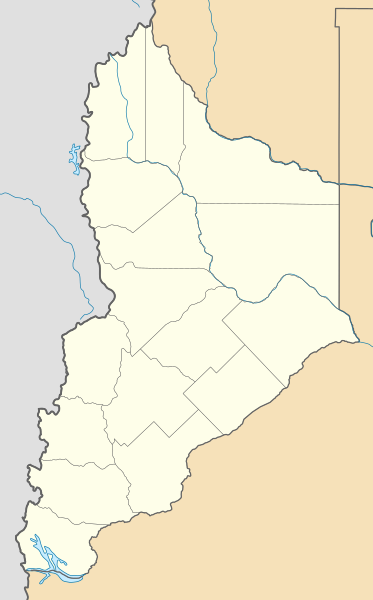
Deutsch: Positionskarte von Neuquén (Argentinien) English: Location map of Neuquén province (Argentina) Español: Mapa de localización de la Provincia de Neuquén.
Equirectangular projection, N/S stretching 128 %. Geographic limits of the map:
|
| Date | (UTC) |
| Source |
This file was derived from: |
| Author |
|
| Other versions |
|

Licensing
[edit]
This file is licensed under the Creative Commons Attribution-Share Alike 3.0 Unported license.
- You are free:
- to share – to copy, distribute and transmit the work
- to remix – to adapt the work
- Under the following conditions:
- attribution – You must give appropriate credit, provide a link to the license, and indicate if changes were made. You may do so in any reasonable manner, but not in any way that suggests the licensor endorses you or your use.
- share alike – If you remix, transform, or build upon the material, you must distribute your contributions under the same or compatible license as the original.
Original upload log
[edit]
This image is a derivative work of the following images:
- File:Argentina_location_map.svg licensed with Cc-by-sa-3.0, GFDL
- File:Map_of_Neuquén_Province.svg licensed with Cc-by-sa-3.0,2.5,2.0,1.0, GFDL
Uploaded with derivativeFX
File history
Click on a date/time to view the file as it appeared at that time.
| Date/Time | Thumbnail | Dimensions | User | Comment | |
|---|---|---|---|---|---|
| current | 19:14, 24 November 2022 | | 630 × 1,012 (333 KB) | GrandEscogriffe (talk | contribs) | more correct north-south stretching |
| 19:43, 28 December 2017 |  | 630 × 900 (334 KB) | Janitoalevic (talk | contribs) | Better Nahuel Huapi | |
| 09:10, 10 September 2017 |  | 630 × 900 (336 KB) | Milenioscuro (talk | contribs) | capas | |
| 15:04, 11 July 2013 |  | 630 × 900 (511 KB) | Milenioscuro (talk | contribs) | == {{int:filedesc}} == {{Information |Description={{de|Positionskarte von Neuquén (Argentinien)}}{{en|Location map of Neuquén province (Argentina)}}{{es|1=Mapa de localización de la Provincia de Neuquén.}} Equi... |
You cannot overwrite this file.
File usage on Commons
The following 11 pages use this file:
- File:Argentina Neuquén topographic location map.png
- Category:Cities in Neuquén Province
- Category:Dams in Neuquén Province
- Category:Departments of Neuquén Province
- Category:Geography of Neuquén Province
- Category:Maps of Neuquén Province
- Category:Neuquén Province
- Category:People of Neuquén Province
- Category:Populated places in Neuquén Province
- Category:Train stations in Neuquén Province
- Category:Transport in Neuquén Province
File usage on other wikis
The following other wikis use this file:
- Usage on de.wikipedia.org
- Usage on eo.wikipedia.org
- Usage on es.wikipedia.org
- Chos Malal
- Zapala
- San Martín de los Andes
- Villa La Angostura
- Cutral Co
- Junín de los Andes
- Andacollo (Neuquén)
- Aluminé (localidad)
- Plaza Huincul
- Villa Pehuenia
- Centenario (Neuquén)
- Villa El Chocón
- Caviahue-Copahue
- Villa Traful
- San Patricio del Chañar
- Neuquén (ciudad)
- Plottier
- Senillosa
- Vista Alegre (Neuquén)
- Añelo
- Las Coloradas (Argentina)
- Rincón de los Sauces
- Piedra del Águila
- Isla Victoria (Argentina)
- Cutral Co-Plaza Huincul
- Tricao Malal
- Villa Curí Leuvú
- Santo Tomás (Neuquén)
- Loncopué
- Las Ovejas
- Huinganco
- Manzano Amargo
- Varvarco
- Los Miches
- Barrancas (Neuquén)
- Buta Ranquil
- Octavio Pico
- Picún Leufú
- Paso Aguerre
- Los Catutos
- Mariano Moreno (Neuquén)
View more global usage of this file.