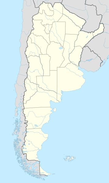
File:Argentina adm location map.svg

Πρωτότυπο αρχείο (Αρχείο SVG, ονομαστικό μέγεθος 1.276 × 2.149 εικονοστοιχεία, μέγεθος αρχείου: 850 KB)
Λεζάντες
Λεζάντες
Σύνοψη
[επεξεργασία]
| Περιγραφή |
Deutsch: Positionskarte von Argentinien
English: Location map of Argentina
|
||||||||||||
| Ημερομηνία | |||||||||||||
| Πηγή |
Own work using:
|
||||||||||||
| Δημιουργός | NordNordWest | ||||||||||||
| άλλες εκδόσεις | File:Argentina topo location map.jpg | ||||||||||||

|
This map has been made or improved in the German Kartenwerkstatt (Map Lab). You can propose maps to improve as well.
|
Αδειοδότηση
[επεξεργασία]
Usage of this file with:

explanatory notes: Legally binding is only the full legalcode. For a free usage I recommend to respect the following licence conditions:
1. Provide my name as given above: NordNordWest,
2. a copy of, or the URI for, the applicable license: https://creativecommons.org/licenses/by-sa/3.0/de/legalcode,
3. the title of the work,
4. in the case of an adaptation, a credit identifying the use of the work in the adaptation.
This license and the rights granted hereunder will terminate automatically upon any breach by you of the terms of this license. Any of the above conditions can be waived if you get permission from the copyright holder. If you have questions or wish differing conditions, please contact me through nnwest or my discussion page ![]() t-online.de
t-online.de
- Είστε ελεύθερος:
- να μοιραστείτε – να αντιγράψετε, διανέμετε και να μεταδώσετε το έργο
- να διασκευάσετε – να τροποποιήσετε το έργο
- Υπό τις ακόλουθες προϋποθέσεις:
- αναφορά προέλευσης – Θα πρέπει να κάνετε κατάλληλη αναφορά, να παρέχετε σύνδεσμο για την άδεια και να επισημάνετε εάν έγιναν αλλαγές. Μπορείτε να το κάνετε με οποιοδήποτε αιτιολογήσιμο λόγο, χωρίς όμως να εννοείται με οποιονδήποτε τρόπο ότι εγκρίνουν εσάς ή τη χρήση του έργου από εσάς.
- παρόμοια διανομή – Εάν αλλάξετε, τροποποιήσετε ή δημιουργήσετε πάνω στο έργο αυτό, μπορείτε να διανείμετε αυτό που θα προκύψει μόνο υπό τους όρους της ίδιας ή συμβατής άδειας με το πρωτότυπο.

Ιστορικό αρχείου
Πατήστε σε μια ημερομηνία/ώρα για να δείτε το αρχείο όπως εμφανιζόταν εκείνη την χρονική στιγμή.
| Ημερομηνία/Ώρα | Μικρογραφία | Διαστάσεις | Χρήστης | Σχόλιο | |
|---|---|---|---|---|---|
| τρέχον | 19:29, 24 Οκτωβρίου 2021 | | 1.276 × 2.149 (850 KB) | GrandEscogriffe (συζήτηση | Συνεισφορά) | borders of Santiago del Estero |
| 23:16, 24 Δεκεμβρίου 2017 |  | 1.276 × 2.149 (849 KB) | Janitoalevic (συζήτηση | Συνεισφορά) | fixed part of the border | |
| 23:52, 16 Μαΐου 2016 |  | 1.276 × 2.149 (848 KB) | Janitoalevic (συζήτηση | Συνεισφορά) | Added Magellan Strait and Beagle Channel Border and fixed small issues in the continental border. | |
| 02:32, 24 Φεβρουαρίου 2016 |  | 1.276 × 2.149 (849 KB) | Janitoalevic (συζήτηση | Συνεισφορά) | Fixed Border | |
| 02:18, 24 Φεβρουαρίου 2016 |  | 1.276 × 2.149 (843 KB) | Janitoalevic (συζήτηση | Συνεισφορά) | The Southern Part of the Southern Patagonian Ice Field Limit was defined in 1998, in the same threathy that says that part of the limit is undefined until both countries solve that. Both countries have claiming over the undefined part and is explained... | |
| 19:03, 28 Απριλίου 2015 |  | 1.276 × 2.149 (845 KB) | NordNordWest (συζήτηση | Συνεισφορά) | == {{int:filedesc}} == {{Information |Description= {{de|1=Positionskarte von Argentinien}} {{en|1=Location map of Argentina}} {{Location map series N (conic)|top=-21.5|longitude=-64|latitude1=-34|latitude2 = -44|bottom = -56.5}} |Source={{Own using}}... |
Δεν μπορείτε να αντικαταστήσετε αυτό το αρχείο.
Χρήση αρχείου
Οι ακόλουθες 4 σελίδες χρησιμοποιούν προς αυτό το αρχείο:
Καθολική χρήση αρχείου
Τα ακόλουθα άλλα wiki χρησιμοποιούν αυτό το αρχείο:
- Χρήση σε als.wikipedia.org
- Χρήση σε de.wikipedia.org
- Buenos Aires
- Tandil
- Ushuaia
- Fußball-Weltmeisterschaft 1978
- Campo del Cielo
- Córdoba (Argentinien)
- San Miguel de Tucumán
- Fußball-Weltmeisterschaft 1978/Deutschland
- Villa Carlos Paz
- Cuesta Blanca
- Río Cuarto
- Villa María
- San Francisco (Córdoba)
- Comodoro Rivadavia
- Rosario (Santa Fe)
- Río Grande (Tierra del Fuego)
- Mendoza (Argentinien)
- San Salvador de Jujuy
- Neuquén (Stadt)
- Nationalpark Los Glaciares
- Salta (Stadt)
- San Nicolás de los Arroyos
- Quilmes (Stadt)
- Quilmes (Befestigungsanlage)
- Santiago del Estero
- La Plata (Argentinien)
- Bariloche
- Humahuaca
- Tilcara
- Sierra del Medio
- Paraná (Entre Ríos)
- Viedma
- Santa Rosa (La Pampa)
- Rawson
- Mar del Plata
- Las Grutas
- Puerto Madryn
- Tartagal
- Santa Fe (Argentinien)
- Resistencia
- Trelew
- Río Gallegos
- Caleta Olivia
- Lobos
- Campeonato Sudamericano 1916
- Posadas
- Villa Gesell
- Villa General Belgrano
Δείτε περισσότερη καθολική χρήση αυτού του αρχείου.