File:Atlas Van der Hagen-KW1049B11 048-HIBERNIAE REGNUM tam in praecipuas ULTONIAE, CONNACIAE, LAGENIAE, et MOMONIAE, quam in minores earundem Provincias, et Ditiones subjacentes peraccuraté divisum.jpeg
Ir a la navegación
Ir a la búsqueda

Tamaño de esta previsualización: 509 × 600 píxeles. Otras resoluciones: 204 × 240 píxeles | 407 × 480 píxeles | 651 × 768 píxeles | 869 × 1024 píxeles | 1737 × 2048 píxeles | 4666 × 5500 píxeles.
Archivo original (4666 × 5500 píxeles; tamaño de archivo: 7,02 MB; tipo MIME: image/jpeg)
Leyendas
Leyendas
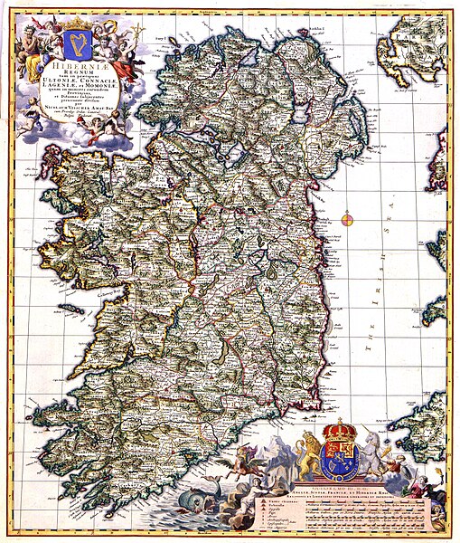
Mapa de Irlanda publicado por Nicolaes Visscher II alrededor de 1689
Resumen[editar]
| Dirk Janszoon van Santen: Atlas van Dirk van der Hagen (volledig, collectie KB)
|
|||||||||||||||||||||||||||
|---|---|---|---|---|---|---|---|---|---|---|---|---|---|---|---|---|---|---|---|---|---|---|---|---|---|---|---|
| Artista |
|
 | |||||||||||||||||||||||||
| Autor |
Author and publisher: Nicolaes Visscher II |
||||||||||||||||||||||||||
| Título |
HIBERNIAE REGNUM tam in praecipuas ULTONIAE, CONNACIAE, LAGENIAE, et MOMONIAE, quam in minores earundem Provincias, et Ditiones subjacentes peraccuraté divisum |
||||||||||||||||||||||||||
| Object type | mapa | ||||||||||||||||||||||||||
| Descripción |
Nederlands: Deze kaart van Ierland werd omstreeks 1689 gepubliceerd door Nicolaes Visscher II (1649-1702). We kunnen dat afleiden uit het feit dat de kaart is opgedragen aan stadhouder Willem III en zijn vrouw Mary Stuart die in 1689 tot koning en koningin van Engeland, Schotland en Ierland waren gekroond.; Rechtsonder een opdracht van Nicolaes Visscher II aan Willem III en Mary Stuart.
English: This map of Ireland was published by Nicolaes Visscher II (1649-1702) about 1689. These facts are known because the map is dedicated to stadholder William III and his wife Mary Stuart who were crowned as king and queen of England, Scotland and Ireland in 1689. |
||||||||||||||||||||||||||
| Idioma |
neerlandés |
||||||||||||||||||||||||||
| Fecha | hacia 1689 | ||||||||||||||||||||||||||
| Fecha de publicación |
hacia |
||||||||||||||||||||||||||
| Técnica |
Nederlands: kopergravure
English: grabado en cobre |
||||||||||||||||||||||||||
| Dimensiones | 56 x 47 cm | ||||||||||||||||||||||||||
| Colección |
|
||||||||||||||||||||||||||
| Número de inventario |
Description of the Atlas Van der Hagen in the catalogue of the KB: http://opc4.kb.nl/DB=1/TTL=1/LNG=EN/PPN?PPN=353012750 |
||||||||||||||||||||||||||
| Lugar de creación | Amsterdam | ||||||||||||||||||||||||||
| Notas | KW1049B11_048 - Volume 1 | ||||||||||||||||||||||||||
| Related persons | Nicolaes Visscher II - Willem III - Stuart, Mary | ||||||||||||||||||||||||||
| Depicted locations | Ireland | ||||||||||||||||||||||||||
| Referencias | |||||||||||||||||||||||||||
| Fuente/fotógrafo |
Source page at the Geheugen van Nederland / Memory of the Netherlands website.
|
||||||||||||||||||||||||||
| Permiso (Reutilización de este archivo) |
|
||||||||||||||||||||||||||
| Otras versiones |
 |
||||||||||||||||||||||||||

Historial del archivo
Haz clic sobre una fecha y hora para ver el archivo tal como apareció en ese momento.
| Fecha y hora | Miniatura | Dimensiones | Usuario | Comentario | |
|---|---|---|---|---|---|
| actual | 12:07 8 feb 2018 | | 4666 × 5500 (7,02 MB) | Gryffindor (discusión | contribs.) | {{Information |Description= |Source={{own}} |Date= |Author= Gryffindor |Permission= |other_versions= }} |
| 15:32 18 jul 2015 |  | 4666 × 5500 (4,95 MB) | OlafJanssen (discusión | contribs.) | GWToolset: Creating mediafile for OlafJanssen. |
No puedes sobrescribir este archivo.
Usos del archivo
Las siguientes páginas usan este archivo:
- Atlas van der Hagen
- Atlas van der Hagen (Volume 2)
- Commons:Koninklijke Bibliotheek/Reports
- Commons:Koninklijke Bibliotheek/Reports/wikimedia usage
- File:Atlas Van der Hagen-KW1049B11 048-HIBERNIAE REGNUM tam in praecipuas ULTONIAE, CONNACIAE, LAGENIAE, et MOMONIAE, quam in minores earundem Provincias, et Ditiones subjacentes peraccuraté divisum.jpeg
- File:Ireland prev.jpg (archivo de redirección)
- File:Kerry cropped 1690.jpeg
- File:UBBasel Map Irland 1677-1702 Kartenslg Mappe 238-56.tif
- Category:Births in Kilkenny
- Category:Commemorative plaques in Kilkenny
- Category:History of Ireland
- Category:Kilkenny
- Category:Maps of Kilkenny
Uso global del archivo
Las wikis siguientes utilizan este archivo:
- Uso en ar.wikipedia.org
- Uso en arz.wikipedia.org
- Uso en bn.wikipedia.org
- Uso en ca.wikipedia.org
- Uso en el.wikipedia.org
- Uso en en.wikipedia.org
- United Kingdom of Great Britain and Ireland
- Irish Republic
- Kingdom of Ireland
- Lordship of Ireland
- History of Northern Ireland
- History of the Republic of Ireland
- History of Ireland (400–795)
- History of the Jews in Ireland
- History of Ireland (1801–1923)
- Template:History of Ireland sidebar
- Economic history of Ireland
- List of conflicts in Ireland
- History of Ireland (1169–1536)
- History of Ireland (795–1169)
- Irish independence
- History of Ireland (1536–1691)
- History of Ireland (1691–1800)
- Prehistoric Ireland
- User:Angusmclellan/Early Christian Ireland
- User talk:Dppowell/Archive1
- Gaelic Ireland
- User:Dppowell/Sandbox/Early Christian Ireland
- Military history of Ireland
- History of Ireland
- Protohistory of Ireland
- User:Finnrind/Historiography
- Hiberno-Roman relations
- Talk:History of Ireland/Archive 3
- User:༆/History of Europe templates
- User:Nashrobert18
- Timeline of Dublin
- Template:History of Ireland sidebar/testcases
- List of participants in the Nine Years' War (Ireland)
- Human rights in Ireland
- Timeline of Belfast history
- User:Mooze17/sandbox
- Uso en es.wikipedia.org
- Uso en eu.wikipedia.org
- Uso en ga.wikipedia.org
- Uso en gl.wikipedia.org
- Uso en hu.wikipedia.org
Ver más uso global de este archivo.