File:Atlas national portatif de la France 1792 (105094065).jpg
Jump to navigation
Jump to search

Size of this preview: 800 × 418 pixels. Other resolutions: 320 × 167 pixels | 640 × 334 pixels | 1,024 × 535 pixels | 1,280 × 669 pixels | 2,560 × 1,338 pixels | 10,970 × 5,733 pixels.
Original file (10,970 × 5,733 pixels, file size: 10.72 MB, MIME type: image/jpeg)
Captions
Captions
Add a one-line explanation of what this file represents
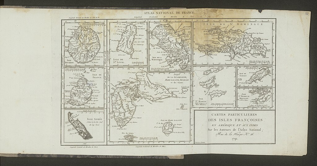
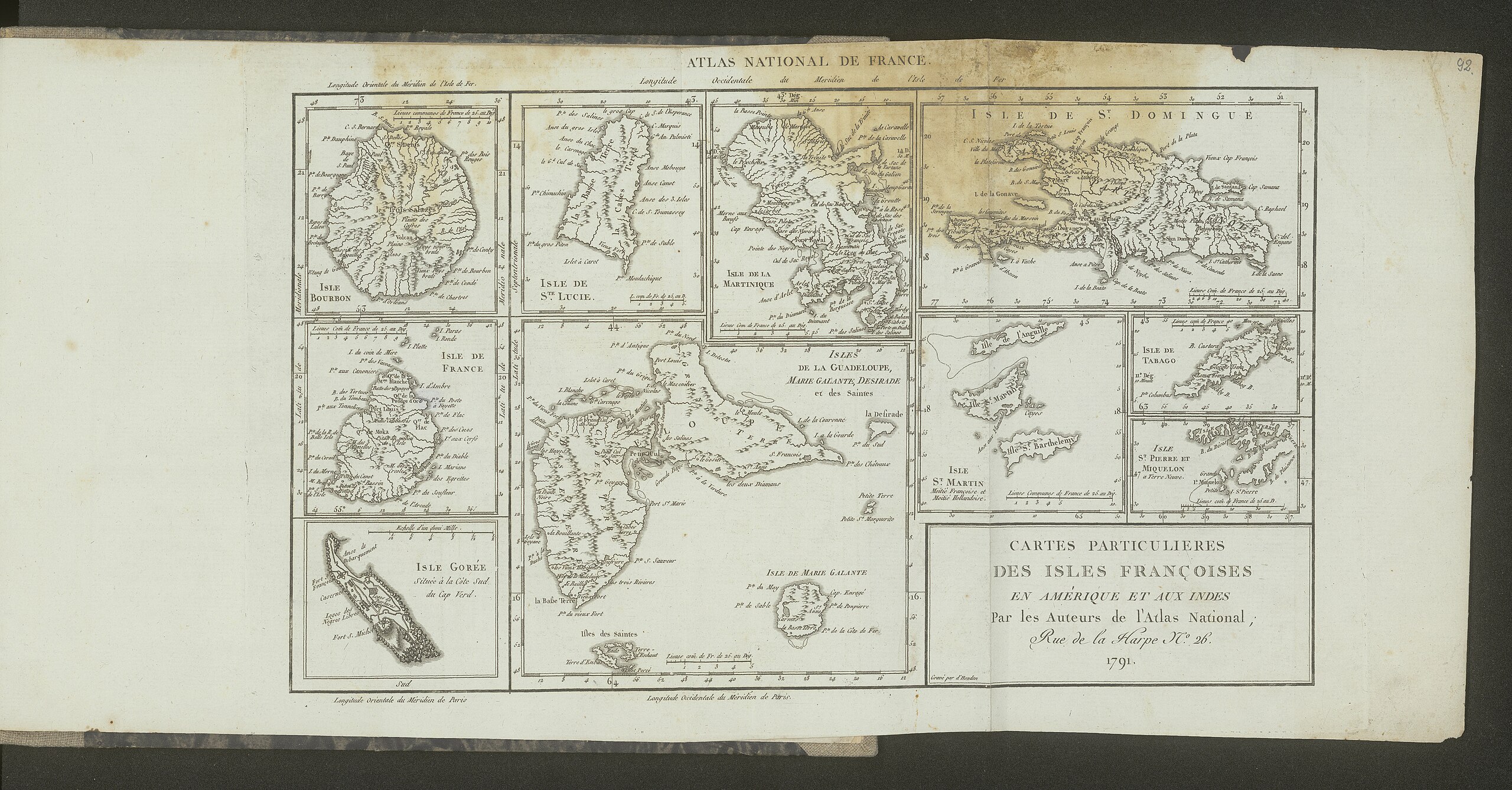
| Atlas national portatif de la France, destiné a l'instruction publique composé de 93 cartes et d'un précis méthodique et elémentaire de la nouvelle géographie du royaume, dédié et présenté a l'assembleé nationale | ||||||||||||||||||||||||
|---|---|---|---|---|---|---|---|---|---|---|---|---|---|---|---|---|---|---|---|---|---|---|---|---|
| Author |
Pierre Dumez |
|||||||||||||||||||||||
| Title |
Atlas national portatif de la France, destiné a l'instruction publique composé de 93 cartes et d'un précis méthodique et elémentaire de la nouvelle géographie du royaume, dédié et présenté a l'assembleé nationale |
|||||||||||||||||||||||
| Publisher |
Bureau de l'Atlas National (Paryż). Wydawca |
|||||||||||||||||||||||
| Description |
Polski: Adres wydawniczy: A Paris ; au Bureau de l'Atlas national [...], 1792 Współtwórcy: Chanlaire, Pierre Grégoire (1758-1817) Autor,Houdan, François d' (1748-1828) Rytownik Opis fizyczny: 1 atlas ([2] strony, XXXVIII łamów, [1] strona, 240 łamów, [6] stron, 93 tablice) : miedzioryt ; 23x28 cm |
|||||||||||||||||||||||
| Language | French | |||||||||||||||||||||||
| Publication date | 1792 | |||||||||||||||||||||||
| Collection |
|
|||||||||||||||||||||||
| Accession number |
ZZK 0.17 |
|||||||||||||||||||||||
| Place of publication | Paris | |||||||||||||||||||||||
| Source |
|
|||||||||||||||||||||||
| Permission (Reusing this file) |
|
|||||||||||||||||||||||


|
This file was uploaded to Wikimedia Commons as part of a GLAM-Wiki partnership between the National Library of Poland and Wikimedia Polska.
|
File history
Click on a date/time to view the file as it appeared at that time.
| Date/Time | Thumbnail | Dimensions | User | Comment | |
|---|---|---|---|---|---|
| current | 16:47, 6 December 2021 | | 10,970 × 5,733 (10.72 MB) | Polona Upload (talk | contribs) |
You cannot overwrite this file.
File usage on Commons
The following page uses this file:
.jpg)
Metadata
.jpg&oldid=806528788)
Categories:
- Atlas national portatif de la France (1792)
- 18th-century maps of Guadeloupe
- 18th-century maps of Hispaniola
- 18th-century maps of Martinique
- Old maps of Réunion
- Old maps of Mauritius
- Old maps of Gorée
- Old maps of Saint Lucia
- Old maps of Saint-Martin (France)
- Old maps of Sint Maarten
- 18th-century maps of Trinidad and Tobago
- Old maps of Saint-Pierre and Miquelon