File:Atlas of the battles of the American Revolution, together with maps shewing the routes of the British and American Armies, plans of cities, surveys of harbors, etc., LOC 74175034-23.jpg
Jump to navigation
Jump to search

Size of this preview: 487 × 599 pixels. Other resolutions: 195 × 240 pixels | 390 × 480 pixels | 624 × 768 pixels | 832 × 1,024 pixels | 1,664 × 2,048 pixels | 5,744 × 7,070 pixels.
Original file (5,744 × 7,070 pixels, file size: 5.85 MB, MIME type: image/jpeg)
Captions
Captions
Add a one-line explanation of what this file represents
Summary[edit]
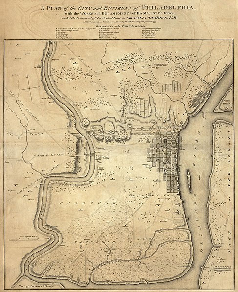
| Description |
English: LC Maps of North America, 1750-1789, 609, 910, 1003, 1013, 1183, 1184, 1185, 1186, 1200, 1291, 1321, 1327, 1337, 1342, 1346, 1356, 1375, 1465, 1474, 1476, 1516, 1543, 1561, 1564, 1566, 1576, 1630, 2075 Available also through the Library of Congress Web site as a raster image. |
||
| Title | Atlas of the battles of the American Revolution, together with maps shewing the routes of the British and American Armies, plans of cities, surveys of harbors, &c., | ||
| Shelf ID | G1201.S3 F2 1845 | ||
| Parent | https://www.loc.gov/resource/g3701sm.gar00004/ | ||
| Sheet title | Plan of city and environs of Philadelphia, 1779 | ||
| Date | |||
| Source | https://www.loc.gov/item/74175034/ | ||
| Author | Faden, William | ||
| Permission (Reusing this file) |
|
||
| Other versions |
|
||
| Location | United States | ||
| Part of | Military Battles And Campaigns · American Memory · Catalog · Geography And Map Division · American Revolution And Its Era: Maps And Charts Of North America And The West Indies, 1750-1789 | ||
| Subject | United States · Campaigns · Maps · Revolution · History |


Licensing[edit]
|
This is a faithful photographic reproduction of a two-dimensional, public domain work of art. The work of art itself is in the public domain for the following reason:
The official position taken by the Wikimedia Foundation is that "faithful reproductions of two-dimensional public domain works of art are public domain".
This photographic reproduction is therefore also considered to be in the public domain in the United States. In other jurisdictions, re-use of this content may be restricted; see Reuse of PD-Art photographs for details. | ||||
File history
Click on a date/time to view the file as it appeared at that time.
| Date/Time | Thumbnail | Dimensions | User | Comment | |
|---|---|---|---|---|---|
| current | 11:16, 23 May 2018 | | 5,744 × 7,070 (5.85 MB) | Fæ (talk | contribs) | LOC Maps multisheet https://www.loc.gov/item/74175034/ sheet 23 of 40 #1566 |
You cannot overwrite this file.
File usage on Commons
The following page uses this file: