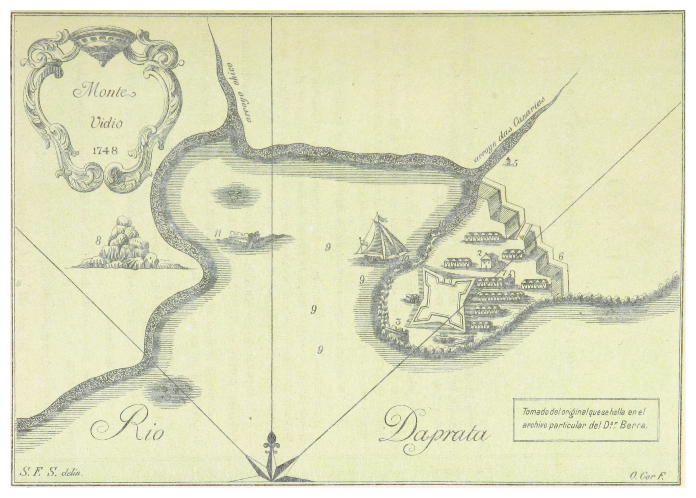
File:BERRA(1882) p363 MONTE VIDEO IN 1748.jpg
Fichier d’origine (2 401 × 1 721 pixels, taille du fichier : 2,1 Mio, type MIME : image/jpeg)
Légendes
Légendes
Description
[modifier]| Date | 1882 | ||||
| Numéro d’inventaire |
British Library HMNTS 10481.g.11. |
||||
| Source / photographe |
Image extracted from page 363 of Album de la República O. del Uruguay compuesto para la Exposicion Continental de Buenos Aires bajo la direction de los señores F. A. Berra, A. de Vedia, y C. M. de Pena., by BERRA, Francisco Antonio. Original held and digitised by the British Library. Copied from Flickr. Note: The colours, contrast and appearance of these illustrations are unlikely to be true to life. They are derived from scanned images that have been enhanced for machine interpretation and have been altered from their originals.
|
||||
| Autorisation (Réutilisation de ce fichier) |
|
||||

_p363_MONTE_VIDEO_IN_1748.jpg&action=edit§ion=1)
Historique du fichier
Cliquer sur une date et heure pour voir le fichier tel qu'il était à ce moment-là.
| Date et heure | Vignette | Dimensions | Utilisateur | Commentaire | |
|---|---|---|---|---|---|
| actuel | 20 novembre 2014 à 16:06 | | 2 401 × 1 721 (2,1 Mio) | Metilsteiner (d | contributions) | User created page with UploadWizard |
Vous ne pouvez pas remplacer ce fichier.
Utilisations locales du fichier
La page suivante utilise ce fichier :
_p363_MONTE_VIDEO_IN_1748.jpg)
Utilisations du fichier sur d’autres wikis
Les autres wikis suivants utilisent ce fichier :
- Utilisation sur es.wikipedia.org
- Utilisation sur fr.wikipedia.org
- Utilisation sur hr.wikipedia.org
_p363_MONTE_VIDEO_IN_1748.jpg&oldid=810405852)
- Maps from the Mechanical Curator collection
- Maps from the Mechanical Curator collection available to georeference
- 1882 maps of Uruguay
- Album de la República Oriental del Uruguay (1882) by BERRA
- Old maps of Montevideo
- 1748 in Montevideo
- Ciudadela de Montevideo
- Maps of the Bay of Montevideo
- Old maps of the Río de la Plata
- Ciudad Vieja in the 19th century