File:Barnet London UK blank ward map 2002 to 2022.svg
Aller à la navigation
Aller à la recherche

Taille de cet aperçu PNG pour ce fichier SVG : 536 × 600 pixels. Autres résolutions : 214 × 240 pixels | 429 × 480 pixels | 686 × 768 pixels | 915 × 1 024 pixels | 1 830 × 2 048 pixels | 1 131 × 1 266 pixels.
Fichier d’origine (Fichier SVG, nominalement de 1 131 × 1 266 pixels, taille : 651 kio)
Légendes
Légendes
Ajoutez en une ligne la description de ce que représente ce fichier
| Description |
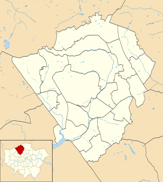
Blank map of the London Borough of Barnet, showing electoral wards. Equirectangular map projection on WGS 84 datum, with N/S stretched 160% Geographic limits:
|
| Date | |
| Source |
|
| Auteur | Nilfanion |
| Autorisation (Réutilisation de ce fichier) |
Ce fichier est disponible selon les termes de la licence Creative Commons Attribution – Partage dans les Mêmes Conditions 3.0 (non transposée). Attribution: Contains Ordnance Survey data © Crown copyright and database right
|
| Autres versions |
Œuvres dérivées de ce fichier : |
Historique du fichier
Cliquer sur une date et heure pour voir le fichier tel qu'il était à ce moment-là.
| Date et heure | Vignette | Dimensions | Utilisateur | Commentaire | |
|---|---|---|---|---|---|
| actuel | 28 juillet 2011 à 21:50 | | 1 131 × 1 266 (651 kio) | Nilfanion (d | contributions) | {{Information |Description=Blank map of the London Borough of Barnet, showing electoral wards. Equirectangular map projection on WGS 84 datum, with N/S stretched 160% Geographic limits: *West: 0.32W *East: 0.12W *North: 51 |
Vous ne pouvez pas remplacer ce fichier.
Utilisations locales du fichier
Les 11 pages suivantes utilisent ce fichier :
Utilisations du fichier sur d’autres wikis
Les autres wikis suivants utilisent ce fichier :
- Utilisation sur en.wikipedia.org
- London Gateway services
- Friern Hospital
- Spaniards Inn
- Barnet Hospital
- List of electoral wards in Greater London
- Hendon Town Hall
- Module:Location map/data/United Kingdom London Barnet/doc
- Jewish Military Museum
- Rising Sun, Mill Hill
- The Red Lion, Chipping Barnet
- Mitre Inn, Chipping Barnet
- North London Coroner's Court
- Finchley Memorial Hospital
- Module:Location map/data/United Kingdom London Barnet
- Friern Barnet Town Hall
- East Barnet Town Hall
- Utilisation sur fa.wikipedia.org
- Utilisation sur fr.wikipedia.org
- Utilisation sur he.wikipedia.org
- Utilisation sur ja.wikipedia.org
- Utilisation sur pl.wikipedia.org
- Underhill Stadium
- Brent Cross
- High Barnet (stacja metra)
- Totteridge and Whetstone
- Woodside Park
- West Finchley
- Finchley Central
- East Finchley (stacja metra)
- Mill Hill East
- Edgware (stacja metra)
- Burnt Oak (stacja metra)
- Colindale (stacja metra)
- Hendon Central
- Brent Cross (stacja metra)
- Golders Green (stacja metra)
- Katedra greckoprawosławna Świętego Krzyża i św. Michała w Londynie
- Moduł:Mapa/dane/Barnet
- Moduł:Mapa/dane/GB-BNE
- Cerkiew św. Cyryla Turowskiego i Wszystkich Patronów Narodu Białoruskiego w Londynie
Voir davantage sur l’utilisation globale de ce fichier.