File:Bedfordshire UK location map.svg
跳至導覽
跳至搜尋

此 SVG 檔案的 PNG 預覽的大小:530 × 599 像素。 其他解析度:212 × 240 像素 | 425 × 480 像素 | 679 × 768 像素 | 906 × 1,024 像素 | 1,812 × 2,048 像素 | 1,120 × 1,266 像素。
原始檔案 (SVG 檔案,表面大小:1,120 × 1,266 像素,檔案大小:1.34 MB)
說明
說明
添加單行說明來描述出檔案所代表的內容
| 描述 |
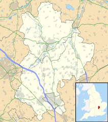
Map of Bedfordshire, UK with the following information shown:
Equirectangular map projection on WGS 84 datum, with N/S stretched 160% Geographic limits:
|
| 日期 | |
| 來源 |
|
| 作者 | Nilfanion, created using Ordnance Survey data |
| 授權許可 (重用此檔案) |
此檔案採用共享創意 姓名標示-相同方式分享 3.0 未在地化版本授權條款。 姓名標示: Contains Ordnance Survey data © Crown copyright and database right
|
| 其他版本 | File:Bedfordshire UK district map (blank).svg - Blank map with administrative borders only. |
.svg)
檔案歷史
點選日期/時間以檢視該時間的檔案版本。
| 日期/時間 | 縮圖 | 尺寸 | 用戶 | 備註 | |
|---|---|---|---|---|---|
| 目前 | 2010年9月26日 (日) 17:56 | | 1,120 × 1,266(1.34 MB) | Nilfanion(對話 | 貢獻) | Tweak m-ways .. again.. |
| 2010年9月6日 (一) 23:56 |  | 1,120 × 1,266(1.34 MB) | Nilfanion(對話 | 貢獻) | Tweaking urban areas, road colours and boundary lines | |
| 2010年9月4日 (六) 20:36 |  | 1,120 × 1,266(1.29 MB) | Nilfanion(對話 | 貢獻) | {{Information |Description=Map of Bedfordshire, UK with the following information shown: *Administrative borders *Coastline, lakes and rivers *Motorways, primary routes and A-roads *Urban areas Equirectangular map projection on WGS 84 |
無法覆蓋此檔案。
檔案用途
下列頁面有用到此檔案:
全域檔案使用狀況
以下其他 wiki 使用了這個檔案:
- af.wikipedia.org 的使用狀況
- ar.wikipedia.org 的使用狀況
- bg.wikipedia.org 的使用狀況
- bn.wikipedia.org 的使用狀況
- ceb.wikipedia.org 的使用狀況
- en.wikipedia.org 的使用狀況
- Bedford
- Bushmead Priory
- Beeston, Bedfordshire
- Luton Airport
- Flitwick
- Kempston
- Biggleswade
- Sandy, Bedfordshire
- Little Barford
- Ampthill
- Leighton Buzzard
- Woburn, Bedfordshire
- Eaton Bray
- Linslade
- Southcote, Bedfordshire
- Woburn Sands
- Studham
- Potton
- Old Warden
- Billington, Bedfordshire
- Eversholt
- RAF Chicksands
- RAF Henlow
- Bromham, Bedfordshire
- Everton, Bedfordshire
- List of places in Bedfordshire
- Stagsden
- Clapham, Bedfordshire
- Pertenhall
- RAE Bedford
- Hockliffe
- Houghton House
- Luton Hoo
- Campton, Bedfordshire
- Haynes, Bedfordshire
- Civil parishes in Bedfordshire
- Wootton, Bedfordshire
- Cranfield
- Hundred of Biggleswade
- Cockayne Hatley
- Odell, Bedfordshire
- Wrest Park
- Cardington, Bedfordshire
檢視此檔案的更多全域使用狀況。