File:Berg Knock in Schönheide.jpg
Jump to navigation
Jump to search

Size of this preview: 800 × 533 pixels. Other resolutions: 320 × 213 pixels | 640 × 427 pixels | 1,024 × 683 pixels | 1,280 × 853 pixels | 2,560 × 1,707 pixels | 3,456 × 2,304 pixels.
Original file (3,456 × 2,304 pixels, file size: 947 KB, MIME type: image/jpeg)
Captions
Captions
Add a one-line explanation of what this file represents
Summary[edit]
| Description |
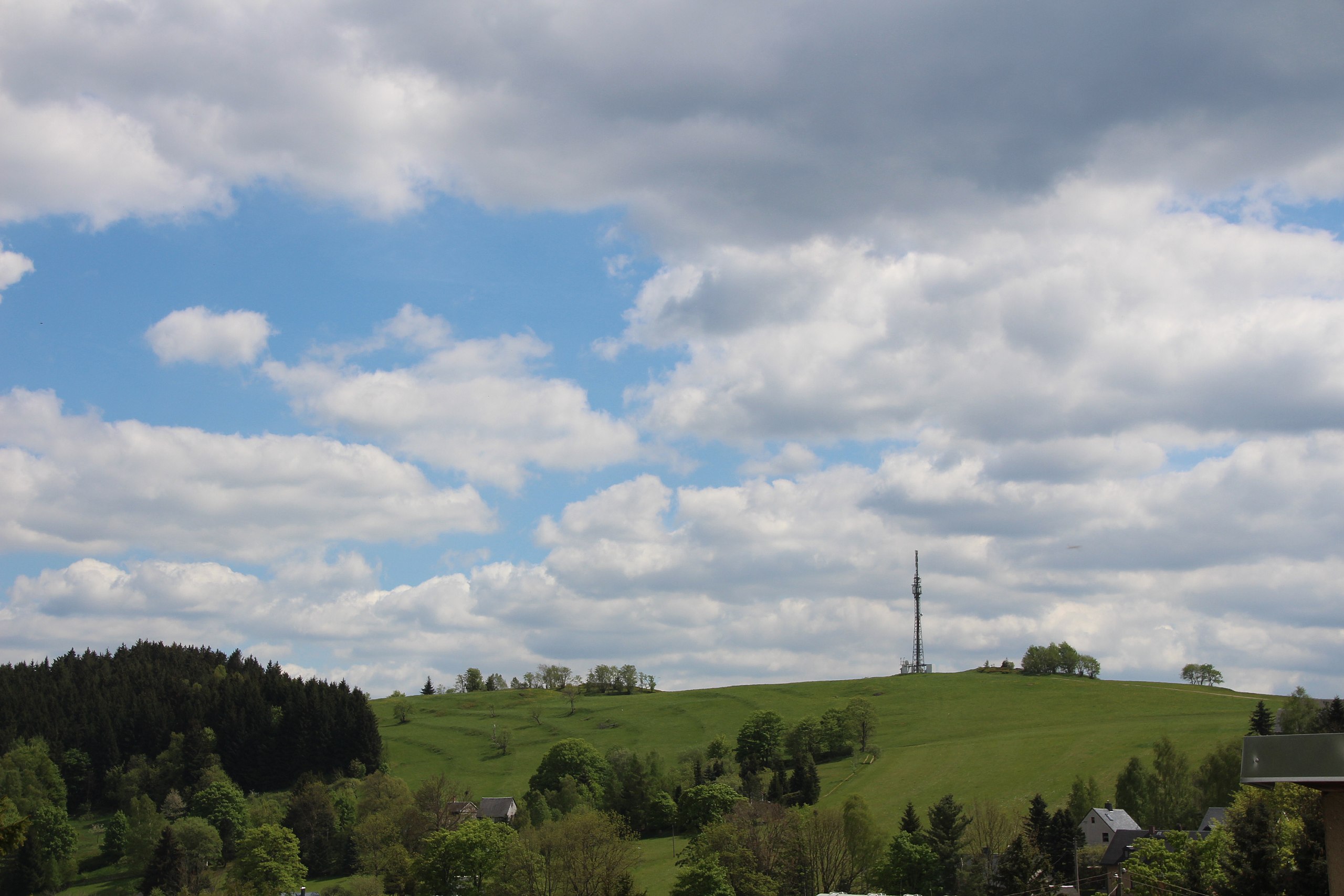
Deutsch: Der Knock (725,5 Meter) ist ein nur östlich des Gipfels am Nord- und am Südhang teilweise bewaldeter Berg in Schönheide. Der höchste Punkt liegt östlich (links) des Sendemasts, der in den 1990er Jahren aufgestellt wurde. Der westlich davon gelegene gänzlich unbewaldete Baumannsberg (Berg) hat mit 725,5 Metern die gleiche Höhe wie der Knock und gab dem Ortsteil Baumannsberg seinen Namen, oder war es umgekehrt? Wer wird/kann dies klären? Der Sendemast rechts steht nicht auf dem höchsten Punkt des Berges. Dieser ist weiter links im Bereich der ersten Büsche. Deutlich sind am Nordhang die Hufe der Feldeinteilung aus der Erstbesiedlung Schönheides zu erkennen. |
| Date | |
| Source | Own work |
| Author | Klaaschwotzer |
| Object location | | View this and other nearby images on: OpenStreetMap |
|---|
| Camera location | | View this and other nearby images on: OpenStreetMap |
|---|
Licensing[edit]
I, the copyright holder of this work, hereby publish it under the following license:
This file is licensed under the Creative Commons Attribution-Share Alike 4.0 International license.
- You are free:
- to share – to copy, distribute and transmit the work
- to remix – to adapt the work
- Under the following conditions:
- attribution – You must give appropriate credit, provide a link to the license, and indicate if changes were made. You may do so in any reasonable manner, but not in any way that suggests the licensor endorses you or your use.
- share alike – If you remix, transform, or build upon the material, you must distribute your contributions under the same or compatible license as the original.
File history
Click on a date/time to view the file as it appeared at that time.
| Date/Time | Thumbnail | Dimensions | User | Comment | |
|---|---|---|---|---|---|
| current | 18:33, 29 August 2018 | | 3,456 × 2,304 (947 KB) | Klaaschwotzer (talk | contribs) | {{Information |description ={{de|1=Der '''Knock''' ist ein nur östlich des Gipfels am Nord- und am Südhang teilweise bewaldeter Berg in Schönheide und 725,5 Meter hoch.<br>Der westlich davon gelegene gänzlich unbewaldete Baumannsberg (Berg) hat mit 725,5 Metern die gleiche Höhe wie der Knock und gab dem Ortsteil Baumannsberg seinen Namen, oder war es umgekehrt? Wer wird/kann dies klären?<br>Der Sendemas... |
You cannot overwrite this file.
File usage on Commons
There are no pages that use this file.
File usage on other wikis
The following other wikis use this file:
- Usage on de.wikipedia.org