File:Berger Berlin 1772.jpg
Jump to navigation
Jump to search
Size of this preview: 468 × 599 pixels. Other resolutions: 187 × 240 pixels | 375 × 480 pixels | 600 × 768 pixels | 1,064 × 1,362 pixels.
Original file (1,064 × 1,362 pixels, file size: 558 KB, MIME type: image/jpeg)
Captions
Captions
Add a one-line explanation of what this file represents
| Description |
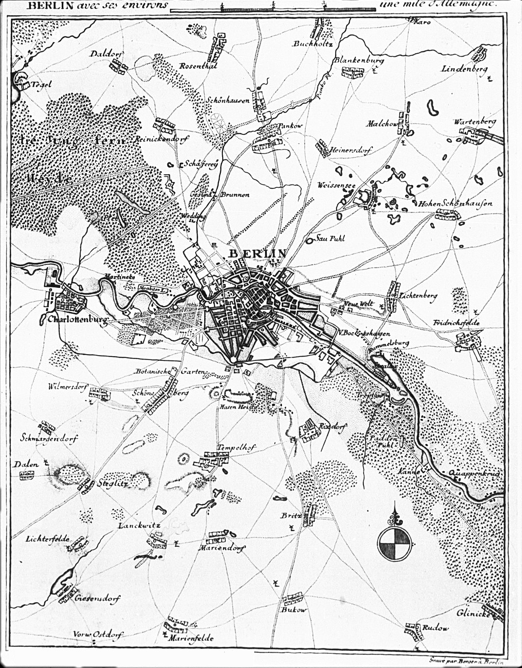
BERLIN avec ses Environs
Über der Karte steht der Titel zusammen mit einem gezeichneten Maßstab über "une mile d'Allemagne". Unten rechts ein Hinweis auf den Stecher: "Gravé par Berger à Berlin". Im Plan rechts unten ein Kompaß, wie in der Karte von Rhode (1772). Das Stadtgebiet entstammt ebenfalls der Karte von Rhode. Neben dieser Karte, existiert noch eine Version mit deutschem Titel GEGEND UM BERLIN aus dem Jahr 1772 von Rhode und Berger. |
| Date | |
| Source | bildindex.de |
| Author | Friedrich Gottlieb Berger |
.jpg)
|
This work is in the public domain in its country of origin and other countries and areas where the copyright term is the author's life plus 100 years or fewer. | |
| This file has been identified as being free of known restrictions under copyright law, including all related and neighboring rights. | |
File history
Click on a date/time to view the file as it appeared at that time.
| Date/Time | Thumbnail | Dimensions | User | Comment | |
|---|---|---|---|---|---|
| current | 17:35, 15 December 2010 | | 1,064 × 1,362 (558 KB) | Alexrk2 (talk | contribs) | {{Information |Description='''BERLIN avec ses Environs''' * Format: 12,8 x 16,1 cm * Maßstab: 1:140.000 * Kupferstich, einfarbig Über der Karte steht der Titel zusammen mit einem gezeichneten Maßstab über "une mile d'Allemagne". Unten rechts ein Hinwe |
You cannot overwrite this file.
File usage on Commons
The following page uses this file:
File usage on other wikis
The following other wikis use this file:
- Usage on de.wikipedia.org