File:Berkshire UK relief location map.jpg
Aller à la navigation
Aller à la recherche

Taille de cet aperçu : 800 × 416 pixels. Autres résolutions : 320 × 166 pixels | 640 × 333 pixels | 1 024 × 533 pixels | 1 280 × 666 pixels | 1 999 × 1 040 pixels.
Fichier d’origine (1 999 × 1 040 pixels, taille du fichier : 238 kio, type MIME : image/jpeg)
Légendes
Légendes
Ajoutez en une ligne la description de ce que représente ce fichier
| Description |
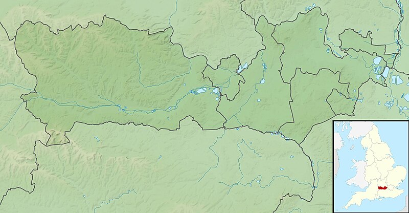
Relief map of Berkshire, UK. Equirectangular map projection on WGS 84 datum, with N/S stretched 160% Geographic limits:
|
| Date | |
| Source |
|
| Auteur | Nilfanion, created using Ordnance Survey data |
| Autorisation (Réutilisation de ce fichier) |
Ce fichier est disponible selon les termes de la licence Creative Commons Attribution – Partage dans les Mêmes Conditions 3.0 (non transposée). Attribution: Contains Ordnance Survey data © Crown copyright and database right
|
| Autres versions | File:Berkshire UK district map (blank).svg - Blank map with administrative borders only. |
.svg)
Historique du fichier
Cliquer sur une date et heure pour voir le fichier tel qu'il était à ce moment-là.
| Date et heure | Vignette | Dimensions | Utilisateur | Commentaire | |
|---|---|---|---|---|---|
| actuel | 29 novembre 2011 à 01:17 | | 1 999 × 1 040 (238 kio) | Nilfanion (d | contributions) | {{Information |Description=Relief map of Berkshire, UK. Equirectangular map projection on WGS 84 datum, with N/S stretched 160% Geographic limits: *West: 1.63W *East: 0.46W *North: 51.59N *South: 51.21N |Source=[[w:Ordnance Survey|Ordnan |
Vous ne pouvez pas remplacer ce fichier.
Utilisations locales du fichier
Aucune page n’utilise ce fichier.
Utilisations du fichier sur d’autres wikis
Les autres wikis suivants utilisent ce fichier :
- Utilisation sur ar.wikipedia.org
- Utilisation sur bg.wikipedia.org
- Utilisation sur bn.wikipedia.org
- Utilisation sur ceb.wikipedia.org
- Utilisation sur en.wikipedia.org
- River Blackwater (River Loddon)
- River Loddon
- Second Battle of Newbury
- Walbury Hill
- Virginia Water Lake
- Queen Mother Reservoir
- Siege of Reading
- Module:Location map/data/United Kingdom Berkshire/doc
- Inkpen Hill
- Bearwood Lakes Golf Club
- Jewish Community of Berkshire
- MDIS & Partners Festival of Golf
- Module:Location map/data/United Kingdom Berkshire
- Module:Location map/data/Berkshire
- Bearwood House
- 2020 Reading stabbings
- 2021 Senior Open Championship
- 2015 Senior Open Championship
- 2009 Senior Open Championship
- Combe Hill, Berkshire
- Utilisation sur es.wikipedia.org
- Utilisation sur fr.wikipedia.org
- Utilisation sur it.wikipedia.org
- Utilisation sur ja.wikipedia.org
- Utilisation sur kn.wikipedia.org
- Utilisation sur la.wikipedia.org
- Utilisation sur lv.wikipedia.org
Voir davantage sur l’utilisation globale de ce fichier.