File:Biafra independent state map-ru.svg
Jump to navigation
Jump to search

Size of this PNG preview of this SVG file: 776 × 600 pixels. Other resolutions: 311 × 240 pixels | 621 × 480 pixels | 994 × 768 pixels | 1,280 × 989 pixels | 2,560 × 1,978 pixels | 1,100 × 850 pixels.
Original file (SVG file, nominally 1,100 × 850 pixels, file size: 455 KB)
Captions
Captions
Add a one-line explanation of what this file represents
Summary
[edit]| Description |
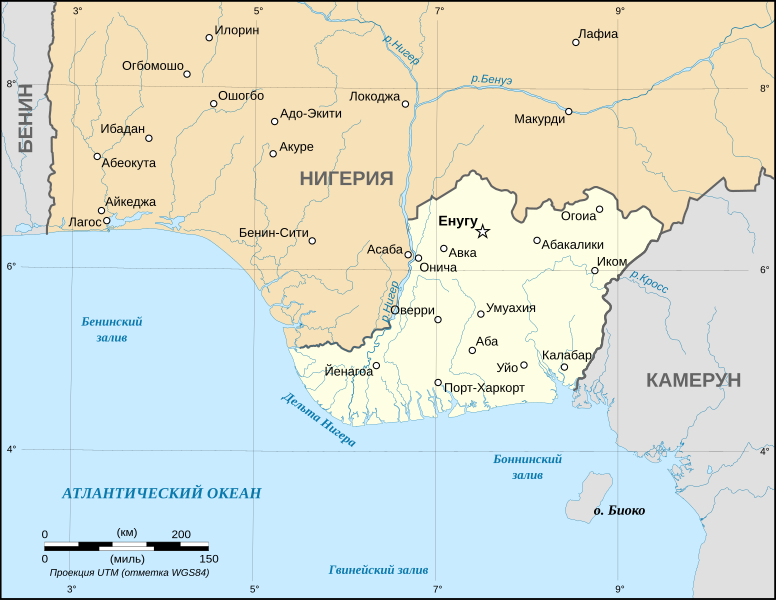
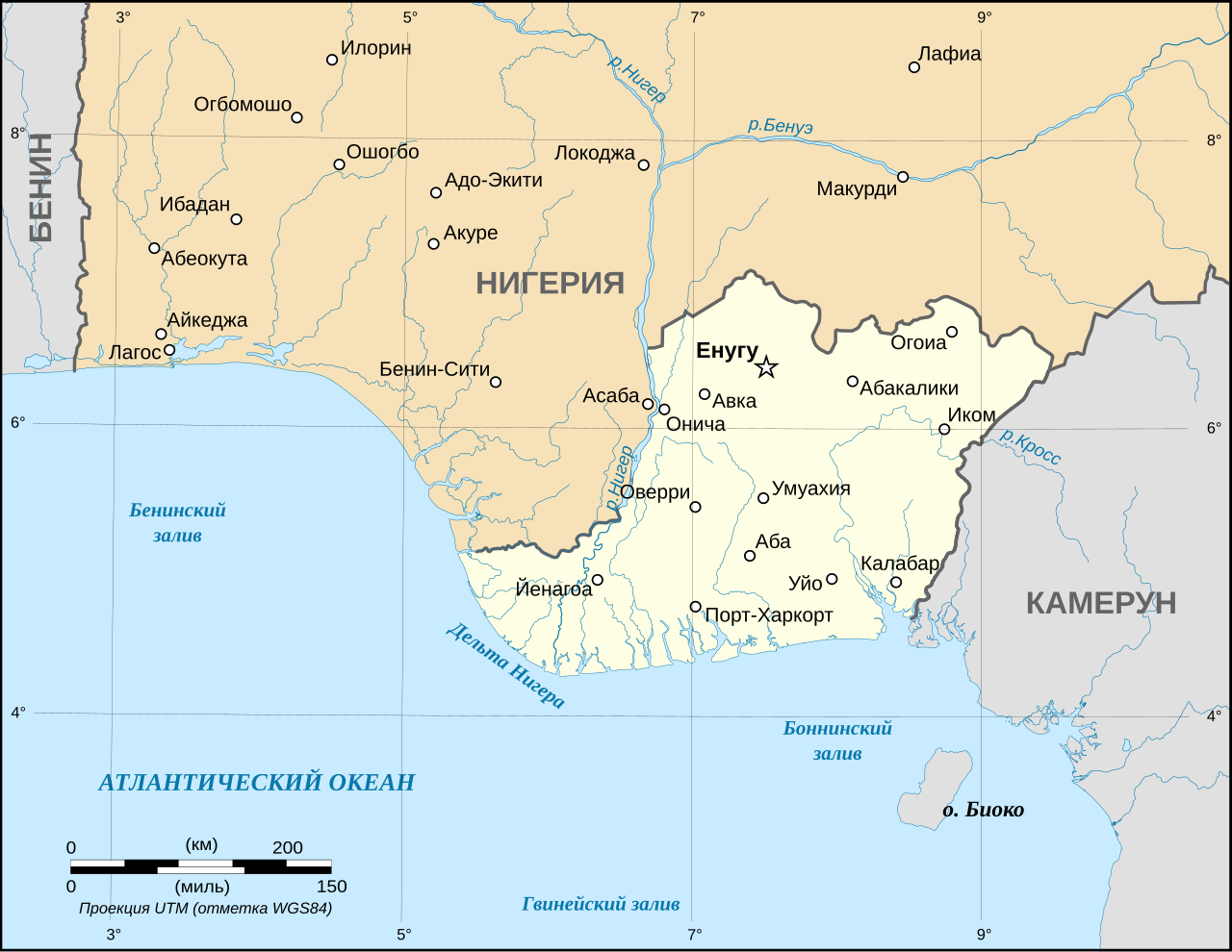
English: Map of the secessionist state of the Republic of Biafra (1967 – 1970) as in May 1967. Note: The western boundary may not be accurate due to the low precision of the reference maps used which are also contradictory. Русский: Карта сепаратистского государства Республики Биафра (1967 - 1970) в мае 1967 года. Примечание: западная граница не может быть точной из-за низкой точности используемых опорных карт, которые изначально противоречивы. |
| Date | |
| Source | This vector image includes elements that have been taken or adapted from this file: |
| Author | Kirill Borisenko |
| Other versions |
[]
|


|
This SVG file contains embedded text that can be translated into your language, using any capable SVG editor, text editor or the SVG Translate tool. For more information see: About translating SVG files. |
Licensing
[edit]
I, the copyright holder of this work, hereby publish it under the following license:
This file is licensed under the Creative Commons Attribution-Share Alike 4.0 International license.
- You are free:
- to share – to copy, distribute and transmit the work
- to remix – to adapt the work
- Under the following conditions:
- attribution – You must give appropriate credit, provide a link to the license, and indicate if changes were made. You may do so in any reasonable manner, but not in any way that suggests the licensor endorses you or your use.
- share alike – If you remix, transform, or build upon the material, you must distribute your contributions under the same or compatible license as the original.
File history
Click on a date/time to view the file as it appeared at that time.
| Date/Time | Thumbnail | Dimensions | User | Comment | |
|---|---|---|---|---|---|
| current | 18:30, 7 March 2015 | | 1,100 × 850 (455 KB) | Kirill Borisenko (talk | contribs) | Small edits in river names. |
| 18:08, 7 March 2015 |  | 1,100 × 850 (455 KB) | Kirill Borisenko (talk | contribs) | User created page with UploadWizard |
You cannot overwrite this file.
File usage on Commons
The following 9 pages use this file:
- File:Biafra independent state map-ar.svg
- File:Biafra independent state map-de.svg
- File:Biafra independent state map-en.svg
- File:Biafra independent state map-fr.svg
- File:Biafra independent state map-it.svg
- File:Biafra independent state map-jp.svg
- File:Biafra independent state map-mk.svg
- File:Biafra independent state map-ru.svg
- Template:Other versions/Biafra independent state map
File usage on other wikis
The following other wikis use this file:
- Usage on be.wikipedia.org
- Usage on bg.wikipedia.org
- Usage on ru.wikipedia.org
- Usage on www.wikidata.org