File:Bretagne region location map.svg
Jump to navigation
Jump to search

Size of this PNG preview of this SVG file: 800 × 496 pixels. Other resolutions: 320 × 198 pixels | 640 × 397 pixels | 1,024 × 635 pixels | 1,280 × 793 pixels | 2,560 × 1,587 pixels | 1,615 × 1,001 pixels.
Original file (SVG file, nominally 1,615 × 1,001 pixels, file size: 477 KB)
Captions
Captions
Add a one-line explanation of what this file represents
Summary[edit]
| Camera location | | View this and other nearby images on: OpenStreetMap |
|---|
| Description |
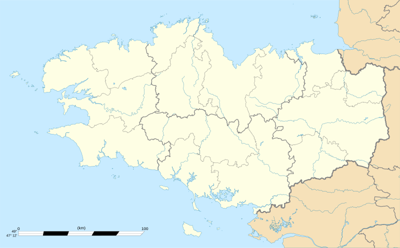
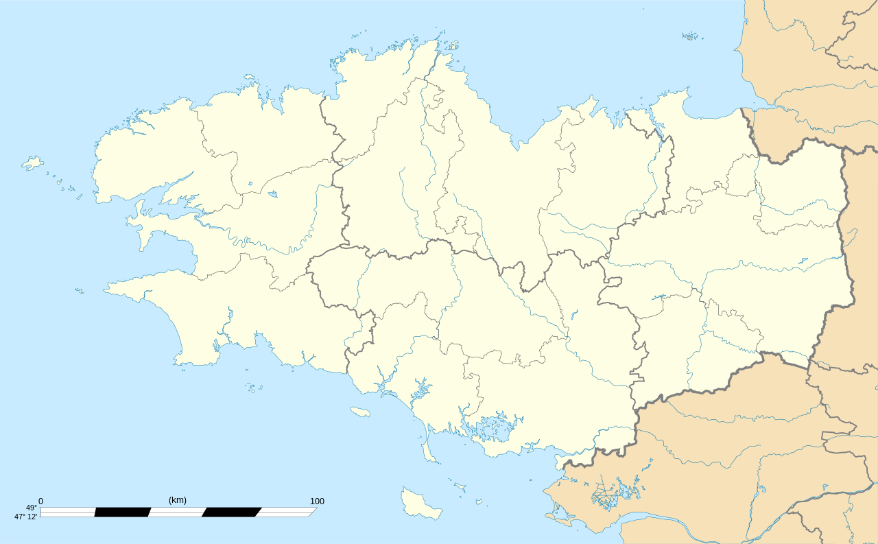
English: Blank administrative map of the region of Bretagne, France, for geo-location purpose, with distinct boundaries for regions, departments and arrondissements.
Français : Carte administrative vierge de la région Bretagne, France, destinée à la géolocalisation, avec limite distincte des régions, départements et arrondissements. Equirectangular projection, WGS84 datum
Geographic limits of the map:
|
||
| Date | |||
| Source |
Own work
|
||
| Author | Eric Gaba (Sting - fr:Sting) | ||
| Permission (Reusing this file) |
|
||
| Other versions |
Derivative works of this file: Niver Brezhonegrien dre c'hant e pep bro Breizh, diouzh an diagnostik war stad ar brezhoneg graet e 2004.png
|

Licensing[edit]
I, the copyright holder of this work, hereby publish it under the following licenses:
This file is licensed under the Creative Commons Attribution-Share Alike 3.0 Unported license.
- You are free:
- to share – to copy, distribute and transmit the work
- to remix – to adapt the work
- Under the following conditions:
- attribution – You must give appropriate credit, provide a link to the license, and indicate if changes were made. You may do so in any reasonable manner, but not in any way that suggests the licensor endorses you or your use.
- share alike – If you remix, transform, or build upon the material, you must distribute your contributions under the same or compatible license as the original.

|
Permission is granted to copy, distribute and/or modify this document under the terms of the GNU Free Documentation License, Version 1.2 or any later version published by the Free Software Foundation; with no Invariant Sections, no Front-Cover Texts, and no Back-Cover Texts. A copy of the license is included in the section entitled GNU Free Documentation License. |
You may select the license of your choice.
File history
Click on a date/time to view the file as it appeared at that time.
| Date/Time | Thumbnail | Dimensions | User | Comment | |
|---|---|---|---|---|---|
| current | 01:10, 7 August 2008 | | 1,615 × 1,001 (477 KB) | Sting (talk | contribs) | == Summary == {{Location|48|06|00|N|03|04|30|W|scale:2000000}} <br/> {{Information |Description={{en|Blank map of the region of Bretagne, France, for geo-location purpose.}} {{fr|Carte vierge de la région Bretagne, Franc |
You cannot overwrite this file.
File usage
The following 9 pages use this file:
- Bretagne - Breizh
- Location maps of regions of France
- User:Sting/Gallery: Location and locator maps
- User:Wikisoft*/Localisation cartes des regions de France
- User talk:NordNordWest/Archive
- File:Bretagne region relief location map.jpg
- File:Carte de l'Île de France (administrative).svg
- File:Carte de la distribution relative des brittophones par Pays (2004).png
- File:Niver Brezhonegrien dre c'hant e pep bro Breizh, diouzh an diagnostik war stad ar brezhoneg graet e 2004.png
.svg)
.png)
Global file usage
The following other wikis use this file:
- Usage on als.wikipedia.org
- Usage on ar.wikipedia.org
- Usage on ast.wikipedia.org
- Usage on atj.wikipedia.org
- Usage on azb.wikipedia.org
- Usage on bg.wikipedia.org
- Usage on bn.wikipedia.org
- Usage on br.wikipedia.org
- Usage on ca.wikipedia.org
- Usuari:PereBot/cobertura/França Bretanya/ranking
- Usuari:PereBot/cobertura/França Bretanya/br
- Usuari:PereBot/cobertura/França Bretanya/ca
- Usuari:PereBot/cobertura/França Bretanya/cy
- Usuari:PereBot/cobertura/França Bretanya/de
- Usuari:PereBot/cobertura/França Bretanya/en
- Usuari:PereBot/cobertura/França Bretanya/es
- Usuari:PereBot/cobertura/França Bretanya/eu
- Usuari:PereBot/cobertura/França Bretanya/fr
- Usuari:PereBot/cobertura/França Bretanya/ga
- Usuari:PereBot/cobertura/França Bretanya/gl
- Usuari:PereBot/cobertura/França Bretanya/it
- Usuari:PereBot/cobertura/França Bretanya/nl
- Usuari:PereBot/cobertura/França Bretanya/pl
- Usuari:PereBot/cobertura/França Bretanya/sk
- Mòdul:Location map/data/França Bretanya
- Mòdul:Location map/data/França Bretanya/ús
- Mòdul:Location map/data/Bretanya
- Usage on ceb.wikipedia.org
- Usage on cs.wikipedia.org
- Usage on cy.wikipedia.org
- Usage on de.wikipedia.org
- Benutzer:Wahrerwattwurm/Trainingsgelände
- Wikipedia Diskussion:WikiProjekt Französische Gemeinden/Archiv/2008
- Wikipedia:Kartenwerkstatt/Positionskarten/Europa
- Vorlage:Positionskarte Frankreich Bretagne
- Vorlage Diskussion:Infobox Gemeinde in Frankreich/Archiv/2008
- Wikipedia Diskussion:WikiProjekt Georeferenzierung/Archiv/2010-I
View more global usage of this file.