File:Bridge over the Liard river.jpg
Jump to navigation
Jump to search

Size of this preview: 800 × 527 pixels. Other resolutions: 320 × 211 pixels | 640 × 421 pixels | 1,024 × 674 pixels | 1,280 × 843 pixels | 2,560 × 1,685 pixels | 3,363 × 2,214 pixels.
Original file (3,363 × 2,214 pixels, file size: 2.88 MB, MIME type: image/jpeg)
Captions
Captions
Add a one-line explanation of what this file represents
Summary
[edit]
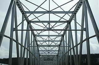
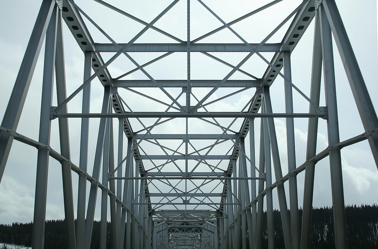
| Description | A truss road bridge over the Liard River within the Liard River First Nation settlement of Upper Liard, Yukon, Canada. |
| Date | |
| Source | Bridge over the Liard river |
| Author | Ian Mackenzie from Ottawa, Canada |
| Camera location | | View this and other nearby images on: OpenStreetMap |
|---|
Licensing
[edit]
This file is licensed under the Creative Commons Attribution 2.0 Generic license.
- You are free:
- to share – to copy, distribute and transmit the work
- to remix – to adapt the work
- Under the following conditions:
- attribution – You must give appropriate credit, provide a link to the license, and indicate if changes were made. You may do so in any reasonable manner, but not in any way that suggests the licensor endorses you or your use.
| This image was originally posted to Flickr by madmack66 at https://www.flickr.com/photos/67038581@N00/2415301918. It was reviewed on 20 October 2012 by FlickreviewR and was confirmed to be licensed under the terms of the cc-by-2.0. |
File history
Click on a date/time to view the file as it appeared at that time.
| Date/Time | Thumbnail | Dimensions | User | Comment | |
|---|---|---|---|---|---|
| current | 01:26, 20 October 2012 | | 3,363 × 2,214 (2.88 MB) | Geo Swan (talk | contribs) | {{Information |Description=Bridge over the Liard river |Source=[http://www.flickr.com/photos/madmack/2415301918/ Bridge over the Liard river] |Date=2008-04-08 15:48 |Author=[http://www.flickr.com/people/67038581@N00 Ian Mackenzie] from Ottawa, Canada |... |
You cannot overwrite this file.
File usage on Commons
There are no pages that use this file.